

Wandelgids St Oswald's Way & Northumberland Coast Path - Cicerone
Heavenfield- Northumberland NP- Simonside Hills- Coquet Valley...
Korte omschrijving
Wandelgidsen Northumberland, Engeland van CICERONE Press. Ideaal voor tochten in England.
St Oswald's Way & Northumberland Coast Path - Cicerone Productomschrijving: Deze gids beschrijft de St Oswald's Way en Northumberland Coast Paths, beide langeafstandswandelpaden door Northum...

Specificaties
- Uitgever: CICERONE Press
- ISBN-13: 9781786311559
- HOOFDCATEGORIEËN: Wandelgids
- Activiteiten: Wandelen, Hiking & Trekking
- Auteur: Rudolf Abraham
- Regio: Northumberland, Engeland
- Land: England
- Lange afstand wandelroutes: Northumberland Coastal Path (42 km), St Oswald's Way (156 km)
- Nationale parken: Northumberland NP, England
- AONB - Area of Outstanding Beauty/National Landscape: Northumberland coast AONB
- Editie: 1
- Taal: Engels
- De Nationale Parken: Northumberland National Park, England
- De Engelse Graafschappen: Northumberland
Volledige omschrijving
St Oswald's Way & Northumberland Coast Path - Cicerone
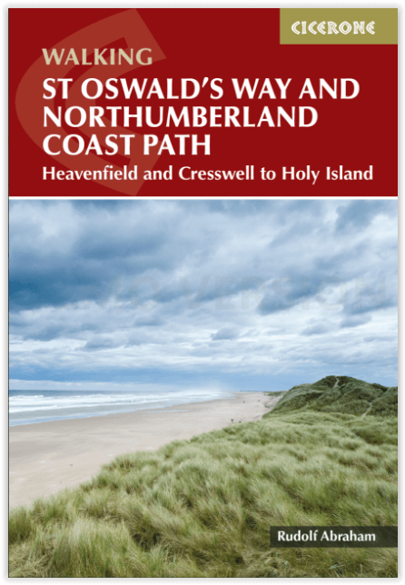
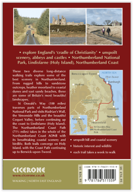
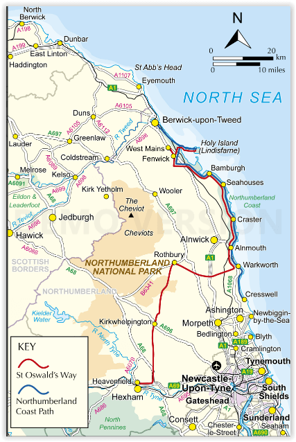
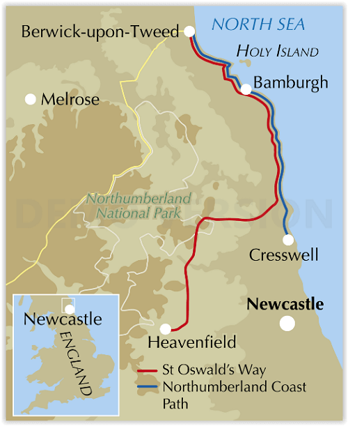
Productomschrijving: Deze gids beschrijft de St Oswald's Way en Northumberland Coast Paths, beide langeafstandswandelpaden door Northumberland. St Oswald's Way (156 km, 97 mijl) begint in Heavenfield en doorkruist delen van het Northumberland National Park en bezoekt Hadrian's Wall, de Simonside Hills en de prachtige Coquet Valley, voordat het verder gaat langs de kust naar Lindisfarne (Holy Island).
Het Northumberland Coast Path (100 km, 62 mijl) loopt door het hele Northumberland Coast AONB met zijn adembenemende kustlandschap en vogelleven. Beide paden komen samen op Holy Island en het kustpad gaat verder naar Berwick-upon-Tweed. Elke route kan in een week worden gelopen.
De gids bevat praktisch advies over wanneer te gaan en wat mee te nemen, en informatie over de regio, het weer, wilde dieren, geschiedenis en erfgoed.
Engelse omschrijving: This guidebook describes the St Oswald's Way and Northumberland Coast Paths, both long-distance trails through Northumberland. St Oswald's Way (156 km, 97 miles) begins in Heavenfield and traverses parts of Northumberland National Park and visits Hadrian’s Wall, the Simonside Hills and the beautiful Coquet Valley, before continuing up the coast to Lindisfarne (Holy Island).
The Northumberland Coast Path (100km, 62 miles) takes in the whole of the Northumberland Coast AONB with its breathtaking coastal scenery and birdlife. Both trails converge on Holy Island, with the Coast Path continuing up to Berwick-upon-Tweed. Each trail can be walked in a week.
The guide includes practical advice on when to go and what to take, and information on the region, its weather, wildlife, history and heritage.
Locatie op kaart
Artikelen uit dezelfde regio

Wandelgids 087 Pathfinder guides Northumberland - OS • 9780319092576
Wandelgids Northumberland - OS Productomschrijving: Opening with a gentle short walk at Kielder Water and concluding with an energetic and challenging ramble to the summit of The Cheviot, walks are arranged in the book by completion time, with shorter and easier routes at the start and longer outings at the end. Walks are professionally authored and depicted with GPS waypoints, Ordnance S…
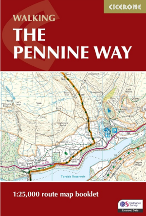
Wandelgids Map Booklet Pennine Way - Cicerone • 9781786311412
Map Booklet Pennine Way - Cicerone Productomschrijving: Map of the 270 miles (435km) Pennine Way National Trail, between Edale in the Peak District and Kirk Yetholm in the Scottish Borders. This booklet is included with the Cicerone guidebook to the trail, and shows the full route on OS 1:25,000 maps. This popular long-distance route typically takes three weeks to complete. Seasons: …

Wandelgids Hadrian's Wall Path - Rucksack Readers • 9781913817312
Wandelgids Hadrian's Wall Path Productomschrijving: Hadrian's Wall Path runs for 86 miles (135 km) between Bowness-on-Solway and Wallsend (Newcastle) along the line of the Roman Wall completed in AD122 under the Emperor Hadrian. This National Trail crosses northern England from Irish Sea to North Sea and offers many chances to look at the forts, milecastles and interpretation centres withi…
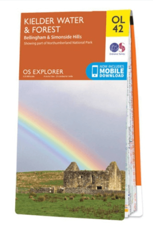
Wandelkaart OL42 Kielder Water & Forest - OS • 9780319242810
Wandelkaart Kielder Water & Forest - OS Productomschrijving: Kielder Water & Forest, Bellingham & Simonside Hills, part of Northumberland National Park, Pennine Way, St Oswald's Way, Lakeside Way & E2 European long distance Path. Omvat: Kielder Water & Forest, Bellingham & Simonside Hills Ontdek de OL-serie van Ordnance Survey: De OL-serie (Outdoor Leisure) van Ordnance Survey i…

Wandelgids Day Walks in Northumberland - Vertebrate Publ. • 9781912560615
Day Walks in Northumberland - Vertebrate Productomschrijving: 20 coastal & countryside routes Day Walks in Northumberlandfeatures 20 routes between 7.6 and 14.5 miles (12.2km and 23.3km) in length, spread across the coast and the countryside of Northumberland and suitable for hillwalkers of all abilities. Researched and written by local walking guide David Wilson, this book covers …