

HOOFDCATEGORIEËN
De Australische Regio's
Reeks/Serie:
Land
Regio
Nationale parken
Regionale parken
Uitgever


 Beste Wegenkaarten Australië
Beste Wegenkaarten Australië, Ontdek Sydney, the Great Barrier Reef & Melbourne.
Een avontuurlijke roadtrip door Australië vraagt om uitstekende wegenkaarten van gerenommeerde uitgevers als Hema Maps en ITMB. Hema Maps levert uiterst gedetailleerde kaarten voor de populaire oostkust van Australië. Hiermee navigeer je eenvoudig naar iconische steden zoals Sydney, beroemd om het Sydney Opera House, Harbour Bridge en het nabijgelegen Bondi Beach. Ook routes naar spectaculaire natuurgebieden zoals de Blue Mountains zijn duidelijk gemarkeerd.
Deze uitgevers bieden praktische kaarten voor Queensland, de thuisbasis van het wereldberoemde Great Barrier Reef en tropische steden zoals Cairns en Townsville. Ontdek met gemak de prachtige stranden, kleurrijke koraalriffen en het regenwoudgebied van Daintree National Park.
ITMB-kaarten zijn ideaal voor reizen naar Melbourne en omgeving. Deze kaarten helpen je probleemloos om de beroemde Great Ocean Road te ontdekken, met spectaculaire bezienswaardigheden zoals de Twelve Apostles en charmante dorpjes zoals Lorne en Apollo Bay. Praktische informatie over parkeergelegenheden, rustplaatsen en toeristische hotspots maken jouw Australische reis comfortabel en plezierig.

Landkaart Wegenkaart Queensland state map - Hema Maps • 9781922668806
Wegenkaart Queensland state map - Hema Productomschrijving: The thirteenth edition of Hema’s Queensland State Map features Hema’s distinctive and informative maps fully, all of which have been field checked by Hema’s Map Patrol to ensure the best possible accuracy with the latest mapping data. A fully indexed state map of Queensland (QLD) at a scale of 2:500,000. Marked on the mapping…
Landkaart Wegenkaart Explorer Map Queensland Outback - Hema Maps • 9781922668769
Explorer Map Queensland Outback - Hema Productomschrijving: Outback Queensland (QLD) contains mapping and visitor information for one of the most iconic regions in Australia. Mapping at a scale of 1:1,500,000 covers from the inland borders to Toowoomba in the east and Charters Towers in the north, with hill shading and elevation tinting creating a more realistic interpretation of the land…

Landkaart Wegenkaart Cape York NP Queensland Australia - Hema • 9781922668790
Cape York NP northern Queensland Australia - Hema Productomschrijving: Featuring the Old Telegraph Track! This brand new edition of Hema’s best-selling Cape York map, on durable waterproof paper, features our latest mapping and points of interest in a new cartographic style. It now features new inset maps for the CREB Track and Rinyirru (Lakefield) National Park. It combines Hema’s en…
Landkaart Wegenkaart Explorer Map Central Coast Queensland - Hema • 9781922668844
Explorer Map Central Coast Queensland - Hema Productomschrijving: Central Coast Queensland Map (1st edition) - a two-sided regional map of the Central Coast of Queensland (1:550,000) that stretches from just south of Bundaberg up to Ingham in the north and as far west as Clermont. This two-sided regional map showcases the Central Coast of Queensland (1:550,000), extending from just so…

Landkaart Wegenkaart Australië - Reise Know How • 9783831773367
Wegenkaart Australië - Reise Know How Productomschrijving: Reis Know-How-kaarten (wereldkaart-projectreeks) zijn gemakkelijk te lezen, waterdichte en zeer duurzame reiskaarten die speciaal zijn ontworpen voor dagelijks gebruik op de weg. Verdeeld over 2 zijden van de kaart, Recto/Verso Onze kaarten combineren state-of-the-art, GPS-compatibele cartografie (inclusief hypsometrische…
Landkaart Wegenkaart Australië Oost - Reise Know How • 9783831774517
Wegenkaart Oost Australië - Reise Know How Productomschrijving: Reis Know-How-kaarten (wereldkaart-projectreeks) zijn gemakkelijk te lezen, waterdichte en zeer duurzame reiskaarten die speciaal zijn ontworpen voor dagelijks gebruik op de weg. Omvat: Queensland, Victoria, New South Wales, Tasmania. Onze kaarten combineren state-of-the-art, GPS-compatibele cartografie (inclusief hyps…

Landkaart Wegenkaart 785 Australië - Michelin • 9782067174085
Wegenkaart Australië - Michelin Productomschrijving: Deze Nationale kaart van Australië, biedt een gedetailleerd overzicht van alle plaatsen. het wegennet wordt verfijnd aangeduid met allerhande symbolen, en voorziet in alle behoeftes, of u op zoek bent naar specifieke wegen, of zich snel uit de voeten wil maken, de plaatsnamenindex, en toeristische informatie, geven u alle elementen om da…
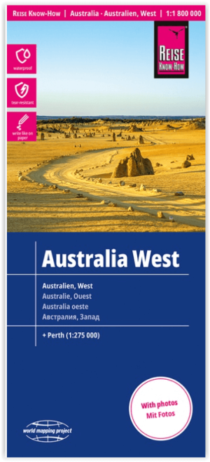
Landkaart Wegenkaart Australië West - Reise Know How • 9783831774739
Wegenkaart West Australië - Reise Know How Productomschrijving: Reis Know-How-kaarten (wereldkaart-projectreeks) zijn gemakkelijk te lezen, waterdichte en zeer duurzame reiskaarten die speciaal zijn ontworpen voor dagelijks gebruik op de weg. Omvat: The Northern Territories, Western Australia & Southern Australia. Onze kaarten combineren state-of-the-art, GPS-compatibele cartograf…
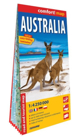
Landkaart Wegenkaart Australië - ExpressMap • 9788383553856
Wegenkaart Australië - ExpressMap Productomschrijving: ExpressMap is de uitgever van comfort! maps, geplastificeerde kaarten die eenvoudig te vouwen zijn, zelfs met één hand. Een uniek en innovatief product. Comfortabel, waterbestand, onverscheurbaar, comfort! maps blijven hun kwaliteit lang behouden. Duurzame kaarten, nuttig om een uitstap te plannen en handig voor onderweg. Een aanta…
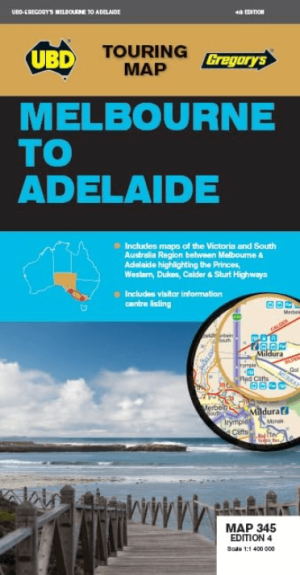
Landkaart Wegenkaart 345 Melbourne to Adelaide - UBD Gregory's • 9780731932467
Wegenkaart Melbourne to Adelaide - UBD Gregory's Productomschrijving: The latest edition of the Melbourne to Adelaide map has been fully revised and updated and includes. Regional mapping highlighting the routes for Princes, Calder/Sturt and Western/Dukes highways with editorial about these routes plus an index to towns. Strip maps and editorial for the Calder/Sturt, Western/Dukes and…


Landkaart Wegenkaart 470 Queensland State & Suburban - Gregory's • 9780731933181
Wegenkaart Queensland State & Suburban - Gregory's Productomschrijving: The latest edition of the popular Queensland State and Suburban Map has been fully revised and updated and is an essential tool for those travelling around Queensland and the Brisbane area. It includes: - State map of Queensland plus an index to the towns and localities featured. - Suburban map coverage of …

Landkaart Wegenkaart 244 Sydney to Brisbane - UBD Gregory's • 9780731933280
Wegenkaart Sydney to Brisbane - UBD Gregory's Productomschrijving: The latest edition of the Sydney to Brisbane touring map has been fully revised and updated and includes: - Information on travelling from Sydney to Brisbane via both the Pacific Motorway/Highway and the New England Highway. - Information on choosing to travel between Sydney and Brisbane via either the Pacific or N…

Landkaart Wegenkaart Australië Alice Springs - Nelles Verlag • 9783865746931
Wegenkaart Alice Springs, Perth, Sydney & Melbourne - Nelles Productomschrijving: Wegenkaart met reliëfschaduw, detailkaarten, stadsplattegronden, toeristische bezienswaardigheden en kilometeraanduidingen Omvat: Allice Springs Environs, Mt. Olga/Ayers Rock, Greater Perth, Greater Sydney, Greater Melbourne, Sunshine Coast/Gold Coast City maps: Central Perth, Central Sydney, Canberr…

Landkaart Wegenkaart 383 Bendigo & Shepparton Victoria- Gregory's • 9780731932474
Wegenkaart Bendigo & Shepparton Victoria - Gregory's Productomschrijving: The latest edition of the Bendigo Shepparton regional touring map features a regional map with coverage from Leitchville and Strathmerton in the north, Creswick and Wallan in the south, Euroa in the east and Emu in the west. Also included is street level mapping and street indexes for Bendigo, Castlemaine, Maryb…

Landkaart Wegenkaart 382 Ballarat Grampians & Spa Country - UBD • 9780731932979
Wegenkaart Ballarat Grampians & Spa Country - Gregory's Productomschrijving: The latest edition of the Ballarat Grampians Spa Country Map has been fully revised and updated. Covers: Harcourt & Campbells Bridge in the north, Cressy in the south, Romsey in the east and Wartook and Dunkeld in the west. - A street level map and street index for Ballarat; - Street level maps of Arara…
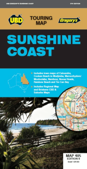
Landkaart Wegenkaart 405 Sunshine Coast Queensland- UBD Gregory's • 9780731932825
Wegenkaart Sunshine Coast Queensland- UBD Gregory's Productomschrijving: Sunshine Coast regional map at a scale of 1 : 171 950 & index covering along the coast from Inskip Peninsula in the north to Caloundra & Toorbul in the south, Wonga Lower in the west and Noosa Heads & Caloundra in the east. - Street level mapping at a scale of 1 : 25 000 with coverage for Caloundra & surrounding …
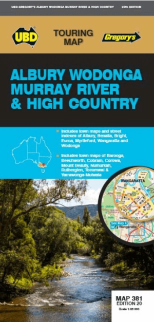
Landkaart Wegenkaart 381 Albury- Wodonga- Murray River- Gregory's • 9780731932481
Wegenkaart Albury- Wodonga- Murray River & High country Productomschrijving: The latest edition of the Albury Wodonga Murray River and High Country touring map has been fully revised and updated and includes regional touring coverage from Finley and Henty in the north, Euroa and Mount Beauty in the south, Darbyshire in the east and Numurkah in the west. There is also street level mapp…

Landkaart Wegenkaart 43 South East Queensland - UBD Gregory's • 9780731932924
Wegenkaart South East Queensland - UBD Gregory's Productomschrijving: The latest edition of the South Eastern Queensland map has been fully revised and updated and includes regional coverage from Murgon, Gympie and Double Island Point in the north, Tenterfield and Evans Head (NSW) in the south, Columboola in the west and east along the coast from Double Island Point to Evans Head. There i…
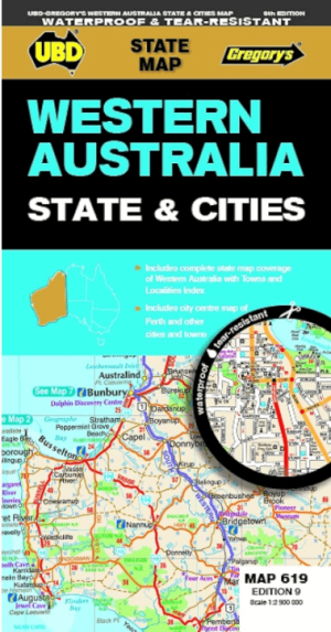
Landkaart Wegenkaart 619 Western Australia State & Cities - UBD • 9780731933198
Wegenkaart Western Australia State & Cities - Gregory's Productomschrijving: The latest edition of the Western Australia State and Cities map has been fully revised and updated. It includes a comprehensive state map with an index to the towns and localities at a scale of 1: 2.900.000 plus more detailed coverage of South West Western Australia at a scale of 1 : 1.870.000 on one side. …
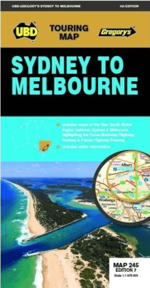
Landkaart Wegenkaart 245 Sydney to Melbourne NP - UBD Gregory's • 9780731933174
Wegenkaart Sydney to Melbourne NP - Gregory's Productomschrijving: The latest edition of the Sydney to Melbourne touring map has been fully revised and updated. It includes strip maps for travelling both the Princes Highway/Freeway and the Hume Motorway/Highway/Freeway with information on the major towns along these routes. There is also state mapping at a scale of 1: 975 000 highligh…

Landkaart Wegenkaart 570 South Australia, State & Suburban - UBD • 9780731933211
Wegenkaart South Australia, State & Suburban - UBD Productomschrijving: The latest edition of the South Australia State and Suburban map has been fully revised and updated and includes the following: - State map coverage at a scale of 1 : 1 900 000 with an index to the towns and localities featured on this map. - Features a regional map at a scale of 1 : 1 100 000 covering 150km aro…
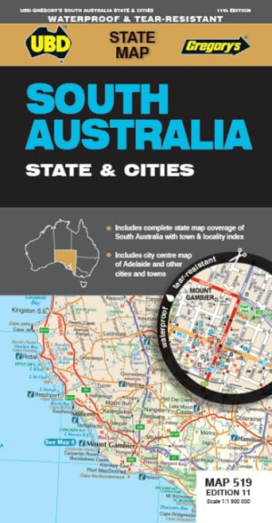
Landkaart Wegenkaart 519 South Australia State & Cities - Gregory • 9780731933242
Wegenkaart South Australia State & Cities - Gregory Productomschrijving: The latest edition of the South Australia State and Cities map is an essential tool when travelling in South Australia. It includes a state map and index to towns and localities at a scale of 1 : 1 900 000 and state touring information. In addition to this, there is a map covering 150km around Adelaide including …
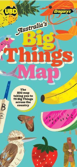
Landkaart Wegenkaart Australia's Big Things Map - UBD Gregory's • 9780731932993
Wegenkaart Australia's Big Things Map - Gregory's Productomschrijving: Australia's Big Things Map Discover 75 of the nation's favourite giant novelty icons and landmarks with the fully illustrated Australia Big Things Map. Holidaymakers, vanlifers and roadtrippers across Australia agree that any road trip should include a stop at one of our beloved Big Things. Whether it's an over…
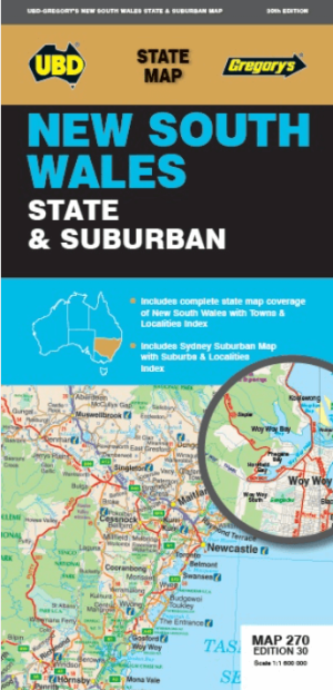
Landkaart Wegenkaart 270 New South Wales State & Suburban - UBD • 9780731933105
Wegenkaart New South Wales State & Suburban - Gregory's Productomschrijving: The latest edition of the New South Wales state and suburban map has been fully revised and updated. It includes state mapping at a scale of 1: 1 600 000 plus an index to towns and localities on one side and on the other side there is Sydney and surrounds suburban coverage north to Gosford, south to Douglas P…
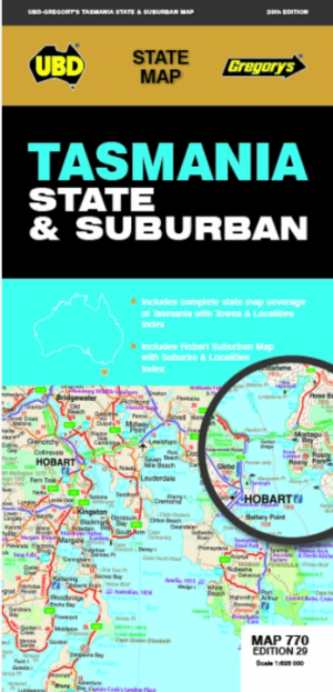
Landkaart Wegenkaart 770 Tasmania State & Suburban - Gregory's • 9780731933204
Wegenkaart Tasmania State & Suburban - Gregory's Productomschrijving: The latest edition of the Tasmania state and suburban map has been fully revised and updated and includes: State map & index to towns and localities Suburban map coverage of Hobart north to Mangalore and Runnymede south to Oyster Cove and South Arm, east to Sorell and west to Molesworth and an index to the Subur…
Complete Wegenkaarten voor West-Australië
Complete Wegenkaarten voor West-Australië, Ontdek Perth, Broome en Kimberley.
Wanneer je West-Australië wilt verkennen, zijn betrouwbare wegenkaarten essentieel. Uitgevers zoals UBD Gregory’s, National Geographic en Hema Maps bieden uitstekende kaarten speciaal voor dit fascinerende gebied. UBD Gregory’s levert gedetailleerde kaarten voor de stad Perth, bekend om Kings Park, Fremantle en nabijgelegen stranden zoals Cottesloe Beach. De praktische weergave maakt het eenvoudig om de stad en haar omgeving grondig te ontdekken.
National Geographic biedt uitgebreide routekaarten voor de regio Kimberley, beroemd om zijn wilde natuur en spectaculaire locaties zoals de Bungle Bungle Range en Gibb River Road. Deze kaarten zijn ideaal voor avonturiers die deze afgelegen regio probleemloos willen verkennen.
Hema Maps is perfect voor reizen naar de kustplaats Broome, bekend om Cable Beach met haar iconische zonsondergangen en historische locaties zoals de Japanse begraafplaats. Dankzij duidelijke schaalverhoudingen, informatie over voorzieningen, en lokale highlights, geniet je optimaal van je roadtrip door het spectaculaire West-Australië.
Praktische Wegenkaarten Australië
Praktische Wegenkaarten Australië, Vind gemakkelijk Adelaide, Tasmanië & het Rode Centrum!
Om de diversiteit van Australië volledig te ervaren, zijn gedetailleerde wegenkaarten van uitgevers als Michelin, Explore Australia en Lonely Planet ideaal. Michelin biedt duidelijke kaarten voor Zuid-Australië, waaronder Adelaide, bekend om haar festivals, wijngebieden zoals Barossa Valley en natuurgebieden zoals Kangaroo Island. Dankzij praktische symbolen en duidelijke routes ontdek je deze regio comfortabel.
Explore Australia biedt uitstekende kaarten voor reizigers die het Rode Centrum (Northern Territory) willen bezoeken. Bereik moeiteloos Uluru (Ayers Rock), Alice Springs en Kings Canyon. De kaarten bevatten nuttige informatie over wandelroutes, kampeerplaatsen en lokale bezienswaardigheden, perfect voor avonturiers.
Lonely Planet-kaarten zijn uitstekend voor reizen door Tasmanië, Australië’s eilandstaat. Hiermee verken je eenvoudig steden als Hobart, bekend om Salamanca Market en historische havenwijken. Ook natuurschatten zoals Cradle Mountain-Lake & St Clair National Park zijn duidelijk aangegeven. Door heldere weergave van voorzieningen en toeristische attracties maak je je Australische avontuur zorgeloos en onvergetelijk.