

Landkaart Wegenkaart 270 New South Wales State & Suburban - UBD
Gosford- Douglas Park- Stanwell Park- Palm Beach- Coalcliff

Korte omschrijving
Wegenkaart New South Wales State & Suburban - Gregory's Productomschrijving: The latest edition of the New South Wales state and suburban map has been fully revised and updated. It incl...

Specificaties
- Uitgever: UBD Gregory's Universal Publishers
- ISBN-13: 9780731933105
- HOOFDCATEGORIEËN: Wegenkaart - Landkaart
- Activiteiten: Street/Road maps & city plans
- Regio: New South Wales, Australië
- Land: Australië
- Schaal: 1:1600000
- Editie: 30
- Taal: Engels
- De Australische Regio's: New South Wales
Volledige omschrijving
Wegenkaart New South Wales State & Suburban - Gregory's
Productomschrijving: The latest edition of the New South Wales state and suburban map has been fully revised and updated.
It includes state mapping at a scale of 1: 1 600 000 plus an index to towns and localities on one side and on the other side there is Sydney and surrounds suburban coverage north to Gosford, south to Douglas Park and Stanwell Park, along the coast from Palm Beach to Coalcliff and west to Springwood plus an index to the suburbs and localities included on this map.
With all this information contained in this handy fold up map this is an essential tool when travelling around New South Wales and the Sydney region.
Artikelen uit dezelfde regio

Landkaart Wegenkaart 283-298 S. Highlands & S. Coast NSW - UBD • 9780731931804
Wegenkaart Southern Highlands & South Coast NSW Productomschrijving: The latest edition of the Southern Highlands and South Coast NSW regional touring map has been fully revised and updated. It includes a regional touring map covering the coast from Shellharbour in the north to Eden in the south and west to Goulburn & Braidwood. There is also street level mapping and indexes at a scal…

Landkaart Wegenkaart Australië Indigenous Journeys Map - Hema Map • 9781922668936
Wegenkaart Australië Indigenous Journeys Map - Hema Maps Productomschrijving: Australië Indigenous Journeys Map hema 1:5.5M Ontdek de zanglijnen van de oudste levende cultuur ter wereld Al meer dan 65.000 jaar bewandelen Aboriginals en Torres Strait Islanders - de traditionele eigenaars van Australië - het land, smeden handelsroutes, delen kennis en zorgen voor het land. De Indigenou…

Landkaart Wegenkaart 280 Newcastle Suburban Streets - UBD • 9780731931927
Wegenkaart Newcastle Suburban Streets - Gregory's Productomschrijving: The latest edition of the popular Newcastle Hunter Valley & surrounding region Map 280 features coverage at a scale of 1: 450 000 from Ardglen & North Haven in the north & Bateau Bay in the south and along the coast & Merriwa in the west plus an index to the towns noted on this map on one side. On the other side th…
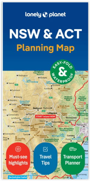
Wegenkaart Planning map New South Wales Australia - Lonely Planet • 9781788688482
Planning map New South Wales Australia - Lonely Planet Productomschrijving: From Lonely Planet: The world's number one travel guide publisher* Durable and waterproof, with a handy slipcase and an easy-fold format, Lonely Planet's New South Wales & the Australian Capital Territory Planning Map helps you explore with ease. Get more from your map and your trip with images and information…
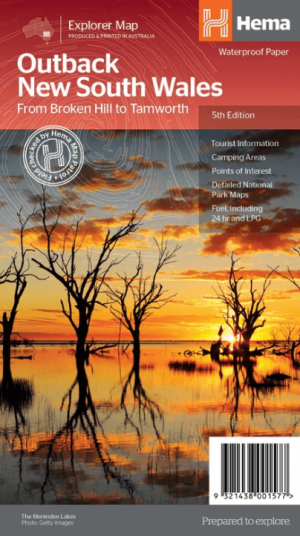
Landkaart Wegenkaart Explorer Map Outback New South Wales - Hema • 9321438001577
Explorer Map Outback New South Wales - Hema Productomschrijving: A regional map of the outback NSW (1:1,100,000) that ranges from Tamworth in the east to Broken Hill in the west, as well as from Wagga Wagga in the south to past the Queensland border in the north. On the opposite side is extensive information on numerous regions, including visitor, historical and background information. …