

Landkaart Wegenkaart Australië Indigenous Journeys Map - Hema Map
Ontdek de zanglijnen van de oudste levende cultuur ter wereld


Korte omschrijving
Wegenkaart Australië Indigenous Journeys Map - Hema Maps Productomschrijving: Australië Indigenous Journeys Map hema 1:5.5M Ontdek de zanglijnen van de oudste levende cultuur ter wereld ...

Specificaties
- Uitgever: Hema Maps
- ISBN-13: 9781922668936
- HOOFDCATEGORIEËN: Wegenkaart - Landkaart
- Activiteiten: Wandelen, Hiking & Trekking
- Regio: New South Wales, Australië, Northern Territory, Australië, Queensland, Noord-Oost Australië, South Australia, Victoria, Western Australia
- Land: Australië
- Schaal: 1:5500000
- Editie: 1
- Taal: Engels
- De Australische Regio's: New South Wales, New-Zeeland, Northern Territories, Queensland, Southern Australia, Tasmania, Victoria, Western Australia
Volledige omschrijving
Wegenkaart Australië Indigenous Journeys Map - Hema Maps
Productomschrijving: Australië Indigenous Journeys Map hema 1:5.5M
Ontdek de zanglijnen van de oudste levende cultuur ter wereld
Al meer dan 65.000 jaar bewandelen Aboriginals en Torres Strait Islanders - de traditionele eigenaars van Australië - het land, smeden handelsroutes, delen kennis en zorgen voor het land. De Indigenous Journeys Map eert deze blijvende banden met het land door middel van een gedetailleerde, respectvolle en unieke weergave van oude handelsroutes, culturele paden en zanglijnen.
Kaart Kenmerken:
* Gedetailleerde handelsroutes en paden
* Inheemse Culturele/Kunstcentra
* Verhandelde goederen en culturele uitwisseling
* Meer dan 250 inheemse taalgroepen
* Authentiek Landschap
Artikelen uit dezelfde regio

Landkaart Wegenkaart Brisbane tot Cairns Region - Hema Maps • 9781865008714
Wegenkaart Brisbane tot Cairns Region - Hema Productomschrijving: City to City Map - via the Bruce Highway A Brisbane to the Cairns Region map at a scale of 1:1,500,000 with tourist drives map (1:3,000,000). Drive between Brisbane to Cairns with relevant touring points of interest and detailed mapping for the trip with 24-hour fuel, camping areas and caravan parks, rest areas and attra…

Landkaart Wegenkaart Queensland state handy - Hema • 9781922668776
Wegenkaart Queensland state handy - Hema Productomschrijving: A compact map of Queensland (QLD) at a scale of 1:2,500,000 for touring throughout the state which features highways, major roads and minor roads. Marked on the map are national parks, camping areas, caravan parks, rest areas, points of interest and 24-hour fuel accompanied by a distance grid and an index.
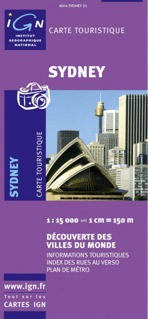
Landkaart Wegenkaart 85314 Sydney Australia - IGN • 9782758512370
Wegenkaart Sydney Australia - IGN Productomschrijving: Deze wegenkaart omvat het volledige Sydney op schaal 1:15.000 (1 cm = 150 m), hij bevat alle touristische wegen als ook Nationale parken. De kaart behoort tot de reeks van de Pays, Découverte du Monde van IGN

Landkaart Wegenkaart Victoria state map - Hema Maps • 9781865009834
Wegenkaart Victoria state map - Hema Productomschrijving: A comprehensive map of Victoria for touring throughout the state that has camping and rest areas, 24-hour fuel and points of interest marked on the mapping. On the reverse are CBD, the surrounding region and through road maps of Melbourne in addition to maps of the Great Ocean Road and East Gippsland. Also included is a national pa…

Landkaart Wegenkaart Western Australia state handy map - Hema • 9321438001560
Wegenkaart Western Australia state handy map - Hema Productomschrijving: A compact map of Western Australia (WA) for touring throughout the state with a distance grid and index for planning and reference. Marked on the mapping are highways, major and minor roads, camping and rest areas, 24-hour fuel, information centres, picnic areas, caravan parks and lookouts.