
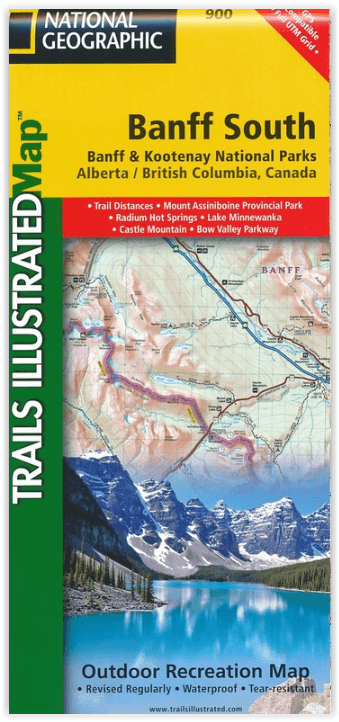
Wandelkaart 900 Banff South & Banff and Kootenay NP - Nat Geo
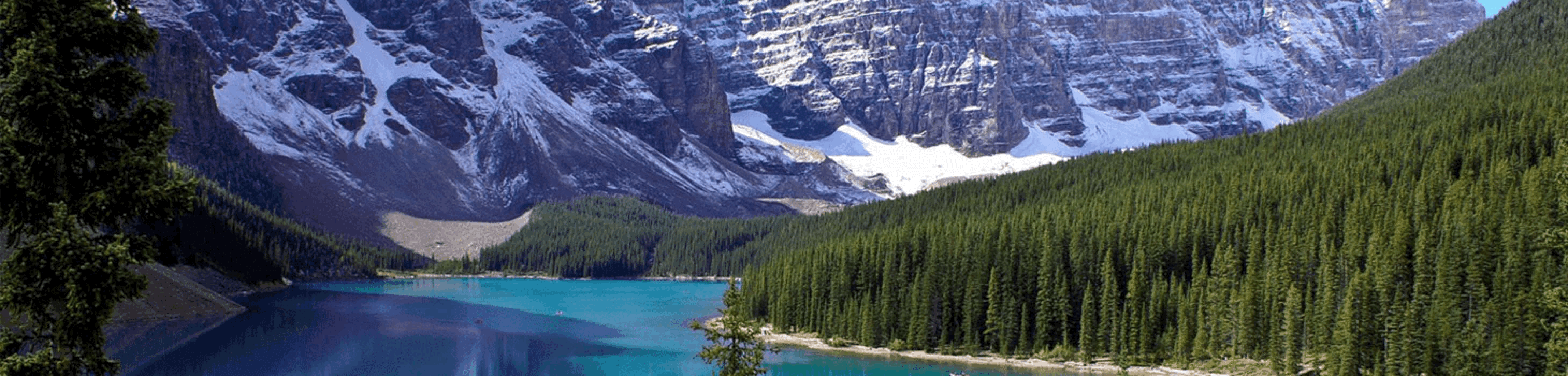
2 van Canada's mooiste nationale parken
Korte omschrijving
Wandelkaarten Alberta, Canada en British Colombia, Canada van National Geographic. Ideaal voor tochten in Canada.
Wandelkaart 900 - Banff South & Banff and Kootenay NP - Natgeo Productomschrijving: Deze omvat een overzicht van alle recreatieve wandelpaden, wegen en vele andere informatie die u zou kunne...

Specificaties
- Uitgever: National Geographic
- ISBN-13: 9781566956581
- HOOFDCATEGORIEËN: Wandelkaart
- Auteur: National Geographic
- Regio: Alberta, Canada, British Colombia, Canada
- Land: Canada
- Nationale parken: Banff NP Alberta Canada, Kootenay National Park BC Canada
- TOPO's & Stafkaarten: Topografisch wandelen
- Schaal: 1:100000
- Taal: Engels
Volledige omschrijving
Wandelkaart 900 - Banff South & Banff and Kootenay NP - Natgeo
Productomschrijving: Deze omvat een overzicht van alle recreatieve wandelpaden, wegen en vele andere informatie die u zou kunnen nodig hebben in deze 2 schitterende nationale parken, die letterlijk aan elkaar werden genaaid. De wildernis van Banff en Kootenay, zijn geen zondag wandelplaatsje, je bereidt uw tocht altijd goed voor, en gaat nooit alleen, mits u over de nodig ervaring beschikt. In deze locaties wonen de dieren nog vrij, en het omvat ook de grotere wilde dieren.
Engelse omschrijving: National Geographic's Trails Illustrated map of Banff South delivers unmatched detail for outdoor enthusiasts exploring the unparalleled mountain scenery and year-round recreational opportunities in the Canadian Rockies. Expertly researched and created in cooperation with Parks Canada and others, the map covers the southern and eastern areas of Banff National Park including popular points of interest Lake Minnewanka, Bow River, Johnston Canyon and the town of Banff. The map also covers Kootenay National Park; Scalp Creek Nature Area; Panther Corner, Dormer Sheep and Ghost PLUZs; Wild Horse and Red Deer River Recreation Areas; Height of the Rockies, Don Getty and Bow Valley Wildland Provincial Parks; Ghost River Wilderness Area; and Mount Assiniboine.
Explore the area by following the map to trailheads and then along precisely mapped trails, shown with distance markers in miles and kilometers and labeled for hiking, biking and horseback riding. To aid in your navigation the map shows glaciers and icefields, contour lines and elevations, labeled peaks and passes and water features. Find suitable areas for exploration, according to your area of interest, with labeled campgrounds and campsites, horse camps and corrals, hot springs, river access points, scenic viewpoints, interpretive trails and areas for hiking, cross-country and downhill skiing, biking, fishing.
.png)
Locatie op kaart
Overzichtskaarten

NAT GEO Jasper Alberta trail map
NAT GEO Jasper Alberta trail map

Producten op de overzichtskaart
Klik op een product om naar de detailpagina te gaan.
Artikelen uit dezelfde regio
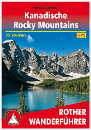

Wandelgids Kanadische Rocky Mountains - Canada - Rother • 9783763345274
Wandelgids Canadian Rocky Mountains - Rother Productomschrijving: De Rocky Mountains zijn een echt openluchtparadijs. De natuur is er nauwelijks door mensenhanden aangeraakt en betovert met haar wilde schoonheid. Dit ruige gebergte is het thuis van poema's, beren en wapiti's, en combineert de meest uiteenlopende ecosystemen in de kleinste ruimte, met enorme ijsvelden, winderige bergtoppen,…
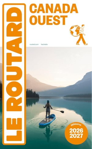
Guide Canada Ouest 2026-2027 - Le Routard • 9782017374541
Reisgids Canada Ouest 2026-27 - Le Routard Productomschrijving: Forêts impénétrables peuplées d'ours noirs, hautes montagnes aux sommets enneigés se reflétant dans des lacs émeraude, panoramas d'anthologie... Sur les traces des pionniers ou dans les parcs nationaux des Rocheuses, la rencontre avec le Grand Ouest est à la hauteur du mythe ! Dans Le Routard Canada Ouest, mis à jour par n…
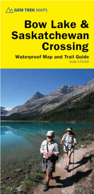
Wandelkaart 15 Bow Lake & Saskatchewan river Crossing - Gem Trek • 9781990161087
Wandelkaart Bow Lake & Saskatchewan river Crossing - Gem Trek Productomschrijving: Deze Gem Trek kaart voldoet aan de behoeften van bezoekers die de Bow Lake en Saskatchewan Crossing regio van Banff National Park willen verkennen. Of je nu over de wegen toert of het binnenland intrekt, de waterdichte en scheurbestendige kaart van Bow Lake & Saskatchewan Crossing is van onschatbare waarde. …

Stadskaart plattegrond Vancouver Canada - Borch • 9783866093294
Wandelkaart Vancouver Canada - Borch Productomschrijving: Our soft-laminated folded map of Vancouver in the 9th edition shows: Vancouver Downtown 1:15 000, Greater Vancouver 1:125 000, Vancouver - Seattle Area 1:1 800 000, Granville Island 1:5 500, Victoria 1:30 000, Public Transport Vancouver, Canada administrative & time zones, Top 30 Sights. Borch Maps are easy to fold, durable and…
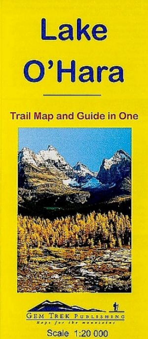
Wandelkaart 14 Lake O'Hara- BC Canada - Gemtrek • 9781895526950
Wandelkaart 14 - Lake O'Hara - Gemtrek Productomschrijving: Dit is een gedetailleerde kaart van het gebied rond Lake O'Hara, in British Colombia. Op de voorkant staat een 1:20, 000-schaal topografische kaart die betrekking heeft op het gehele Lake O'Hara trail netwerk met al de beschikbare ingetelende wandelpaden en alpine routes. De contour-interval op de kaart is 25 meter (80 voet). …