
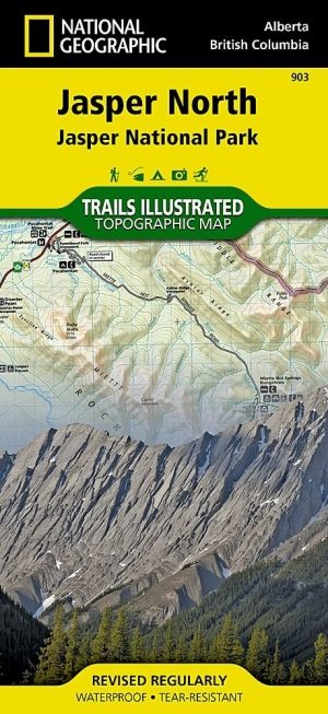
Wandelkaart 902 Jasper NP South - Nat Geo
Het Banff National Park ligt ten zuiden van dit park

Korte omschrijving
Wandelkaarten Alberta, Canada van National Geographic. Ideaal voor tochten in Canada.
TOPO Wandelkaart 902 - Jasper NP South - Alberta - Natgeo Productomschrijving: Het Jasper National Park is een nationaal park in Canada, gelegen in het westen van Alberta, en onderdeel van d...

Specificaties
- Uitgever: National Geographic
- ISBN-13: 9781566956604
- HOOFDCATEGORIEËN: Wandelkaart
- Auteur: National Geographic
- Regio: Alberta, Canada
- Land: Canada
- TOPO's & Stafkaarten: Topografisch wandelen
- Schaal: 1:100000
- Taal: Engels
Volledige omschrijving
TOPO Wandelkaart 902 - Jasper NP South - Alberta - Natgeo
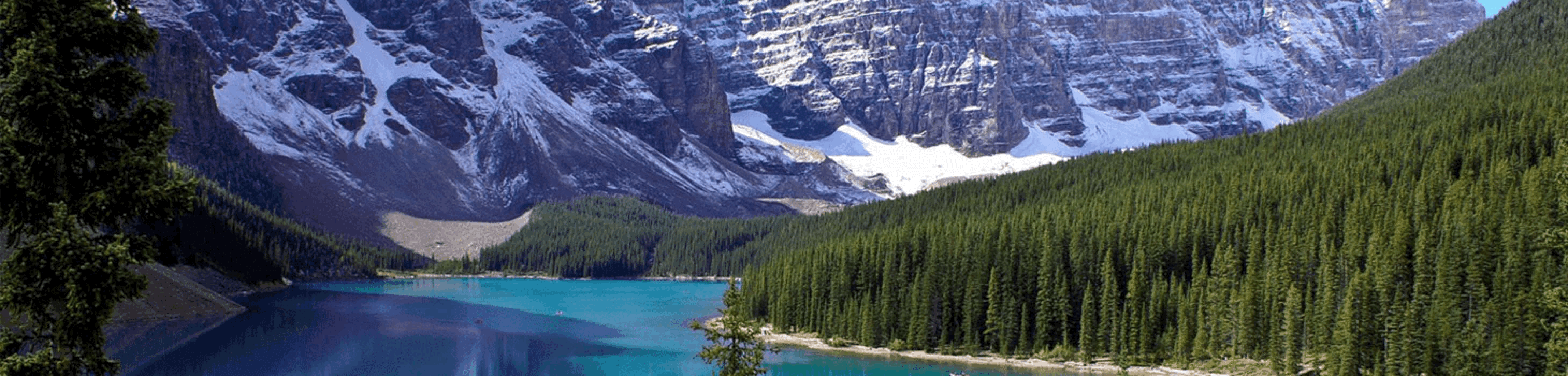
Productomschrijving: Het Jasper National Park is een nationaal park in Canada, gelegen in het westen van Alberta, en onderdeel van de Rocky Mountains. Het omvat onder meer het plaatsje Jasper en Maligne Lake. Het Banff National Park ligt ten zuiden van dit park. Jasper staat bekend om het vele wild. Dikhoornschapen, edelherten, bevers, elanden, sneeuwgeiten, rendieren, wolven, grizzlyberen en zwarte beren
Engelse omschrijving: The largest park in the Canadian Rockies, Jasper National Park is a UNESCO World Heritage Site with breathtaking mountain scenery and bountiful recreational opportunities. Expertly researched and created in cooperation with Parks Canada and others, National Geographic's Trails Illustrated map of Jasper South provides outdoor enthusiasts unparalleled detail of the region. The map covers the park from the town of Jasper and the Victoria Cross Ranges in the north to its southern boundary and includes such popular points of interest as Athabasca and Sunwapta Falls, Maligne Canyon and Lake, Icefield Centre, and Medicine Lake. Also covered are the neighboring Mount Robson, Whitehorse Wildland and Hamber Provincial Parks and the northwestern corner of Banff National Park with the Colombia Icefield.
Explore the area by following the map to trailheads and then along precisely mapped trails, labeled with distance markers and according to designated usage, whether hiking, biking, horseback riding or ATVing. Popular scenic roads are shown as well, including Highway #93A, Yellowhead Highway, Maligne Road and the spectacular Icefields Parkway, shown with distance markers, scenic pullouts and facilities alongside the road. To aid in your navigation the map shows glaciers and icefields, contour lines and elevations, labeled peaks and passes and water features. Recreation points of interest include campgrounds and primitive camps, backcountry lodging and cabins, river access and boat launch points, horse stables and corrals, downhill ski areas and scenic viewpoints. Every Trails Illustrated map is printed on "Backcountry Tough" waterproof, tear-resistant paper. A full UTM grid is printed on the map to aid with GPS navigation.
Other features found on this map include: Athabasca Falls, Icefield Centre, Jasper National Park, Maligne Canyon Maligne Lake, Medicine Lake, Sunwapta Falls.

Locatie op kaart
Gekoppelde artikelen
Wandelkaart 903 Jasper NP North - Alberta - Nat Geo • 9781566956611
standaard versieTOPO Wandelkaart 903 - Jasper NP North - Alberta - National Geographic Productomschrijving: Het Jasper National Park is een nationaal park in Canada, gelegen in het westen van Alberta, en onderdeel van de Rocky Mountains. Het beslaat een gebied van 10.878 km² en omvat onder meer het plaatsje Jasper en Maligne Lake. Het Banff National Park ligt ten zuiden van dit park. Jasper staat bekend o…
Overzichtskaarten

NAT GEO Jasper Alberta trail map
NAT GEO Jasper Alberta trail map

Producten op de overzichtskaart
Klik op een product om naar de detailpagina te gaan.
Artikelen uit dezelfde regio

Landkaart Wegenkaart D60 Jasper National Park - Gem Trek • 9781990161100
Wegenkaart Jasper National Park - Gem Trek Productomschrijving: Waterproof and tear-resistant map for Jasper National Park in the Canadian Rockies. Whether you are a first-time visitor or a long-time local, you’ll find Gem Trek’s Jasper National Park Map to be an invaluable tool. Researched and designed by locals, and printed in Canada, this map features accurate cartography and subtl…
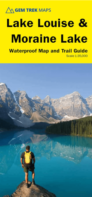
Wandelkaart 65 Lake Louise & Moraine Lake - Gem trek Pub • 9781990161162
Wandelkaart Lake Louise & Moraine Lake - Gem trek Productomschrijving: Gem Trek's 1:35,000 Lake Louise and Moraine Lake Map is a waterproof and tear-resistant relief-shaded topographic map of the Lake Louise area of Banff National Park in the Canadian Rockies. Like all Gem Trek maps, the Lake Louise and Moraine Lake Map features detailed cartography and accurate hiking trails with distanc…

Wandelkaart Canmore Up-Close Alberta Canada - Gem Trek Publ. • 9781990161209
Wandelkaart Canmore Up-Close - Gem Trek Publ. Productomschrijving: Gem Trek’s 1:35,000 Canmore Up-Close Map is a detailed relief-shaded topographic map of Canmore and the Bow Valley area. This edition has been updated to show all new subdivisions and recent changes to the trail network. On the back of the Canmore Up-Close Map are descriptions of recommended sights and detailed descrip…

Wandelkaart Banff National Park - Gem Trek • 9781990161117
Wandelkaart Banff NP - Gem Trek Productomschrijving: Waterproof and tear-resistant map for Banff National Park in the Canadian Rockies. Whether you are a first-time visitor or a long-time local, you’ll find Gem Trek’s Banff National Park Map to be an invaluable tool. Researched and designed by locals, and printed in Canada, this map features accurate cartography and subtly colored reli…
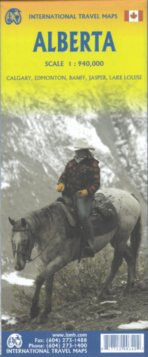
Landkaart Wegenkaart Alberta Canada - ITMB • 9781771290340
Wegenkaart Alberta Canada - ITMB Productomschrijving: Alberta is many different things - a dynamic powerhouse of the Canadian economy, the source of oil in vast quantities, cow country, the Calgary Stampede, the Rockies. Alberta is a real gem in the crown of Canada, and is one of the most popular touristic destinations in North America. With Calgary, Edmonton, Banff NP, Jasper & Lake Louis…