
Wandelkaart Icefields Parkway Alberta Canada - Gem Trek Publ.
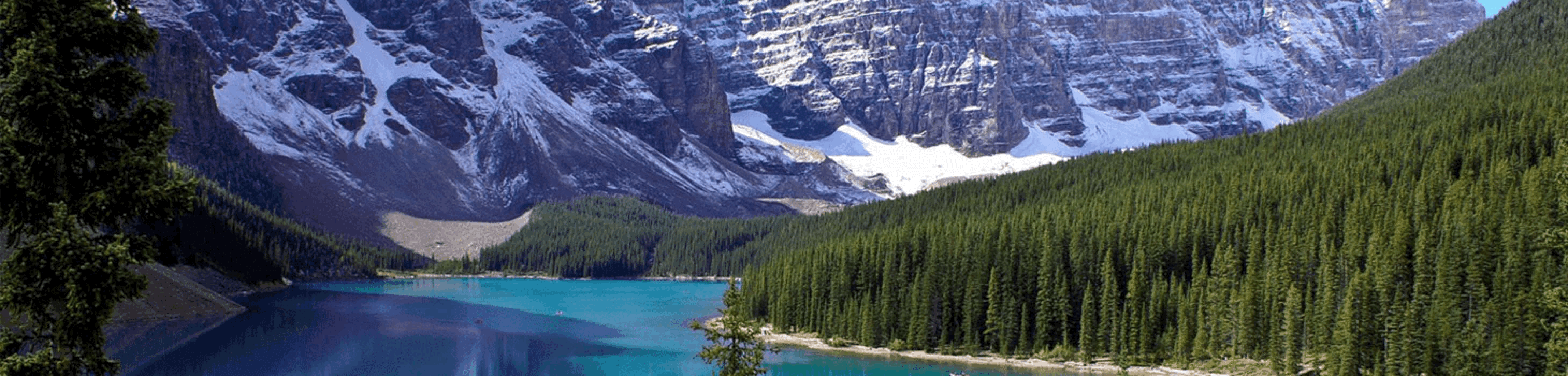
De Gletcher van Icefields Parkway met de Athabascca Pas


Korte omschrijving
Wandelkaarten Alberta, Canada en British Colombia, Canada van Gem Trek Publishing. Ideaal voor tochten in Canada.
Wandelkaart Icefields Parkway - Gem Trek Publ. Productomschrijving: In eerste instantie is wat u tegenkomt langs de weg tussen Banff & Jasper National Parks, de Gletcher zelf, zicht baar van...

Specificaties
- Uitgever: Gem Trek Publishing
- ISBN-13: 9781990161186
- HOOFDCATEGORIEËN: Wandelkaart
- Activiteiten: Wandelen, Hiking & Trekking
- Regio: Alberta, Canada, British Colombia, Canada
- Land: Canada
- Schaal: 1:400000
- Editie: 5
- Taal: Engels
Volledige omschrijving
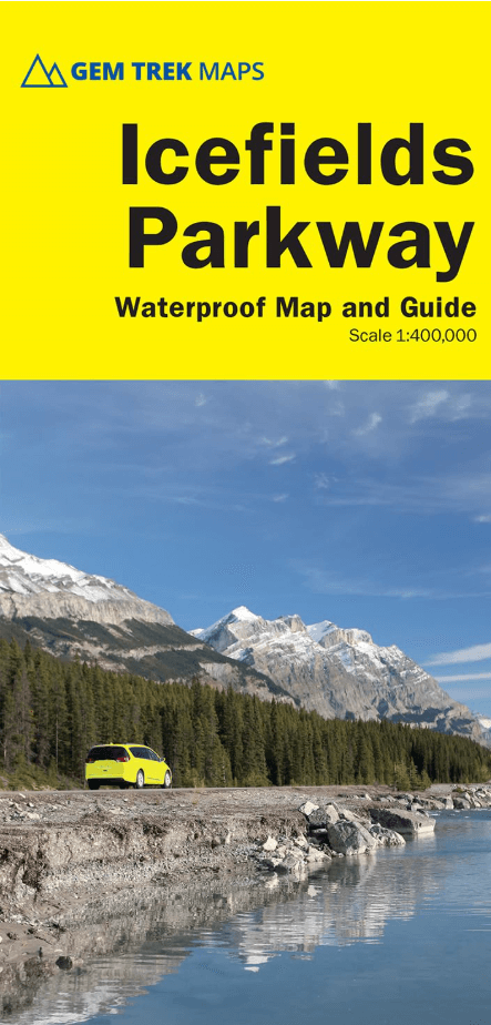
Wandelkaart Icefields Parkway - Gem Trek Publ.
Productomschrijving: In eerste instantie is wat u tegenkomt langs de weg tussen Banff & Jasper National Parks, de Gletcher zelf, zicht baar vanop de weg. Tijdens de seizoensmaanden kunt u als toerist meegaan met een bus met gigantische wielen, die u dan tot bijna boven op de gletcher brengt. Een hele speciale belevenis, Bibliotrek deed het zelf!
Engelse omschrijving: Whether you have a day or a week to spend exploring the sights along the spectacular Icefields Parkway highway, this combination map and guide will help you make the most of your time. Like our much-loved hiking maps, the Best of the Icefields Parkway map features detailed cartography and is printed on waterproof and tear-resistant paper.
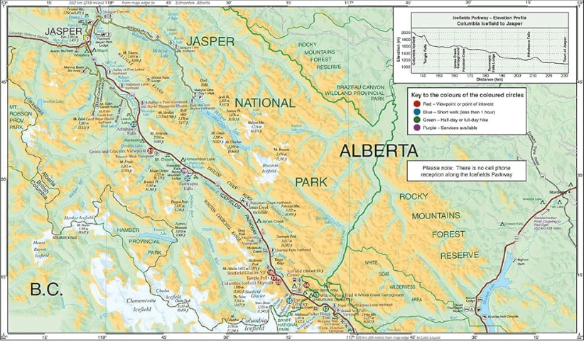
The Best of the Icefields Parkway map shows all viewpoints, picnic areas, trailheads, campgrounds, hostels, lodges and other services along the Icefields Parkway, while the descriptions in the guide point you to the best of these – the best viewpoints of mountains and lakes, the most interesting points of interest and exhibits, and the best bets for spotting wildlife such as moose, bighorn sheep and mountain goats. Also included are short descriptions of the ten best walks and day hikes along the Icefields Parkway—from the short stroll to Peyto Lake Viewpoint to the rewarding hike through alpine meadows to Helen Lake.
To make it easier to plan your day, we’ve also provided information about campgrounds, lodges, visitor centres and other key services along the Icefields Parkway. A mileage chart, area map and elevation profile complete the map.
Artikelen uit dezelfde regio
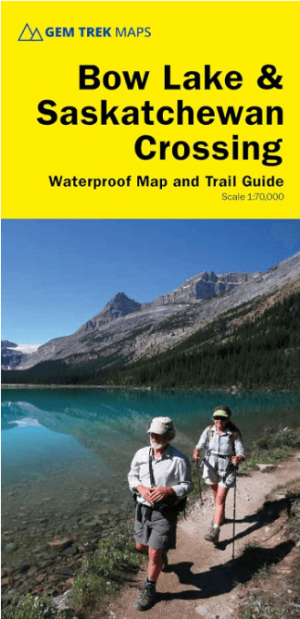
Wandelkaart 15 Bow Lake & Saskatchewan river Crossing - Gem Trek • 9781990161087
Wandelkaart Bow Lake & Saskatchewan river Crossing - Gem Trek Productomschrijving: Deze Gem Trek kaart voldoet aan de behoeften van bezoekers die de Bow Lake en Saskatchewan Crossing regio van Banff National Park willen verkennen. Of je nu over de wegen toert of het binnenland intrekt, de waterdichte en scheurbestendige kaart van Bow Lake & Saskatchewan Crossing is van onschatbare waarde. …

Wandelkaart Canmore Up-Close Alberta Canada - Gem Trek Publ. • 9781990161209
Wandelkaart Canmore Up-Close - Gem Trek Publ. Productomschrijving: Gem Trek’s 1:35,000 Canmore Up-Close Map is a detailed relief-shaded topographic map of Canmore and the Bow Valley area. This edition has been updated to show all new subdivisions and recent changes to the trail network. On the back of the Canmore Up-Close Map are descriptions of recommended sights and detailed descrip…
Reisgids Vancouver Canada - Gallimard • 9782742466078
Reisgids Vancouver - Gallimard Productomschrijving: Van de wolkenkrabbers van Downtown tot de stranden van Kitsilano, van de gerenoveerde pakhuizen van Yaletown tot de skipistes van Grouse Mountain, de grote stad van West-Canada wordt in een oogwenk onthuld met een gids als geen ander. Franse omschrijving: Des gratte-ciel de Downtown aux plages de Kitsilano, des entrepôts réhabil…
Reisgids Wat & Hoe West Canada - Kosmos • 9789043942690
Reisgids Wat & Hoe West Canada - Kosmos Productomschrijving: Met deze Wat & Hoe Reisgids West-Canada ga je voorbereid onderweg. Bezoek het multiculturele Vancouver, ontdek de moderne architectuur van Calgary of trek door de Canadese Rocky Mountains in. Ook de prachtige nationale parken van Canada, zoals Banff of Jasper, zijn het bezoeken meer dan waard. Wat krijg je: Een gids met p…
Guide Canada Ouest 2026-2027 - Le Routard • 9782017374541
Reisgids Canada Ouest 2026-27 - Le Routard Productomschrijving: Forêts impénétrables peuplées d'ours noirs, hautes montagnes aux sommets enneigés se reflétant dans des lacs émeraude, panoramas d'anthologie... Sur les traces des pionniers ou dans les parcs nationaux des Rocheuses, la rencontre avec le Grand Ouest est à la hauteur du mythe ! Dans Le Routard Canada Ouest, mis à jour par n…