

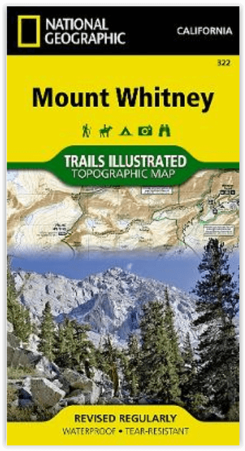
Wandelkaart 322 Mount Whitney California - Nat Geo
South Fork Kern River- Diaz Lake & Cottonwood Lakes
Korte omschrijving
Wandelkaart Mount Whitney California - Nat Geo Productomschrijving: Mount Whitney is universeel bekend als de hoogste piek in de aangrenzende Verenigde Staten, evenals het hoogste punt in Ca...

Specificaties
- Uitgever: National Geographic
- ISBN-13: 9781566956468
- HOOFDCATEGORIEËN: Wandelkaart
- Activiteiten: Wandelen, Hiking & Trekking
- Auteur:: National Geographic
- Regio: Californië, USA
- Land: Verenigde Staten van Amerika (USA)
- Schaal: 1:40000
- Taal: Engels
- Reeks/Serie:: National Geographic
Volledige omschrijving
Wandelkaart Mount Whitney California - Nat Geo
Productomschrijving: Mount Whitney is universeel bekend als de hoogste piek in de aangrenzende Verenigde Staten, evenals het hoogste punt in Californië. National Geographic's Trails Illustrated kaart van Mount Whitney levert ongeëvenaarde details en waardevolle informatie om je te helpen bij je verkenning van dit prachtige gebied.
Deze kaart, die deskundig is onderzocht en gemaakt in samenwerking met lokale beheerders, toont de belangrijkste interessante gebieden, waaronder Sequoia, Kings Canyon en Inyo nationale parken, Sequoia-Kings Canyon en de John Muir wildernisgebieden: South Fork Kern River, Diaz Lake en Cottonwood Lakes.
Engelse omschrijving: Mount Whitney is universally famous as the highest peak in the contiguous United States, as well as the highest point in California. National Geographic's Trails Illustrated map of Mount Whitney delivers unmatched detail and valuable information to assist you in your exploration of this beautiful region. Expertly researched and created in partnership with local land management agencies, this map features key areas of interest including Sequoia, Kings Canyon, and Inyo national parks, Sequoia-Kings Canyon and the John Muir wildernesss areas: South Fork Kern River, Diaz Lake, and Cottonwood Lakes.
With miles of mapped trails including the popular Pacific Crest and John Muir trails, this map can guide you off the beaten path and back again in some of the most breathtaking scenery in the region. The clearly marked trails include mileage between intersections. A Mount Whitney trail profile inset showing the changes in altitude from various points along the Pacific Crest Trail Junction and the Whitney Portal Trailhead provides a handy tool for hikers. Scenic byways are noted for those wishing to take in the scenery by car. The map base includes contour lines and elevations for summits, passes and many lakes. Some of the many recreation features noted are campgrounds, trailheads, boat launches, swimming and fishing areas, and pack stations. A variety of helpful information about climbing Mount Whitney, Inyo National Forest, Sequoia and Kings Canyon National Parks, safety tips, and more is included as well.
Every Trails Illustrated map is printed on ''Backcountry Tough'' waterproof, tear-resistant paper. A full UTM grid is printed on the map to aid with GPS navigation.
Locatie op kaart
Overzichtskaarten

NAT GEO California trail maps
NAT GEO California trail maps

Producten op de overzichtskaart
Klik op een product om naar de detailpagina te gaan.
- Wandelkaart 205 Sequoia & Kings Canyon NP - California
- Wandelkaart 206 Yosemite NP - California - Nat Geo
- Wandelkaart 218 Redwood National & State Parks - Nat Geo
- Wandelkaart 221 Death Valley NP - Nevada - Natgeo
- Wandelkaart 226 Joshua Tree NP - California - Nat Geo
- Wandelkaart 256 Mojave National park California - Nat Geo
- Wandelkaart 306 Yosemite SW- Yosemite Valley - Nat Geo
- Wandelkaart 307 Yosemite NP North West - Nat Geo
- Wandelkaart 308 Yosemite NE- Tuolumne Meadows - Nat Geo
- Wandelkaart 309 Yosemite SE - Ansel Adams Wilderness - Nat Geo
- Wandelkaart 322 Mount Whitney California - Nat Geo
- Wandelkaart 803 Lake Tahoe Basin - California - Nat Geo
- Wandelkaart 804 Tahoe National Forest West - Nat Geo
- Wandelkaart 805 Tahoe Nat. Forest East - Sierra Buttes - Nat Geo
- Wandelkaart 809 Mammoth Lakes - Mono Divide - Nat Geo
- Wandelkaart 810 Shaver Lake - Sierra National Forest - Nat Geo
Artikelen uit dezelfde regio

Wandelkaart 809 Mammoth Lakes - Mono Divide - Nat Geo • 9781566952668
TOPO Wandelkaart 809 - Mammoth Lakes - Mono Divide - National Geographic Productomschrijving: Mammoth Lakes is een stadje in Mono County, California, de enige geintegreerde community in de regio. Gelegen direct ten oosten van Mammoth Mountain. Engelse omschrijving: Explore the magnificent alpine landscape of Mammoth Lakes, Mono Divide with National Geographic's Trails Illustrated map. …

Wandelkaart 268 Lassen Volcanic NP - California - Nat Geo • 9781566956796
TOPO Wandelkaart 268 - Lassen Volcanic NP - Nat Geo Productomschrijving: Het Lassen Volcanic National Park is een Amerikaans nationaal park in het noordoosten van de staat Californië. Het meest in het oog springende kenmerk in het park is de Lassen Peak, een 3181 meter hoge kegelvulkaan en de meest zuidelijke vulkaan in het Cascadegebergte. Engelse omschrijving: Lassen Volcanic Nation…
Reisgids USA Southwest & National Parks - DK Eyewitness • 9780241365519
USA Southwest & National Parks Omvat: Arizona, Las Vegas, Southern Utah, the Four Corners & New Mexico. Productomschrijving: Staar naar de diepten van de Grand Canyon, ervaar de glitter en glamour van de Las Vegas strip, beklim de rotsachtige overspanningen van Arches National Park of wandel door het historische Santa Fe: alles wat u moet weten is overzichtelijk weergegeven in kleurgec…

Wandelkaart 811 Angeles National Forest - Natgeo • 9781566955775
Wandelkaart Angeles National Forest, California USA (9781566955775) National Geographic Productomschrijving: Een bosgebied in de onmiskenbare San Gabriel Mountains in het zuiden van de Amerikaanse staat Californië. Het bestaat uit twee delen die van elkaar gescheiden worden door de Soledad Canyon. Het Angeles National Forest reikt tot net over de grens met San Bernardino County in het oost…

Wandelkaart 307 Yosemite NP North West - Nat Geo • 9781566954129
Yosemite North West - Nat Geo Omvat: Emigrant Wilderness, Lake Eleanor, Stanislaus National Forest, Yosemite National Park. Engelse omschrijving: National Geographic's Trails Illustrated map of Yosemite North West- Hetch Hetchy Reservoir is designed to meet the needs of outdoor enthusiasts by combining valuable information with unmatched detail of this magnificent region of Yosemite Na…