

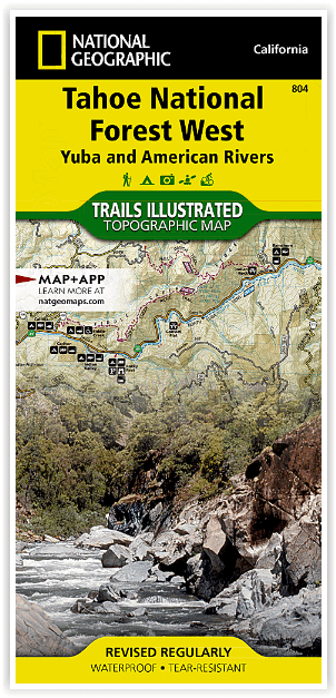
Wandelkaart 804 Tahoe National Forest West - Nat Geo
Yuba & American Rivers
Korte omschrijving
Wandelkaarten Californië, USA van National Geographic. Ideaal voor tochten in Verenigde Staten van Amerika (USA).
Tahoe National Forest West - Nat Geo Omvat: Donner Pass, Eldorado National Forest, Granite Chief Wilderness, Mosquito Ridge, Plumas National Forest, Sawtooth Ridge, Tahoe National Forest, Tr...

Specificaties
- Uitgever: National Geographic
- ISBN-13: 9781566954259
- HOOFDCATEGORIEËN: Wandelkaart
- Activiteiten: Wandelen, Hiking & Trekking
- Auteur: National Geographic
- Regio: Californië, USA
- Land: Verenigde Staten van Amerika (USA)
- Waterafstotende kaart: Nat Geo waterproof series
- TOPO's & Stafkaarten: Topografisch wandelen
- Schaal: 1:63360
- Taal: Engels
Volledige omschrijving
Tahoe National Forest West - Nat Geo
Omvat: Donner Pass, Eldorado National Forest, Granite Chief Wilderness, Mosquito Ridge, Plumas National Forest, Sawtooth Ridge, Tahoe National Forest, Truckee.
Engelse omschrijving: Expertly researched and created in partnership with the U.S. Forest Service and others, National Geographic's Trails Illustrated map of Yuba and American Rivers region of Tahoe National Forest provides an unparalleled tool for exploring this historically significant region of the Sierras. Whatever the season, you'll find this map a useful tool in pursuing a host of recreational activities from skiing and snowmobiling to camping and boating. The map features many key points of interest, including French Meadows and New Bullards Bar Reservoirs, Granite Chief Wilderness, South Yuba River Recreation Area, Malakoff Diggins State Historic Park, Donner Memorial State Park and the western rim of the Lake Tahoe Basin Management Unit.
The Tahoe National Forest West map can guide you off the beaten path and back again with miles of clearly marked trails including portions of the Pacific Crest, Pioneer, and Tahoe Rim trails. To help you choose the path that's right for you, trails are color coded according to the designated usage and mileage between intersections is indicated. The Yuba Donner scenic byways is noted for those wishing to take in the scenery by car. Many recreation features are noted as well, including ski areas, campgrounds, trailheads, wildlife viewing areas, boat launches, and swimming and fishing areas. The map base includes contour lines and elevations for summits, passes and many lakes.
Every Trails Illustrated map is printed on "Backcountry Tough" waterproof, tear-resistant paper. A full UTM grid is printed on the map to aid with GPS navigation.
Locatie op kaart
Artikelen uit dezelfde regio

Reisgids Anwb Extra Los Angeles- San Francisco & Las Vegas - Anwb • 9789018049782
Reisgids Los Angeles- San Francisco & Las Vegas - Anwv Productomschrijving: ANWB Extra reisgids Los Angeles, San Francisco en Las Vegas - Amerika Ontdek Los Angeles, San Francisco en Las Vegas met de compleet vernieuwde reisgids ANWB Extra Los Angeles, San Francisco en Las Vegas! In deze Amerikaanse driehoek komt elke vakantieganger aan zijn trekken. De natuurliefhebber in Big Sur en d…
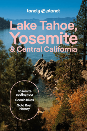
Reisgids Lake Tahoe, Yosemite California - Lonely Planet • 9781837588152
Reisgids Lake Tahoe Yosemite NP, California - Lonely Planet Productomschrijving: Lonely Planet's local travel experts reveal all you need to know to plan the trip of a lifetime in this latest edition of our guide to Lake Tahoe, Yosemite & Central California. Discover Lake Tahoe, Yosemite & Central California's most popular experiences and best kept secrets from paddleboarding or kayaking o…

Reisgids Los Angeles & Southern California - Lonely planet • 9781787017085
Los Angeles & Southern California - Lonely planet Productomschrijving: Cruise the slow lanes of the Pacific Coast Highway, ride in spinning teacups at Disneyland Resort, or hit the trails in Joshua Tree National Park, all with your trusted travel companion. Begin your journey now! - Full-color maps and images throughout - Highlights and itineraries help you tailor your trip to your p…

Wandelkaart 226 Joshua Tree NP - California - Nat Geo • 9781566953009
TOPO Wandelkaart 226 - Joshua Tree NP- California - Nat Geo Productomschrijving: Het Joshua Tree National Park is een nationaal park in het zuiden van de staat Californië in de Verenigde Staten, ten oosten van het gebied tussen Los Angeles en San Diego en ten noorden van Palm Springs. De afmetingen zijn ongeveer 100 km van oost naar west, en 50 km van noord naar zuid. Engelse omschrij…
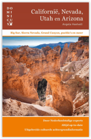
Reisgids Californië- Arizona- Nevada & Utah - Gottmer • 9789025779139
Californië- Arizona- Nevada & Utah van Gottmer Productomschrijving: Of je nu nieuwsgierig bent naar cultuurbepalende wereldsteden als San Francisco en Los Angeles dan wel je juist graag terugtrekt in de natuur: de zuidwestelijke hoek van de VS is voor iedereen een gebied vol hoogtepunten. Californië trekt het grootste aantal bezoekers, gevolgd door de Grand Canyon in Arizona, de nationale …