

Wandelkaart 1201 Colorado Trail Zuid - NAT GEO
Zuidelijke trail van Durango tot Monarch

Korte omschrijving
Wandelkaarten Colorado, USA van National Geographic. Ideaal voor tochten in Verenigde Staten van Amerika (USA).
TOPO Wandelkaart 1201 - Colorado Trail Zuid - Durango tot Monarch Productomschrijving: The Colorado Trail is een lange-afstands wandelroute van om en bij de 782 km. Deze loopt van de mond va...

Specificaties
- Uitgever: National Geographic
- ISBN-13: 9781566956949
- HOOFDCATEGORIEËN: Wandelkaart
- Auteur: National Geographic
- Regio: Colorado, USA
- Land: Verenigde Staten van Amerika (USA)
- Lange afstand wandelroutes: Colorado Trail (782 km)
- TOPO's & Stafkaarten: Topografisch wandelen
- Schaal: 1:75000
- Taal: Engels
Volledige omschrijving
TOPO Wandelkaart 1201 - Colorado Trail Zuid - Durango tot Monarch
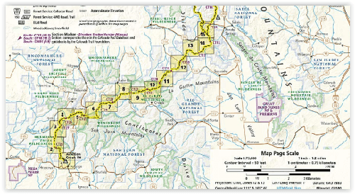
Productomschrijving: The Colorado Trail is een lange-afstands wandelroute van om en bij de 782 km. Deze loopt van de mond van Waterton Canyon ten zuidwesten van Denver tot Durango in Colorado. Zijn hoogste punt is 4,045 meter boven zeeniveau, en de overgrote meerderheid van de route loopt boven de 3,000 meter. Ondanks zijn hoog gelegen elevatie, loopt de route hier en daar onder de boomgrens om zo wat onderdak te bieden van de elementen.
Engelse omschrijving: The Colorado Trail, South Topographic Map Guide has been designed as the perfect traveling companion when navigating the southern section of The Colorado Trail. In a state known for its trails, The Colorado Trail is Colorado's premier long distance trail. Conceived in 1973 and completed in 1987, the trail runs 486 miles between Denver and Durango, traversing some of the most spectacular scenery in the state.
When The Colorado Trail is traversed from its southern terminus outside of Durango it climbs steeply into the San Juan Mountains where it stays above 10,000 feet for almost 150 miles with only a single steep decent to the Animas River near Silverton. The highest point on the trail is found in the San Juan Mountains at 13,271 feet. After leaving the San Juan Mountains, the trail travels for a short time below 10,000 feet before once again climbing into the Sawatch Range and joining The Colorado Trail North and Collegiate Loop. Each page is centered on the trail and overlaps with adjacent pages so there is little chance of getting lost. Along the bottom of each page is a trail profile that shows the distance between passes, camping areas, and trail access points. The map and trail profile provide a step by step visual guide to hiking the trail, mile by rugged mile.
Expertly researched and created in partnership with local land management agencies including The Colorado Trail Foundation, this map guide provides detailed topographic maps, interesting history, bike detour maps, and a resupply location chart shows distances, and services available at each resupply point. More convenient and easier to use than folded maps, but just as compact and lightweight, National Geographic's Topographic Map Guide booklets are printed on "Backcountry Tough" waterproof, tear-resistant paper with stainless steel staples. A full UTM grid is printed on the map to aid with GPS navigation.
.png)
Locatie op kaart
Gekoppelde artikelen

Wandelkaart 1203 Colorado Trail & Collegiate Loop- Natgeo • 9781566957229
standaard versieWandelkaart 1203- Colorado Trail & Collegiate Loop- Natgeo Productomschrijving: The Colorado Trail is een lange-afstands wandelroute van om en bij de 782 km. Deze loopt van de mond van Waterton Canyon ten zuidwesten van Denver tot Durango in Colorado. Zijn hoogste punt is 4,045 meter boven zeeniveau, en de overgrote meerderheid van de route loopt boven de 3,000 meter. Ondanks zijn hoog gel…

Wandelkaart 1202 Colorado Trail Noord - Nat geo • 9781566956956
standaard versieTOPO Wandelkaart 1202 - Colorado Trail Noord - Natgeo Productomschrijving: The Colorado Trail is een lange-afstands wandelroute van om en bij de 782 km. Deze loopt van de mond van Waterton Canyon ten zuidwesten van Denver tot Durango in Colorado. Zijn hoogste punt is 4,045 meter boven zeeniveau, en de overgrote meerderheid van de route loopt boven de 3,000 meter. Ondanks zijn hoog gelegen …
Artikelen uit dezelfde regio
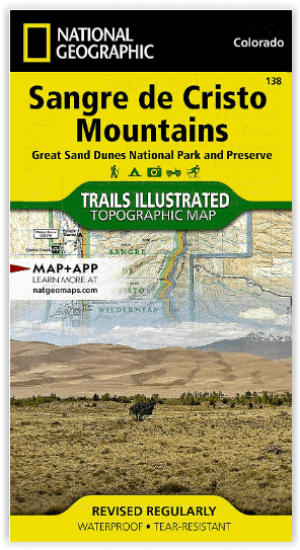
Wandelkaart 138 Sangre de Cristo Mountains - Nat Geo • 9781566953511
Sangre de Cristo Mountains - Great Sand Dunes NP & Preserve Productomschrijving: Verken de kroon van de zuidelijke Rockies en het wonder van de Great Sand Dunes met National Geographic's Trails Illustrated kaart van Sangre de Cristo Mountains. Gemaakt in samenwerking met lokale land management agentschappen, deze deskundig onderzochte kaart levert ongeëvenaarde details en nuttige informati…

Wandelkaart 1303 Colorado 14ers- Zuid - Nat geo • 9781566957007
TOPO Wandelkaart 1303 - Colorado 14ers- Zuid - Natgeo Productomschrijving: De colorad 14'ers Zuid, zijn de 14 meest indrukwekkende bergmassieven in het zuiden van Colorado. De locatie is onderverdeeld in drie regio's zoals: De Elk Range, San Juan Range & Sangre De Cristo Range. Elk Range: Capitol Peak, Castle Peak, Conundrum Peak, Maroon Peak, North Maroon Peak, Pyramid Peak, Snowmass …

Wandelkaart 1304 Colorado Backpack Loops- Noord - Natgeo • 9781566957557
TOPO Wandelkaart 1304 - Colorado Backpack Loops- Noord - Natgeo Productomschrijving: Colorado is gelend voor zijn outdoor recreatrieve opportuniteiten. Eén van deze bezigheden is uiteraard backcountry & hiking. De Colorado Backpack Loops North Topographic Map Guide omavt de dozijn aan cirkelvormige wandelroutes geselecteerd door het personeel van National Geographic voor hun diversiteit, h…
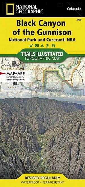
Wandelkaart 245 Black Canyon of the Gunnison NP - Natgeo • 9781566953689
TOPO Wandelkaart 245 - Black Canyon of the Gunnison NP - Nat Geo Productomschrijving: Het Black Canyon of the Gunnison National Park is een nationaal park in het westen van de Amerikaanse staat Colorado. Het beschermt 19 km van de 77 km lange kloof van de Gunnison River, een zijrivier van de Colorado River. Engelse omschrijving: The Black Canyon, 48 miles of awe-inspiring, steep-walle…
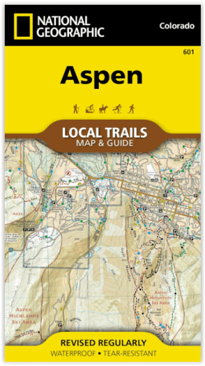
Wandelkaart 601 Aspen Local Trails - Nat Geo • 9781566957526
Wandelkaart Aspen Local Trails - Nat Geo Productomschrijving: Met meer dan 320 km aan wandelpaden op korte afstand van de stad hebben bezoekers van Aspen een benijdenswaardig probleem: met al deze paden om uit te kiezen, waar moeten ze beginnen? De Aspen Local Trails-kaart helpt bij het beantwoorden van deze vraag - waar gaan de plaatselijke bewoners heen als ze een korte wandeling met het…