

Wandelkaart 1202 Colorado Trail Noord - Nat geo
Noordelijk deel van Monarch tot Denver

Korte omschrijving
Wandelkaarten Colorado, USA van National Geographic. Ideaal voor tochten in Verenigde Staten van Amerika (USA).
TOPO Wandelkaart 1202 - Colorado Trail Noord - Natgeo Productomschrijving: The Colorado Trail is een lange-afstands wandelroute van om en bij de 782 km. Deze loopt van de mond van Waterton C...

Specificaties
- Uitgever: National Geographic
- ISBN-13: 9781566956956
- HOOFDCATEGORIEËN: Wandelkaart
- Auteur: National Geographic
- Regio: Colorado, USA
- Land: Verenigde Staten van Amerika (USA)
- Lange afstand wandelroutes: Colorado Trail (782 km)
- TOPO's & Stafkaarten: Topografisch wandelen
- Schaal: 1:75000
- Taal: Engels
Volledige omschrijving
TOPO Wandelkaart 1202 - Colorado Trail Noord - Natgeo
Productomschrijving: The Colorado Trail is een lange-afstands wandelroute van om en bij de 782 km. Deze loopt van de mond van Waterton Canyon ten zuidwesten van Denver tot Durango in Colorado. Zijn hoogste punt is 4,045 meter boven zeeniveau, en de overgrote meerderheid van de route loopt boven de 3,000 meter. Ondanks zijn hoog gelegen elevatie, loopt de route hier en daar onder de boomgrens om zo wat onderdak te bieden van de elementen.
Engelse omschrijving: The Colorado Trail North Topographic Map Guide has been designed as the perfect traveling companion when navigating the north section of The Colorado Trail. In a state known for its trails, The Colorado Trail is Colorado's premier long distance trail. Conceived in 1973 and completed in 1987, the trail runs 486 miles between Denver and Durango, traversing some of the most spectacular scenery in the state.
The Colorado Trail is often started at its north terminus in Waterton Canyon just outside of Denver. When traveling from north to south the trail follows the South Platte River and quickly climbs into the Lost Creek Wilderness. From here the trail crosses into Holy Cross Wilderness near Leadville. The trail then skirts the eastern slope of the Sawatch Range and passes beneath Mount Elbert, the highest mountain in Colorado. Next comes the Collegiate Peaks Wilderness with its multiple 14ers before finally joining with the Collegiate Loop near Monarch Pass. The Colorado Trail from Monarch to Durango is then picked up on the south Topographic Map Guide. Each page is centered on the trail and overlaps with adjacent pages so there is little chance of getting lost. Along the bottom of each page is a trail profile that shows the distance between passes, camping areas, and trail access points. The map and trail profile provide a step by step visual guide to hiking the trail, mile by rugged mile.
Expertly researched and created in partnership with local land management agencies including The Colorado Trail Foundation, this map guide provides detailed topographic maps, interesting history, bike detour maps, and a resupply location chart shows distances, and services available at each resupply point. More convenient and easier to use than folded maps, but just as compact and lightweight, National Geographic's Topographic Map Guide booklets are printed on "Backcountry Tough" waterproof, tear-resistant paper with stainless steel staples. A full UTM grid is printed on the map to aid with GPS navigation.
.png)
.png)
Locatie op kaart
Gekoppelde artikelen

Wandelkaart 1201 Colorado Trail Zuid - NAT GEO • 9781566956949
standaard versieTOPO Wandelkaart 1201 - Colorado Trail Zuid - Durango tot Monarch Productomschrijving: The Colorado Trail is een lange-afstands wandelroute van om en bij de 782 km. Deze loopt van de mond van Waterton Canyon ten zuidwesten van Denver tot Durango in Colorado. Zijn hoogste punt is 4,045 meter boven zeeniveau, en de overgrote meerderheid van de route loopt boven de 3,000 meter. Ondanks zijn h…
Artikelen uit dezelfde regio

Wandelkaart 140 Weminuche Wilderness Colorado USA - Nat Geo • 9781566952910
Wandelkaart Weminuche Wilderness Colorado USA - Nat Geo Productomschrijving: De Weminuche Wilderness overspant de Continental Divide en is met bijna een half miljoen hectare het grootste wildernisgebied in Colorado. Deskundig onderzocht en gemaakt in samenwerking met lokale landbeheerders, biedt National Geographic's Trails Illustrated kaart van de Weminuche Wilderness een ongeëvenaard hul…
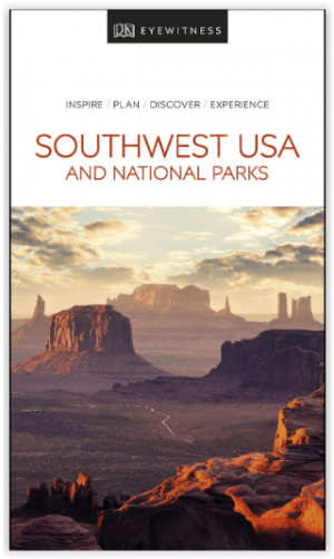
Reisgids USA Southwest & National Parks - DK Eyewitness • 9780241365519
USA Southwest & National Parks Omvat: Arizona, Las Vegas, Southern Utah, the Four Corners & New Mexico. Productomschrijving: Staar naar de diepten van de Grand Canyon, ervaar de glitter en glamour van de Las Vegas strip, beklim de rotsachtige overspanningen van Arches National Park of wandel door het historische Santa Fe: alles wat u moet weten is overzichtelijk weergegeven in kleurgec…

Wandelkaart 127 Aspen - Independence Pass - Colorado USA • 9781566953580
TOPO Wandelkaart 127 - Aspen - Independence Pass - Colorado USA Productomschrijving: Independence Pass in Aspen Colorado is een uitmuntende wandellocatie. Deze omvat een topografische wandelkaart die echt tot de verbeelding spreekt. Een subliem exemplaar als het over wandelen gaat. Engelse omschrijving: Independence Pass, originally known as Hunter Pass, is a high mountain pass in cen…

Wandelkaart 134 Black Mesa - Curecanti Pass Colorado - Nat Geo • 9781566954303
Wandelkaart Black Mesa - Curecanti Pass Colorado - Nat Geo Productomschrijving: Outdoor enthousiastelingen die de afgelegen en ongetemde bergen van westelijk Colorado willen verkennen zullen zich verbazen over National Geographic's Trails Illustrated kaart van Black Mesa en Curecanti Pass. Gemaakt in samenwerking met de U.S. Forest Service, dekt deze deskundig onderzochte kaart, het recrea…

Wandelkaart 1303 Colorado 14ers- Zuid - Nat geo • 9781566957007
TOPO Wandelkaart 1303 - Colorado 14ers- Zuid - Natgeo Productomschrijving: De colorad 14'ers Zuid, zijn de 14 meest indrukwekkende bergmassieven in het zuiden van Colorado. De locatie is onderverdeeld in drie regio's zoals: De Elk Range, San Juan Range & Sangre De Cristo Range. Elk Range: Capitol Peak, Castle Peak, Conundrum Peak, Maroon Peak, North Maroon Peak, Pyramid Peak, Snowmass …