

Wandelkaart 1304 Colorado Backpack Loops- Noord - Natgeo
12 Verkozen wandelroutes in Colorado

Korte omschrijving
Wandelkaarten Colorado, USA van National Geographic. Ideaal voor tochten in Verenigde Staten van Amerika (USA).
TOPO Wandelkaart 1304 - Colorado Backpack Loops- Noord - Natgeo Productomschrijving: Colorado is gelend voor zijn outdoor recreatrieve opportuniteiten. Eén van deze bezigheden is uiteraard b...

Specificaties
- Uitgever: National Geographic
- ISBN-13: 9781566957557
- HOOFDCATEGORIEËN: Wandelkaart
- Activiteiten: Wandelen, Hiking & Trekking
- Auteur: National Geographic
- Regio: Colorado, USA
- Land: Verenigde Staten van Amerika (USA)
- TOPO's & Stafkaarten: Topografisch wandelen
- Schaal: 1:63360
- Taal: Engels
Volledige omschrijving
TOPO Wandelkaart 1304 - Colorado Backpack Loops- Noord - Natgeo
Productomschrijving: Colorado is gelend voor zijn outdoor recreatrieve opportuniteiten. Eén van deze bezigheden is uiteraard backcountry & hiking. De Colorado Backpack Loops North Topographic Map Guide omavt de dozijn aan cirkelvormige wandelroutes geselecteerd door het personeel van National Geographic voor hun diversiteit, hun afgelegenheden, en inspirerende plaatsen van hystorisch belang. Elke route ligt tussen 8 en 25 miles met hoogtes tussen de 2,000 en 7,000 feet. (1500 tot 2500 meter)
Engelse omschrijving: Colorado is renowned for its outdoor recreational opportunities. One of these pastimes is, of course, backcountry hiking. The Colorado Backpack Loops North Topographic Map Guide covers a dozen backpack loops selected by National Geographic staff for their diversity, remoteness, and inspiring vistas. Each page of the Topographic Map Guide includes a detailed map of the trail with directions to the trailhead from the nearest major town as well as a trail profile with mileages to foreshadow the elevation changes that will be met along the way. GPS coordinates are also provided for strategic points along the trail to help with navigation.
The trails are organized by the number of nights backpackers can expect to be in the backcountry, from one to more than three. They range from 8 to 25 miles long with elevation gains from 2,000 to over 7,000 feet. Written descriptions of each trail give an overview of the natural features that will be encountered along the way as well as the length, total elevation gain, and nearest town to each trailhead. This Topographic Map Guide will get you into the wild lands of northern Colorado that most hikers in the country can only dream about.
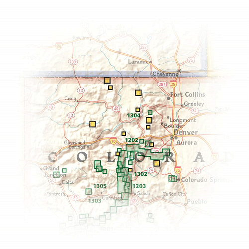
Locatie op kaart
Artikelen uit dezelfde regio

Wandelkaart 134 Black Mesa - Curecanti Pass Colorado - Nat Geo • 9781566954303
Wandelkaart Black Mesa - Curecanti Pass Colorado - Nat Geo Productomschrijving: Outdoor enthousiastelingen die de afgelegen en ongetemde bergen van westelijk Colorado willen verkennen zullen zich verbazen over National Geographic's Trails Illustrated kaart van Black Mesa en Curecanti Pass. Gemaakt in samenwerking met de U.S. Forest Service, dekt deze deskundig onderzochte kaart, het recrea…

Wandelkaart 139 La Garita Caldera - Cochetopa - Nat Geo • 9781566953399
TOPO Wandelkaart 139 - La Garita Caldera - Cochetopa - National Gepgraphic Productomschrijving: La Garita Caldera is de krater van een grote dode vulkaan in het zuidwesten van Colorado in de Verenigde Staten. De caldera, een ringvormige bergketen die centraal binnen een cluster van kleinere caldera's ligt, maakt deel uit van het San Juan Gebergte in de Rocky Mountains. Engelse omschrij…

Wandelkaart 127 Aspen - Independence Pass - Colorado USA • 9781566953580
TOPO Wandelkaart 127 - Aspen - Independence Pass - Colorado USA Productomschrijving: Independence Pass in Aspen Colorado is een uitmuntende wandellocatie. Deze omvat een topografische wandelkaart die echt tot de verbeelding spreekt. Een subliem exemplaar als het over wandelen gaat. Engelse omschrijving: Independence Pass, originally known as Hunter Pass, is a high mountain pass in cen…

Wandelkaart 100 Boulder & Golden Colorado USA - Nat Geo • 9781566953351
Wandelkaart Boulder & Golden Colorado USA - Nat Geo Productomschrijving: National Geographic's Trails Illustrated kaart van Boulder en Golden combineert ongeëvenaarde details met nuttige informatie om een onschatbaar hulpmiddel te bieden om het meeste uit uw verkenning van de centrale Colorado Front Range te halen. Deskundig onderzocht en gemaakt in samenwerking met lokale landbeheerders. …

Wandelkaart 141 Telluride- Silverton- Ouray & Lake City - Nat Geo • 9781566953405
Wandelkaart Telluride- Silverton- Ouray & Lake City - Nat Geo Productomschrijving: De National Geographic Trails Illustrated kaart van Telluride, Silverton, Ouray, en Lake City is deskundig onderzocht en gemaakt in samenwerking met lokale landbeheerders. Het is een ongeëvenaard hulpmiddel voor het verkennen van deze adembenemende regio van Colorado. Ongeacht het seizoen is deze kaart een h…