
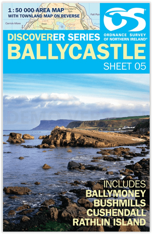
Wandelkaart 05 Discoverer Ballycastle - Discoverer series - OSNI
Ballymoney - Bushmills - Cushendall & Rathlin Island
Korte omschrijving
Wandelkaarten Northern Ireland, UK van Ordnance Survey. Ideaal voor tochten in Ierland.
Wandelkaart Ballycastle N. Ireland - OSI Productomschrijving: Ballycastle is een locatie in het Noord-Ierse graafschap County Antrim. Omvat: Ballymoney, Bushmills, Cushendall & Rathlin I...

Specificaties
- Uitgever: Ordnance Survey
- ISBN-13: 9781911643005
- HOOFDCATEGORIEËN: Wandelkaart
- Activiteiten: Wandelen, Hiking & Trekking
- Regio: Northern Ireland, UK
- Land: Ierland
- TOPO's & Stafkaarten: Topografisch wandelen
- Schaal: 1:50000
- Taal: Engels
- Reeks/Serie: OSNI, Northern Ireland
Volledige omschrijving
Wandelkaart Ballycastle N. Ireland - OSI
Productomschrijving: Ballycastle is een locatie in het Noord-Ierse graafschap County Antrim.
Omvat: Ballymoney, Bushmills, Cushendall & Rathlin Island.

Locatie op kaart
Overzichtskaarten

OSNI Northern Ireland - OSNI
OSNI Northern Ireland - OSNI

Producten op de overzichtskaart
Klik op een product om naar de detailpagina te gaan.
- Wandelkaart 04 Discoverer Coleraine- Northern Ireland - OSNI
- Wandelkaart 05 Discoverer Ballycastle - Discoverer series - OSNI
- Wandelkaart 07 Discoverer Londonderry- Ulster - N.Ireland - OSNI
- Wandelkaart 08 Ballymoney County Antrim - OSNI
- Wandelkaart 09 Larne County Antrim - OSNI
- Wandelkaart 13 The Sperrins Ulster N. Ireland - OSNI
- Wandelkaart 14 Discoverer Lough Neagh - Antrim - N.Ireland - OSNI
- Wandelkaart 17 Discoverer Lower Lough Erne - OSNI
- Wandelkaart 18 Discoverer Enniskillen & Irvinestown - OSNI
- Wandelkaart 19 Armagh Northern Ireland - Ordnance Survey
- Wandelkaart 20 Discoverer Craigavon- N.Ireland - OSNI
- Wandelkaart 21 Strangford Lough County Cork - OSNI
- Wandelkaart 27 Upper Lough Erne (Lisnaskea) - OSNI
- Wandelkaart 28 Monaghan-Keady (Castleblayney) - OSNI
- Wandelkaart 29 Discoverer The Mournes - OSNI
Artikelen uit dezelfde regio

Reisgids Secret Belfast - Editions Jonglez • 9782361952631
Reisgids Secret Belfast - Editions Jonglez Productomschrijving: Laat Secret Belfast je rondleiden door het ongewone en onbekende. Verlaat de gebaande paden met deze fascinerende reisgids over Belfast en laat onze lokale experts u de goed verborgen schatten van deze geweldige stad laten zien. Ideaal voor lokale bewoners, nieuwsgierige bezoekers en leunstoelreizigers. Ontdek hoe de stad…

Wandelkaart 21 Strangford Lough County Cork - OSNI • 9781911643074
Wandelkaart Strangford Lough County Cork - Ordnance Survey Productomschrijving: Strangford Lough is een inlaat/haven(tje) van de Ierse Zee in het noordoosten van Ierland. Maps in the Discoverer series have contours at 10m intervals, with plenty of spot heights and bold altitude colouring above 150m. Graphics indicate different types of woodlands. In coastal areas the maps show high and…

Wegenatlas Groot Brittanië & Noord Ierland - Freytag & Berndt • 9783707924985
Groot Brittanië & Noord Ierland - Freytag & Berndt Productomschrijving: De ideale autoatlas voor Groot-Brittannië en Noord-Ierland Het dichte wegennet is nauwkeurig weergegeven en veel uitstapjes zijn op de kaart aangegeven. Auto- en motorrijders waarderen de nauwkeurige cartografie vooral voor het plannen en oriënteren ter plaatse. Om de reis ook met een camper, caravan of kampeerwag…

Wandelkaart 20 Discoverer Craigavon- N.Ireland - OSNI • 9781905306916
Wandelkaart Craigavon - N. Ireland Productomschrijving: Omvat onder meer: Lisburn, Lurgan, Bandridge & Slieve Croob. Noord Ierland is een prachtige locatie voor wandelaars en toeristen. De toeristen series kaart van Ordnance Servey, is een kwalitaieve kaart vol informatie die u zeker allemaal kunt gebruiken op deze routes. Engelse omschrijving: With its 2 cm to 1 km, 1? inches to 1 mi…
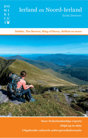
Reisgids Dominicus Ierland en Noord-Ierland - Gottmer • 9789465250106
Reisgids Ierland en Noord-Ierland - Gottmer Productomschrijving: Ierland heeft zijn geheel eigen charme: ruige kusten, golvende groene heuvels, verstilde veengebieden, vriendelijke en humorvolle mensen, Keltische mystiek en vrolijke folkmuziek. Daarbij zijn twee fascinerende grote steden, Dublin en Belfast, elk voor zich al een lange stedentrip waard. Middelgrote plaatsen als Cork en Galw…