
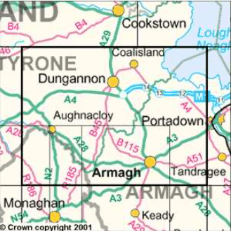
Wandelkaart 19 Armagh Northern Ireland - Ordnance Survey
Coalisland - Dungannon - Richhill

Korte omschrijving
Wandelkaarten Northern Ireland, UK van Ordnance Survey. Ideaal voor tochten in Noord Ierland en Ierland.
Wandelkaart Armagh N. Ireland - Ordnance Survey Productomschrijving: Armagh of County Armagh beter gezegd ligt in Noord Ierland, het deel dat nog tot de UK behoort. Sinds Brexit,is het moeil...

Specificaties
- Uitgever: Ordnance Survey
- ISBN-13: 9781911643067
- HOOFDCATEGORIEËN: Wandelkaart
- Activiteiten: Wandelen, Hiking & Trekking
- Regio: Northern Ireland, UK
- Land: Ierland, Noord Ierland
- TOPO's & Stafkaarten: Topografisch wandelen
- Schaal: 1:50000
- Taal: Engels
- Reeks/Serie: OSNI, Northern Ireland
Volledige omschrijving
Wandelkaart Armagh N. Ireland - Ordnance Survey
Productomschrijving: Armagh of County Armagh beter gezegd ligt in Noord Ierland, het deel dat nog tot de UK behoort. Sinds Brexit,is het moeilijk voor hen om nog normale handelingen te voeren met de mainland. Deze kaart is de vernieuwde versie van alles die er in County Armagh te beleven valt.
Maps in the Discoverer series have contours at 10m intervals, with plenty of spot heights and bold altitude colouring above 150m. Graphics indicate different types of woodlands. In coastal areas the maps show high and low water mark, cliffs, mud/shingle or sand, etc. Road network grades minor roads according to their widths, includes local tracks and shows gradients on steep routes.
Railways are shown with stations and the maps include other details expected of topographic mapping at this scale. An overprint highlights waymarked walking trails as well as cycle routes of the Sustrans National Cycle Network. Boundaries of National Trust land are marked, indicating areas with limited opening. Places of interest are prominently highlighted and a range of symbols provide other tourist information including camping or caravan sites and youth hostels, bus stations, parking, picnic areas, viewpoints, gold courses, etc. Each map covers an area of 40 x 30km (25 x 19 miles approximately) and has a 1km Irish Grid, plus latitude and longitude margin ticks at 1' intervals. Map legend is English, French and German. On the reverse each sheet has an indexed monochrome map showing townland boundaries.
Locatie op kaart
Overzichtskaarten

OSNI Northern Ireland - OSNI
OSNI Northern Ireland - OSNI

Producten op de overzichtskaart
Klik op een product om naar de detailpagina te gaan.
- Wandelkaart 04 Discoverer Coleraine- Northern Ireland - OSNI
- Wandelkaart 05 Discoverer Ballycastle - Discoverer series - OSNI
- Wandelkaart 07 Discoverer Londonderry- Ulster - N.Ireland - OSNI
- Wandelkaart 08 Ballymoney County Antrim - OSNI
- Wandelkaart 09 Larne County Antrim - OSNI
- Wandelkaart 13 The Sperrins Ulster N. Ireland - OSNI
- Wandelkaart 14 Discoverer Lough Neagh - Antrim - N.Ireland - OSNI
- Wandelkaart 17 Discoverer Lower Lough Erne - OSNI
- Wandelkaart 18 Discoverer Enniskillen & Irvinestown - OSNI
- Wandelkaart 19 Armagh Northern Ireland - Ordnance Survey
- Wandelkaart 20 Discoverer Craigavon- N.Ireland - OSNI
- Wandelkaart 21 Strangford Lough County Cork - OSNI
- Wandelkaart 27 Upper Lough Erne (Lisnaskea) - OSNI
- Wandelkaart 28 Monaghan-Keady (Castleblayney) - OSNI
- Wandelkaart 29 Discoverer The Mournes - OSNI
Artikelen uit dezelfde regio
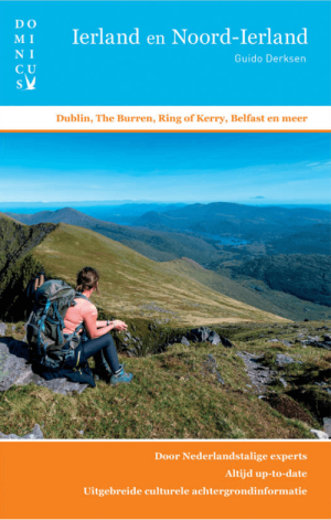
Reisgids Dominicus Ierland en Noord-Ierland - Gottmer • 9789465250106
Reisgids Ierland en Noord-Ierland - Gottmer Productomschrijving: Ierland heeft zijn geheel eigen charme: ruige kusten, golvende groene heuvels, verstilde veengebieden, vriendelijke en humorvolle mensen, Keltische mystiek en vrolijke folkmuziek. Daarbij zijn twee fascinerende grote steden, Dublin en Belfast, elk voor zich al een lange stedentrip waard. Middelgrote plaatsen als Cork en Galw…
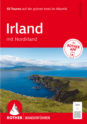
Wandelgids Irland mit Nordirland - Rother Bergverlag • 9783763314904
Wandelgids Irland mit Nordirland - Rother Productomschrijving: 65 Touren auf der grünen Insel im Atlantik. Irland – die perfekte Insel zum Wandern. - 65 sorgfältig ausgewählte Wanderungen in Irland und Nordirland – von Küstenpfaden bis zu Bergtouren - Detaillierte Wegbeschreibungen, Wanderkärtchen und Höhenprofile für jede Tour - Inklusive GPS-Tracks und Rother App für komfortable …
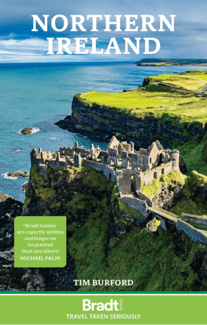
Reisgids Northern Ireland Noord Ierland - Bradt travel Guides • 9781804693292
Reisgids Northern Ireland - Bradt Productomschrijving: The new Bradt Northern Ireland Guidebook, from prolific travel-guide author Tim Burford, is the longest and widest-ranging standalone guide to the country. A UK-governed part of the island of Ireland that comprises six of the original nine counties of Ulster, there is nowhere in Europe quite like Northern Ireland. From great city break…

Wegenatlas Groot Brittanië & Noord Ierland - Freytag & Berndt • 9783707924084
Wegenatlas Groot Brittanië & Noord Ierland - F&B Productomschrijving: Autoatlas Großbritannien - Nordirland 1:200.000 - 1:266.000 ist der ideale Begleiter für alle, die mit dem Auto unterwegs sind und dabei nicht nur die Hauptstraßen und Autobahnen nutzen möchten. Er ist ideal für die Planung und erweist sich auch während der Reise als unverzichtbare Orientierungshilfe. Mit dem detail…

Reisgids Great Britain - DK Eyewitness • 9780241408292
Reisgids Great Britain - DK Eyewitness Productomschrijving: Visit Stonehenge's mysterious monoliths, take the sea air in buzzing Brighton or come face to face with the Vikings in York: everything you need to know is clearly laid out within colour-coded chapters. Discover the best of Great Britain with this indispensable travel guide. Inside DK Eyewitness Travel Guide Great Britain: -…