
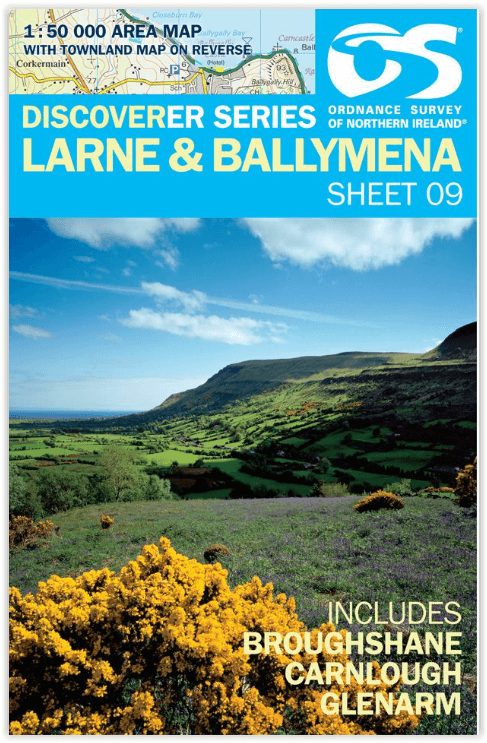
Wandelkaart 09 Larne County Antrim - OSNI
Broughshane - Carnlough - Glenarm
Korte omschrijving
Wandelkaarten County Antrim, Northern Ireland van Ordnance Survey. Ideaal voor tochten in Northern Ireland.
Wandelkaart Larne County Antrim - Ordnance Survey Productomschrijving: Larne is een kust- en havendorp in het Ierse County Antrim. Omvat een kleine gemeente van de Free Presbyterian Church o...

Specificaties
- Uitgever: Ordnance Survey
- ISBN-13: 9781905306923
- HOOFDCATEGORIEËN: Wandelkaart
- Activiteiten: Wandelen, Hiking & Trekking
- Regio: County Antrim, Northern Ireland
- Land: Northern Ireland
- TOPO's & Stafkaarten: Topografisch wandelen
- Schaal: 1:50000
- Taal: Engels
- Reeks/Serie: OSNI, Northern Ireland
Volledige omschrijving
Wandelkaart Larne County Antrim - Ordnance Survey
Productomschrijving: Larne is een kust- en havendorp in het Ierse County Antrim. Omvat een kleine gemeente van de Free Presbyterian Church of Scotland.
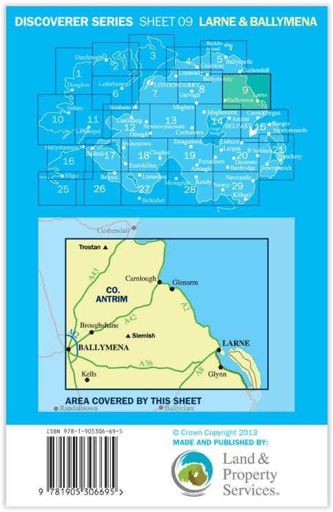
Engelse omschrijving: The Discoverer series are designed for tourist and leisure activities. Each one covers an area of 40km x 30km at the scale 1:50,000. There are 93 sheet in the series. 75 are produced by Ordnance Survey Ireland and 18 by Ordnance Survey Northern Ireland. The maps maps produced by Ordnance Survey Ireland are called the Discovery Series.
Discoverer Sheet No. 9 covers Larne & Ballymena and includes Broughshane, Carnlough and Glenarm.
Locatie op kaart
Overzichtskaarten

OSNI Northern Ireland - OSNI
OSNI Northern Ireland - OSNI

Producten op de overzichtskaart
Klik op een product om naar de detailpagina te gaan.
- Wandelkaart 04 Discoverer Coleraine- Northern Ireland - OSNI
- Wandelkaart 05 Discoverer Ballycastle - Discoverer series - OSNI
- Wandelkaart 07 Discoverer Londonderry- Ulster - N.Ireland - OSNI
- Wandelkaart 08 Ballymoney County Antrim - OSNI
- Wandelkaart 09 Larne County Antrim - OSNI
- Wandelkaart 13 The Sperrins Ulster N. Ireland - OSNI
- Wandelkaart 14 Discoverer Lough Neagh - Antrim - N.Ireland - OSNI
- Wandelkaart 17 Discoverer Lower Lough Erne - OSNI
- Wandelkaart 18 Discoverer Enniskillen & Irvinestown - OSNI
- Wandelkaart 19 Armagh Northern Ireland - Ordnance Survey
- Wandelkaart 20 Discoverer Craigavon- N.Ireland - OSNI
- Wandelkaart 21 Strangford Lough County Cork - OSNI
- Wandelkaart 27 Upper Lough Erne (Lisnaskea) - OSNI
- Wandelkaart 28 Monaghan-Keady (Castleblayney) - OSNI
- Wandelkaart 29 Discoverer The Mournes - OSNI
Artikelen uit dezelfde regio

Wandelkaart The Glens of Antrim, County Antrim N. Ireland - OSI • 9781905306671
The Glens of Antrim, County Antrim N. Ireland - OSI Productomschrijving: De Glens of Antrim: Tussen Legende, Kust en Groene Rust. De Glens of Antrim, gelegen in het noordoosten van Noord-Ierland, vormen een betoverend landschap van negen diepe valleien die zich uitstrekken van het Antrim Plateau tot aan de ruige Atlantische kust. Deze regio is een droom voor wandelaars: ruig en groen,…
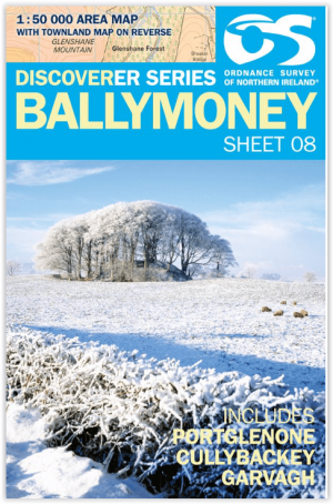
Wandelkaart 08 Ballymoney County Antrim - OSNI • 9781905306831
Wandelkaart Ballymoney - Ordnance Survey Productomschrijving: Ballymoney is een plaats in het Noord-Ierse graafschap County Antrim. Engelse omschrijving: The Discoverer series are designed for tourist and leisure activities. Each one covers an area of 40km x 30km at the scale 1:50,000. There are 93 sheet in the series. 75 are produced by Ordnance Survey Ireland and 18 by Ordnance Surve…