

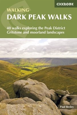
Wandelgids Dark Peak Walks in the Peak District - Cicerone
Het Nationaal park Peak District- is een zeer heuvelrijk park

Korte omschrijving
Wandelgidsen Midlands, England van CICERONE Press. Ideaal voor tochten in England.
Wandelgids - Dark Peak Walks in the Peak District - Cicerone Productomschrijving: Het Nationaal park Peak District, is een zeer heuvelrijk nationaal park in het noorden van Engeland. Meestal...

Specificaties
- Uitgever: CICERONE Press
- ISBN-13: 9781852845193
- HOOFDCATEGORIEËN: Wandelgids
- Activiteiten: Wandelen, Hiking & Trekking
- Auteur: Paul Besley
- Regio: Midlands, England
- Land: England
- Nationale parken: Peak District NP, Derbyshire UK
- Editie: 1
- Taal: Engels
- De Nationale Parken: Peak District Nationaal Park, England
- De Engelse Graafschappen: Derbyshire, South Yorkshire
Volledige omschrijving
Wandelgids - Dark Peak Walks in the Peak District - Cicerone
Productomschrijving: Het Nationaal park Peak District, is een zeer heuvelrijk nationaal park in het noorden van Engeland. Meestal wordt het onderverdeeld in het noordelijke Dark Peak, waar vooral veel heidegebieden zijn en het zuidelijke White Peak, waar de meeste mensen wonen.
Product description: Located in the Peak District and distinguished from the neighbouring White Peak by the layer of gritstone which covers its limestone bed, the Dark Peak features a wild landscape of sweeping moorland and big skies. Easily accessible from Sheffield, it boasts a wealth of natural, geological, historical and cultural interest – and some great walking.
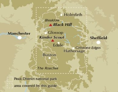
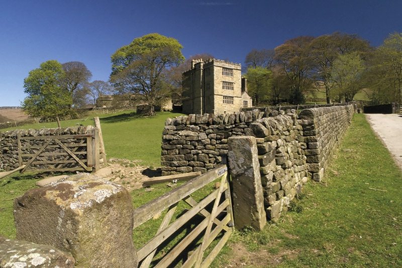
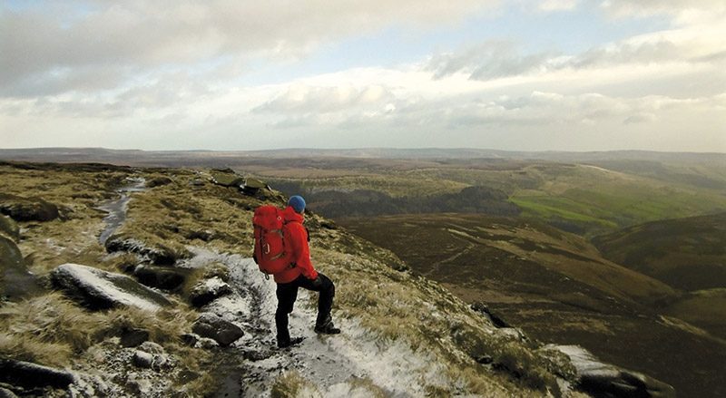
This guidebook describes 40 walks in the Dark Peak. Ranging from short strolls to full-day adventures, they showcase the region's unique character. Dramatic waterfalls, striking gritstone edges, heath and woodland are just some of the delights encountered, with many of the routes venturing off-path to explore hidden cloughs and valleys. Detailed route description is provided for 35 walks, accompanied by 1:50,000 OS mapping and interesting facts about local points of interest, then a further five longer walks (of 25-45km) are summarised in the final section, including a classic circuit of the Kinder Scout skyline.
Seasons:
The high moorlands in winter and summer; the gritstone edges in spring and summer; the valleys in autumn; the cloughs in spring.
Centres:
Hathersage, Grindleford, Langsett, Marsden, Dove Stones, Edale, Upper Derwent Valley, Castleton, Greenfield, Chatsworth, Sheffield, Hayfield, Crowden, Hope, Dunford Bridge.
Difficulty:
Walking in the Dark Peak requires good navigational skills, especially in winter, and a good level of hillcraft. Having the correct equipment and clothing and knowing how to use it is paramount when venturing out onto the high moors.
Must See:
Kinder Scout, the highest point in the Peak District; Bleaklow, the second highest; Howden and Derwent Edges; Black Hill and the Wessenden Moors; the gritstone edges of Derwent, Bamford, Stanage, Burbage, Froggatt, Curbar, Birchen, Gardoms and the Roaches; the Eastern Moors; the Goyt Valley, Shutlingsloe and Wildboarclough.

Locatie op kaart
Artikelen uit dezelfde regio
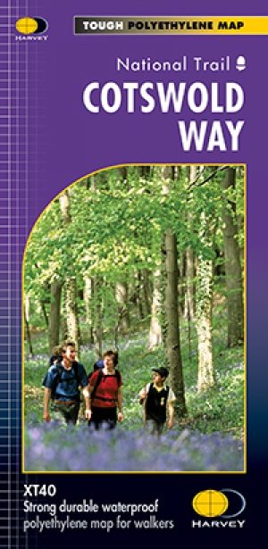
Wandelkaart Cotswold Way - Harvey maps • 9781851374182
Wandelkaart Cotswold Way - Chipping Campden to Bath - Harvey maps Productomschrijving: Toont de gehele 166km (103miles) van The Cotswold Way, door de Cotswolds van Chipping Campden naar Bath, Broadway, Winchcombe, Stroud, Wooton-under-Edge en Chipping Sodbury passeren. Informatie over het vinden van accommodatie, camping, voedsel. Routebeschrijving naar het begin. Ook Ranger Service en…

Landkaart Wegenkaart 6 Wales & Midlands West - OSI • 9780319263785
Wegenkaart Wales & Midlands West - OSI Productomschrijving: Plan your journey with this series of road maps from OS. Showing all major road, rail and ferry links as well as settlements and selected features in 1: 250 000 scale, this is the ideal map for planning trips and holidays by car or cycle. OS Road 6 covers: the Wales plus the West Midlands.
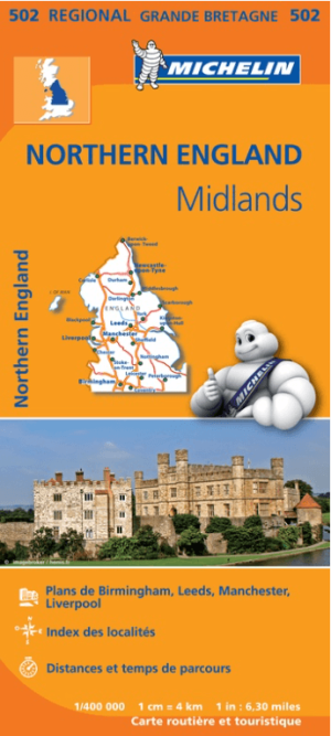
Landkaart Wegenkaart 502 Engeland Noord & Midlands - Michelin • 9782067183230
Regionale Wegenkaart Noord Engeland & the Midlands Productomschrijving: De volledig bijgewerkte MICHELIN-kaart van Engeland Noord, Midlands geeft u alle WEG- EN TOERISME-informatie die u nodig hebt om uw reizen in deze regio te optimaliseren: een INDEX VAN LOCATIES, een TABEL VAN AFSTANDEN en REISTIJDEN. Dankzij de schaal van 1:400.000 (1 cm = 4 km) kun je zowel de hoofdwegen als de klein…

Landkaart Wegenkaart 5 Midlands Oost & East Anglia - OSI • 9780319263778
Wegenkaart Midlands Oost & East Anglia - OSI Productomschrijving: Plan your journey with this series of road maps from OS. Showing all major road, rail and ferry links as well as settlements and selected features in 1: 250 000 scale, this is the ideal map for planning trips and holidays by car or cycle. OS Road 5 covers: the East Midlands, including the Norfolk and the Thames Estuary.…
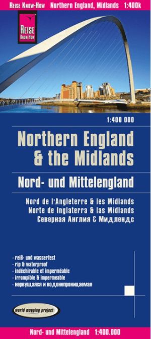
Landkaart Wegenkaart Engeland Noord & Midlands - Reise Know-How • 9783831774364
Wegenkaart Engeland Noord & Midlands - Reise Know-How Productomschrijving: De Reise Know-How wegenkaart van Engeland Noord & Midlands is een betrouwbare, gedetailleerde en duurzame landkaart voor wie Engeland Noord & Midlands zelfstandig wil verkennen. Deze hoogwaardige reiskaart is ideaal voor gebruik tijdens een rondreis met de auto, camper, motor of fiets en biedt alle informatie die j…