

Wales Hillwalking vol.1 - Arans & Dovey Hills - Cicerone
Omvat de Wail-backed bergkammen van de Black Mountains


Korte omschrijving
Wandelgidsen Wales van CICERONE Press. Ideaal voor tochten in Wales.
Wales Hillwalking vol.1 - Arans & Dovey Hills - Cicerone Omvat: De Wail-backed bergkammen van de Black Mountains, en de Brecon Beacons & de Cwmdeuddwr hooglanden, Productomschrijving: De...

Specificaties
- Uitgever: CICERONE Press
- ISBN-13: 9781852844677
- HOOFDCATEGORIEËN: Wandelgids
- Activiteiten: Wandelen, Hiking & Trekking
- Regio: Wales
- Land: Wales
- Editie: 2
- Taal: Engels
Volledige omschrijving
Wales Hillwalking vol.1 - Arans & Dovey Hills - Cicerone
Omvat: De Wail-backed bergkammen van de Black Mountains, en de Brecon Beacons & de Cwmdeuddwr hooglanden,
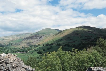
Productomschrijving: De eerste van twee gidsen die wandeltrajecten beschrijft in Wales - covers Arans - Dovey heuvels. De routes - alle 166 van hen - zijn alfabetisch gerangschikt over de twee volumes. Het resultaat is niet alleen een gids voor de bergen van Snowdonia, maar een handboek van meer dan 450 routes die betrekking hebben op 21 Welsh bergketens – de Wail-backed bergkammen van de Black Mountains, de Brecon Beacons steile hellingen en de Cwmdeuddwr hooglanden, Cader Idris, de enorme eenzaamheden van de Arans en Arenigs, de Rhinogs en de wildste grond in Wales.
Product description: The first of two guidebooks describing walking routes up every 2000-footer in Wales - covers Arans, Arenigs, Berwyns, Black Mountains, Brecon Beacons, Cader Idris, Carneddau, Cwmdeuddwr hills and the Dovey hills. The entire collection of 166 routes are arranged alphabetically over the two volumes.
Seasons:
All year round, but in winter, higher walks suitable only for those with appropriate skills and equipment.
Centres:
Bala, Betws-y-Coed, Brecon, Capel Curig, Crickhowell, Dolgellau, Llangynog, Rhaeadr.
Difficulty:
Higher-level ridge walks (over 2000ft) and easier lower-level walks. Mainly walking, a little scrambling, but no climbing.
Must See:
Cwm Croes horseshoe (HS); Arenig Fawr/Moel Llyfnant circular; Pistyll Rhaeadr circular; Grwyne Fechan HS; Neuadd HS Minffordd trail; Carnedd N–S traverse.
Artikelen uit dezelfde regio
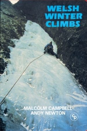
Klimgids Welsh Winter Climbs - Cicerone • 9781852840013
Klimgids - Welsh Winter Climbs - Cicerone Productomschrijving: Klimgids, winter beklimmingen in Wales. Alle klassieke winterroutes, plus vele korte rotsbeklimmingen. Bedekt Carneddau, Glyderau, Llanberis, Yr Wyddfa, Nantlle, Lleyn Schiereiland, Moelwynion, Rhinog, Cader Idris, Aran, Dyfi en Berwyn. Het biedt een volledige beschrijving, over het al dan niet beschikbaar zijn van routes, en t…

Landkaart Wegenkaart 6 Wales & Midlands West - OSI • 9780319263785
Wegenkaart Wales & Midlands West - OSI Productomschrijving: Plan your journey with this series of road maps from OS. Showing all major road, rail and ferry links as well as settlements and selected features in 1: 250 000 scale, this is the ideal map for planning trips and holidays by car or cycle. OS Road 6 covers: the Wales plus the West Midlands.
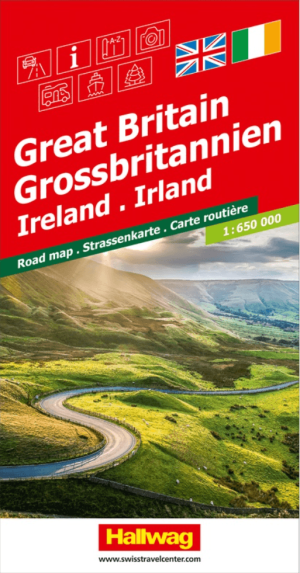
Landkaart Wegenkaart Road Map Groot-Brittannië & Ierland - Halwag • 9783828310780
Wegenkaart Road Map Groot-Brittannië & Ierland - Halwag Productomschrijving: Op zoek naar betrouwbare Hallwag wegenkaarten? Deze klassieke road maps staan bekend om hun duidelijke cartografie, praktische indeling en heldere weergave van wegen en verbindingen. Voor autoritten, vakanties, camperreizen en lange roadtrips bieden Hallwag wegenkaarten het overzicht dat je onderweg nodig hebt. …
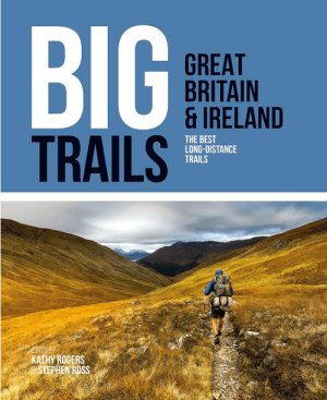
Wandelgids Big Trails DEEL 1 Great Britain & Ireland - Vertebrate • 9781839810008
Big Trails, Great Britain & Ireland - Vertebrate Productomschrijving: The best long-distance trails Big Trails: Great Britain & Ireland features 25 long-distance trails in England, Scotland, Wales, Northern Ireland and Ireland, and includes a general overview of the trails, specific technical information, overview mapping, key information and stunning photography. Big Trails: Great…

Wandelgids Glyndwr's Way walking - Cicerone • 9781786311290
Glyndwr's Way walking - Cicerone Productomschrijving: Gids over de hystorische wandelroute van de Glyndwr's Way, een langeafstandspad door midden-Wales. De 217 Km lange route van Knighton via Machynlleth naar Welshpool duurt 9 dagen om te lopen, en 2 dagen (29 mijl) om de lus langs het Offa's Dyke Path af te maken zodat er een rondwandeling ontstaat. Een prachtige route door rustige heuvel…