

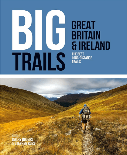
Wandelgids Big Trails DEEL 1 Great Britain & Ireland - Vertebrate
25 long-distance trails in England- Scotland- Wales & Ireland

Korte omschrijving
Wandelgidsen Engeland, Wales, Schotland en Ierland van Vertebrate Publishing. Ideaal voor tochten in United Kingdom, Great Britain en Ierland.
Big Trails, Great Britain & Ireland - Vertebrate Productomschrijving: The best long-distance trails Big Trails: Great Britain & Ireland features 25 long-distance trails in England, Scotl...

Specificaties
- Uitgever: Vertebrate Publishing
- ISBN-13: 9781839810008
- HOOFDCATEGORIEËN: Wandelgids
- Activiteiten: Wandelen, Hiking & Trekking
- Auteur: Kathy Rogers
- Regio: Engeland, Ierland, Schotland, Wales
- Land: Ierland, United Kingdom, Great Britain
- Taal: Engels
- Reeks/Serie: Big trails, Vertebrate Publ.
Volledige omschrijving
Big Trails, Great Britain & Ireland - Vertebrate
Productomschrijving: The best long-distance trails
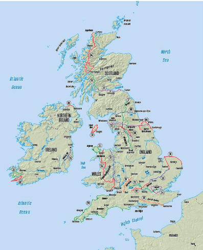
Big Trails: Great Britain & Ireland features 25 long-distance trails in England, Scotland, Wales, Northern Ireland and Ireland, and includes a general overview of the trails, specific technical information, overview mapping, key information and stunning photography.
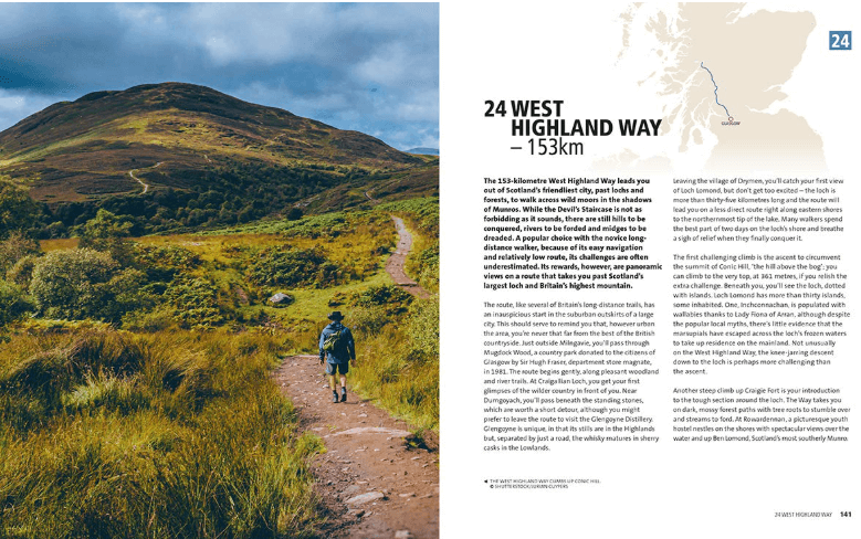
Big Trails: Great Britain & Ireland is an inspirational guide to the most iconic, spectacular and popular long-distance trails in England, Scotland, Wales, Northern Ireland, Ireland and the Isle of Man. The twenty-five featured routes will take you across the best of the British Isles. From the South Downs Way in South-East England and across Wales's mountains in the Cambrian Way, the book delves into the heart of Scotland on the West Highland Way, along the Causeway Coast Way on Northern Ireland’s coast, and into southern Ireland on the Beara Way. The book is designed to inspire big adventures. Rather than being carried along the route, this guide provides everything you need to plan and explore further, including a general overview of the trails, specific technical information, overview mapping, key information and stunning photography.
As well as this, each route specifies approximate timings devised using the Jones–Ross formula, which allows for custom itineraries to be generated depending upon the speed of the user. Whether you’re walking, trekking, fastpacking or running, let Big Trails: Great Britain & Ireland be your guide.
Gekoppelde artikelen

Wandelgids Big Trails DEEL 2 Great Britain & Ireland - Vertebrate • 9781839810459
standaard versieBig Trails DEEL 2 Great Britain & Ireland - Vertebrate Publ. Productomschrijving: More of the best long-distance trails Big Trails: Great Britain & Ireland Volume 2 features twenty-five long-distance trails in England, Scotland, Wales, Northern Ireland and Ireland, and includes a general overview of the trails, specific technical information, overview mapping, key information and stun…

Wandelgids Big Trails DEEL 3 Heart of Europe - Vertebrate Publ. • 9781839810022
standaard versieBig Trails DEEL 3 Heart of Europe - Vertebrate Productomschrijving: The best long-distance trails in Western Europe and the Alps Big Trails: Heart of Europe features 25 long-distance trails in France, Belgium, Netherlands, Luxembourg, Germany, Switzerland, Austria and Italy, and includes a general overview of the trails, specific technical information, overview mapping, key information…
Artikelen uit dezelfde regio
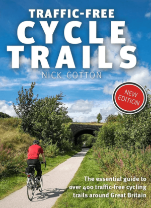
Traffic-Free Cycle Trails around Great Britain - Vertebrate Publ. • 9781912560769
Traffic-Free Cycle Trails around Great Britain - Vertebrate Productomschrijving: The essential guide to over 400 traffic-free cycling trails around Great Britain Traffic-Free Cycle Trails by Nick Cotton contains over 400 cycle routes in Great Britain. This book includes a great variety of routes on former railway paths, canal towpaths and forest trails in England, Scotland and Wales, w…
Landkaart Wegenkaart 798 Groot-Brittannië & Ierland - Michelin • 9782067137998
Wegenkaart Groot-Brittannië & Ierland - Michelin Productomschrijving: Deze Nationale kaart van Groot-Brittannië & Ierland, biedt een gedetailleerd overzicht van alle plaatsen. het wegennet wordt verfijnd aangeduid met allerhande symbolen, en voorziet in alle behoeftes, of u op zoek bent naar specifieke wegen, of zich snel uit de voeten wil maken, de plaatsnamenindex, en toeristische inform…
Landkaart Wegenkaart 3325 Adventue map Groot-Brittannië - Nat Geo • 9781566956444
Wegenkaart Adventue map Groot-Brittannië - Nat Geo Productomschrijving: National Geographic's United Kingdom Adventure Map is designed to meet the needs of adventure travelers with its detailed, accurate information and user-friendly design. Cities and towns are easy to find with the map's helpful index. Motorways, highways, and other roads are clearly designated and include distance in ki…
Wandelgids Wales backpacker's Britain vol.2 - Cicerone • 9781852844080
Wandelgids - Wales backpacker's Britain vol.2 - Cicerone Productomschrijving: Gids bevat 25, 2 of 3-daagse wandelingen en nemen wandelaars mee in de meest schilderachtige en wilde delen van Wales, van Snowdon, de Glyderau en Carneddau in het noorden, naar de Black Mountains en de Brecon Beacons Fforest Fawr in het zuiden, met inbegrip van de ruggen van de Arans, Arenigs, Berwyns en Cadair …

Wandelgids 100 outstanding British Walks - Ordnance Survey • 9780319090862
100 outstanding British Walks - OS Productomschrijving: Deze gloednieuwe wandelgids van Ordnance Survey, brengt u een hoop prachtige wandelingen over het ganse Britse landschap verdeeld. Onderaan vindt u de lijst, opgedeeld in de verschillende regio's van de Britse eilanden. Engelse omschrijving: This magnificent compendium of outstanding British walks brings together the finest sele…