

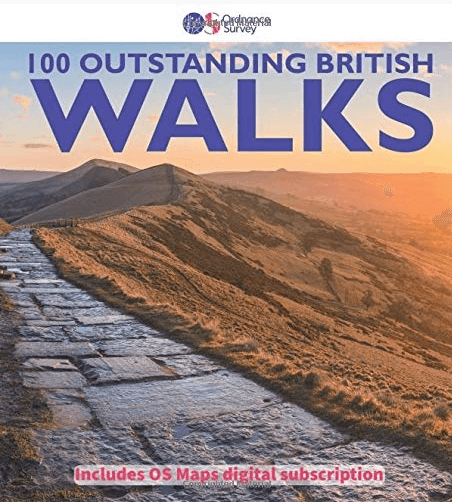
Wandelgids 100 outstanding British Walks - Ordnance Survey
Een hoop prachtige wandelingen over het ganse Britse landschap
Korte omschrijving
Wandelgidsen Engeland, Schotland, Wales en Ierland van Ordnance Survey. Ideaal voor tochten in United Kingdom, Great Britain, England, Wales, Schotland en Ierland.
100 outstanding British Walks - OS Productomschrijving: Deze gloednieuwe wandelgids van Ordnance Survey, brengt u een hoop prachtige wandelingen over het ganse Britse landschap verdeeld. Ond...

Specificaties
- Uitgever: Ordnance Survey
- ISBN-13: 9780319090862
- HOOFDCATEGORIEËN: Wandelgids
- Activiteiten: Wandelen, Hiking & Trekking
- Auteur: Ordnance Survey
- Regio: Engeland, Ierland, Schotland, Wales
- Land: England, Ierland, Schotland, United Kingdom, Great Britain, Wales
- Editie: 1
- Taal: Engels
Volledige omschrijving
100 outstanding British Walks - OS
Productomschrijving: Deze gloednieuwe wandelgids van Ordnance Survey, brengt u een hoop prachtige wandelingen over het ganse Britse landschap verdeeld. Onderaan vindt u de lijst, opgedeeld in de verschillende regio's van de Britse eilanden.
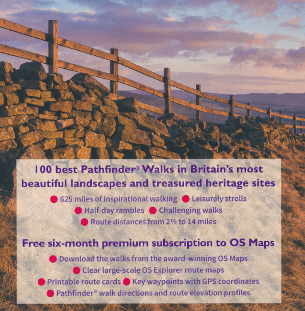
Engelse omschrijving: This magnificent compendium of outstanding British walks brings together the finest selection of Pathfinder (R) Walks in Britain's officially designated places of scenic beauty and historic interest: National Parks, Areas of Outstanding Natural Beauty, National Scenic Areas, Heritage Coast, National Trails and UNESCO World Heritage Sites.
There are 100 walking gems in this collection, recommended by a group of experienced authors and guides. The walks span a range of distances and degrees of challenge and are organised by region with coverage across England, Wales and Scotland.
Walks include: 100 best Pathfinder walks | 625 miles (1,000 km) of inspirational walking | Leisurely strolls, half-day rambles, challenging walks | Route distances from 2½ to 14 miles | Clear and detailed OS Explorer walking maps | Key waypoints with GPS coordinates | Pathfinder walk directions + route elevation profiles | Free 6-month premium subscription to OS Maps online mapping tool
South-west England:
1: Wistman's Wood - 7.2km (4.5m)
2: Rippon Tor, Pil Tor and Buckland Beacon - 10.3km (6.5m)
3: Lynton and Valley of Rocks - 8.8km (5.5m)
4: Simonsbath and the River Barle - 12.1km (7.5m)
5: Hurlstone and Selworthy Beacon - 10.1km (6.25m)
6: Helford, Little Dennis and Manaccan - 8km (5m)
7: Tollard Royal and Win Green - 11.3km (7m)
8: Corfe Castle and the Purbeck Ridge - 9.7km (6m)
9: Beer and Branscombe - 9.9km (6.25m)
10: Cheddar Gorge and Velvet Bottom - 10.5km (6.5m)
11: Baggy Point and Saunton Down - 11.4km (7.25m)
12: Wills Neck and Triscombe Combe - 10.5km (6.5m)
13: Kingston and the River Erme - 9.1km (5.75m)
14: Cotehele - 5.6km (3.5m)
15: Around St Agnes - 10km (6.25m)
16: Golden Cap - 10.5km (6.5m)
17: Bath and Claverton Down - 13.5km (8.5m)
18: Avebury, West Kennett and Silbury Hill - 10.5km (6.5m)
19: Stonehenge - 12.9km (8m)
South-east England:
20: New Forest Snapshot - 4.5km (2.75m)
21: Around Burley - 6.8km (4.25m)
22: Firle Beacon and Charleston Farmhouse - 8km (5m)
23: Friston Forest, the Seven Sisters and Cuckmere Haven - 10.5km (6.5m)
24: Cissbury and Chanctonbury Rings - 17.6km (11m)
25: The Chidham Peninsula - 8km (5m)
26: Ibstone, Turville and Fingest - 12.3km (7.75m)
27: Albury, Ivinghoe Beacon and Ashridge - 11.8km (7.5m)
28: Cranbrook and Sissinghurst - 11.6km (7.25m)
29: Freshwater and Tennyson Down - 6km (3.75m)
30: Wye and Crundale Downs - 13.5km (8.5m)
31: Albury Downs and St Martha's Hill - 11.2km (7m)
32A: Whitehall - 1.4km (0.75m)
32B: St James's - 3.2km (2m)
Heart of England:
33: Shugborough Park and Sherbrook Valley - 12km (7.5m)
34: Wotton-under-Edge and the Tyndale Monument - 6.5km (4m)
35: Bourton-on-the-Water, the Slaughters and Naunton - 16km (10m)
36: Great Malvern and the Worestershire Beacon - 8.9km (5.5m)
37: Corvedale and Wenlock Edge - 10.9km (6.75m)
38: Caer Caradoc and Cardington - 11.6km (7.25m)
39: Goodrich Castle - 13.3km (8.25m)
40: Blenheim Park - 10.5km (6.5m)
41: Ironbridge World Heritage Site - 11.6km (7.25m)
42: Cromford and Matlock Bath - 11.3km (7m)
East England:
43: Horsey - 6km (3.75m)
44: River Bure and Upton Marshes - 9.7km (6m)
45: The Weavers' Way to The Berney Arms - 14.5km (9m)
46: Constable Country - Flatford and East Bergholt - 8.9km (5.5m)
47: Walesby, Claxby and Normanby le Wold - 8.4km (5.25m)
48: Castle Rising - 3.6km (2.25m)
49: West Runton and Beacon Hill - 11.7km (7.25m)
50: Dunwich Heath and Minsmere Marsh - 8km (5m)
North of England:
51: Elterwater - 8.9km (5.5m)
52: Wray Castle and Blelham Tarn - 9.7km (6m)
53: Crummock Water - 13.8km (8.5m)
54: Kielder Water and the Bull Crag Peninsula - 10.1km (6.25m)
55: Hartside, Salter's Road and High Cantle - 13.7km (8.5m)
56: Farndale - 5.6km (3.5m)
57: The Cook Monument and Roseberry Topping - 10.5km (6.5m)
58: Robin Hood's Bay and Ravenscar - 14.5km (9m)
59: Stanage Edge and Higger Tor - 5.6km (3.5m)
60: Lose Hill - 9.7km (6m)
61: The Manifold Valley - 10.5km (6.5m)
62: Malham Cove, Gordale Scar and Janet's Foss - 8km (5m)
63: Pen-y-ghent - 9.5km (6m)
64: Gunnerside, Kisdon and Muker - 18km (11.25m)
65: Leighton Moss - 7.3km (4.5m)
66: Kirkham Priory and the River Derwent - 7.6km (4.75m)
67: High Cup Nick - 12.9km (8m)
68: How Stean Gorge and Upper Nidderdale - 7km (4.25m)
69: Craster and Dunstanburgh Castle - 7.6km (4.75m)
70: Fountains Abbey - 9.3km (5.75m)
71: Durham - Riverside and Woods - 8km (5m)
72: Hadrian's Wall at Walton and Thirlwall Castle - 12.5km (7.75m)
Wales:
73: Llyn y Fan Fach and the Carmarthen Fans - 9.7km (6m)
74: Waterfalls Walk - 14.5km (9m)
75: Brecon Beacons Horseshoe - 13.7km (8.5m)
76: Porthgain and Abereiddi - 5.6km (3.5m)
77: St David's, Porth Clais and Ramsey Sound - 14km (9m)
78: Precipice Walk - 5.5km (3.5m)
79: Conwy Mountain and Sychnant Pass - 9.5km (6m)
80: Cnicht - 10.7km (6.75m)
81: Moel Famau - 8.25km (5.25m)
82: Llanmadoc Hill - 10.5km (6.5m)
83: Aberdaron and Land's End - 12km (7.5m)
84: Wynford Vaughan Thomas' Viewpoint - 9.7km (6m)
85: Ty Mawr and the Pontcysyllte Aqueduct - 9km (5.5m)
86: Saundersfoot and Tenby - 6.5km (4m)
Scotland:
87: Glen Feshie - 5.5km (3.5m)
88: The Lily Loch and Loch an Eileen from Inverdruie - 9.7km (6m)
89: Morrone - 11.3km (7m)
90: Lochnagar and Loch Muick - 22.4km (14m)
91: Lochgoilhead and Donich Water - 4km (2.5m)
92: Ben Lomond - 11.7km (7.25m)
93: Ben Venue - 13.3km (8.25m)
94: Pap of Glencoe - 8km (5m)
95: Isle of Iona - 13.7km (8.5m)
96: Dunkeld, The Hermitage and Birnam - 12.4km (7.75m)
97: Camasunary-Elgol-Glasnakille - 18km (11.25m)
98: The Quiraing and Meall na Suiramach - 6.5km (4m)
99: Rascarrel Bay and Balcary Point - 8km (5m)
100A: Grassmarket and Greyfriars - 2.3km (1.5m)
100B: Georgian New Town - 4.7km (2.75m)
Artikelen uit dezelfde regio
Landkaart Wegenkaart Schotland & Engeland Noord - Freytag & Bernd • 9783707924060
Wegenkaart Schotland & Noord Engeland - Freytag & Berndt Productomschrijving: Deze recto/verso gedetailleerde landkaart van Noord Engeland en Schotland is zeer geschikt voor het plannen en voor het rondtrekken door het land. Het wegennetwerk is goed weergeven, zowel de hoofdwegen, de provinciale en lokale wegen. Tevens worden wegnummers duidelijk vermeld. Afstanden tussen plaatsen zijn in…

Reisgids Great Britain - DK Eyewitness • 9780241408292
Reisgids Great Britain - DK Eyewitness Productomschrijving: Visit Stonehenge's mysterious monoliths, take the sea air in buzzing Brighton or come face to face with the Vikings in York: everything you need to know is clearly laid out within colour-coded chapters. Discover the best of Great Britain with this indispensable travel guide. Inside DK Eyewitness Travel Guide Great Britain: -…
Wales Hillwalking vol.1 - Arans & Dovey Hills - Cicerone • 9781852844677
Wales Hillwalking vol.1 - Arans & Dovey Hills - Cicerone Omvat: De Wail-backed bergkammen van de Black Mountains, en de Brecon Beacons & de Cwmdeuddwr hooglanden, Productomschrijving: De eerste van twee gidsen die wandeltrajecten beschrijft in Wales - covers Arans - Dovey heuvels. De routes - alle 166 van hen - zijn alfabetisch gerangschikt over de twee volumes. Het resultaat is niet a…
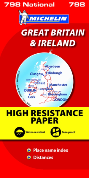
Landkaart Wegenkaart 798 Groot-Brittannië & Ierland - Michelin • 9782067137998
Wegenkaart Groot-Brittannië & Ierland - Michelin Productomschrijving: Deze Nationale kaart van Groot-Brittannië & Ierland, biedt een gedetailleerd overzicht van alle plaatsen. het wegennet wordt verfijnd aangeduid met allerhande symbolen, en voorziet in alle behoeftes, of u op zoek bent naar specifieke wegen, of zich snel uit de voeten wil maken, de plaatsnamenindex, en toeristische inform…
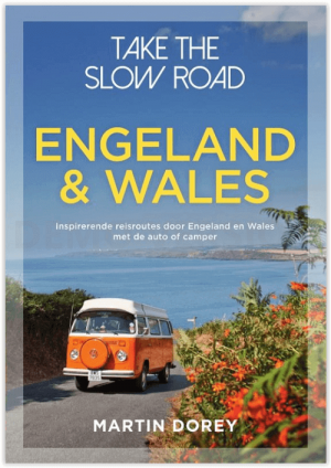
Campergids Take the Slow Road Engeland en Wales - Lannoo • 9789000381890
Campergids - Take the Slow Road Engeland en Wales Productomschrijving: Ontdek op je gemak unieke routes door Engeland en Wales met de camper of de zogenaamde Mobilehome. Snel rijden? Echt niet! Met je voet op het gaspedaal door het landschap racen is niet meer van deze tijd. Vergeet het gehaaste leven, rustig rondtrekken is de nieuwe manier van reizen. En hoe ga je dat doen? Met een ca…