

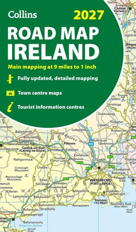
Landkaart Wegenkaart Ireland Road Map 2027 - Harper Collins
Covers the whole of the Republic of Ireland and Northern Ireland
Korte omschrijving
Wegen- & stadskaarten Ierland van HarperCollins Publishers. Ideaal voor tochten in Ierland.
Wegenkaart Ireland Road Map 2027 - Harper Collins Productomschrijving: Full-colour map of Ireland at 9 miles to 1 inch (1:570,240), with clear, detailed road network and counties and new adm...

Specificaties
- Uitgever: HarperCollins Publishers
- ISBN-13: 9780008779061
- HOOFDCATEGORIEËN: Wegenkaart - Landkaart
- Activiteiten: Street/Road maps & city plans
- Regio: Ierland
- Land: Ierland
- Schaal: 1:470000
- Taal: Engels
Volledige omschrijving
Wegenkaart Ireland Road Map 2027 - Harper Collins
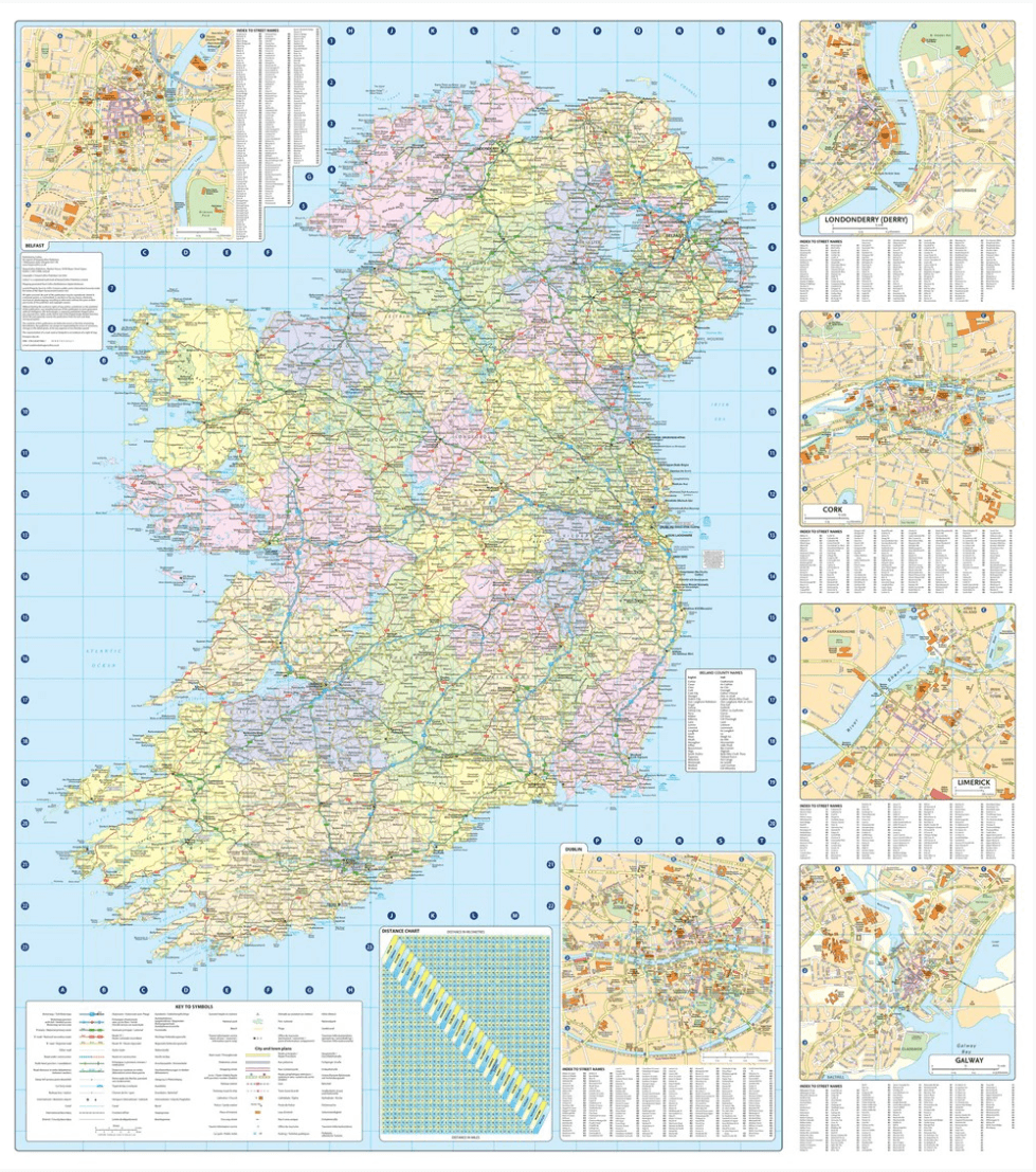
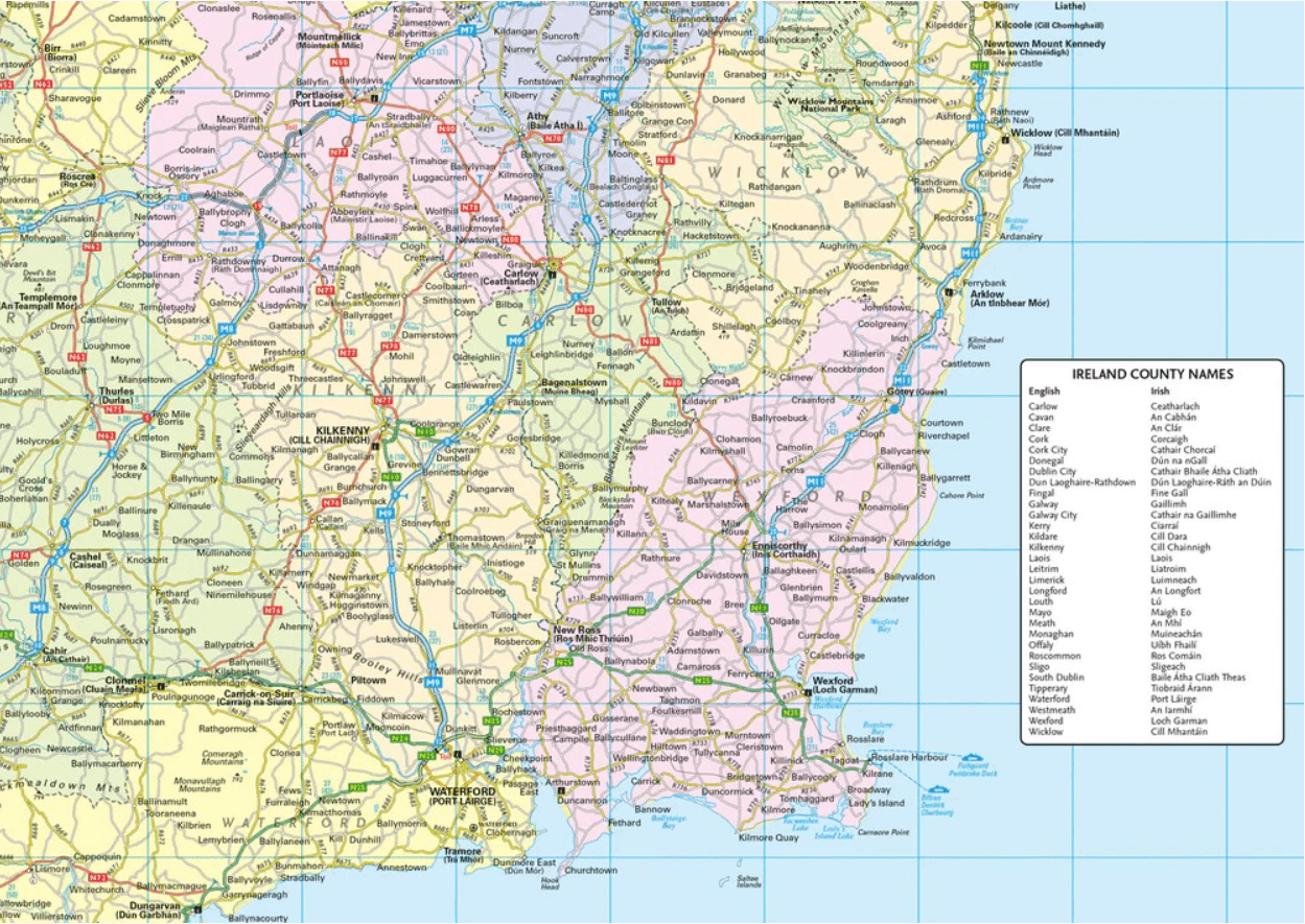
Productomschrijving: Full-colour map of Ireland at 9 miles to 1 inch (1:570,240), with clear, detailed road network and counties and new administrative areas shown in colour. This double-sided map covers the whole of Ireland, and is ideal for reference or route planning. This map of Ireland shows the road network in detail. It is ideal for business users, with colouring of local council areas, but it is also perfect for tourists as a route planning map.
Main features:
Fully updated
New administrative areas shown in colour
Clear, detailed road network
Town and city names, rivers, lakes, spot heights, railway lines and canals are clearly shown
City/town centre, street plans of Belfast, Cork, Dublin, Dún Laoghaire, Galway, Limerick Londonderry/Derry and Waterford showing places of interest
Full index to place names
Mileage chart
Car ferry routes
Key in English, French and German
Area of coverage
Covers the whole of the Republic of Ireland and Northern Ireland
Artikelen uit dezelfde regio
Traffic-Free Cycle Trails around Great Britain - Vertebrate Publ. • 9781912560769
Traffic-Free Cycle Trails around Great Britain - Vertebrate Productomschrijving: The essential guide to over 400 traffic-free cycling trails around Great Britain Traffic-Free Cycle Trails by Nick Cotton contains over 400 cycle routes in Great Britain. This book includes a great variety of routes on former railway paths, canal towpaths and forest trails in England, Scotland and Wales, w…

Wandelkaart 10 County Donegal South West - OSI Ireland • 9781912140053
Wandelkaart Donegal South West Ireland - OSI Productomschrijving: Ontdek Ierland met de Discovery Series Wandelkaarten van Ordnance Survey Ireland. De Discovery Series wandelkaarten van Ordnance Survey Ireland (OSi) zijn dé keuze voor wandelaars, fietsers en avonturiers die Ierland echt willen verkennen. Deze hoogwaardige topografische kaarten bieden een gedetailleerd en nauwkeurig ove…

Wegenatlas Ierland official road spiraal atlas - OSI Ireland • 9781912140473
Wegenatlas Ierland official road atlas - OSI Ireland Productomschirjving: This edition contains updated road maps covering Ireland, plus City and Town Maps and Motoring Information, Distance Charts and Extensive Gazetteer (Index of Towns). The atlas covers all of the Island of Ireland using mapping information from both Ordnance Survey Ireland and Ordnance Survey Northern Ireland. …

Guide Routard Irlande 2026-27 - Le Routard • 9782017338079
Reisgids Irlande - Le Routard Productomschrijving: Le Routard, le meilleur compagnon de voyage depuis 45 ans. Dans cette nouvelle édition du Routard Irlande vous trouverez une première partie en couleurs avec des cartes et des photos, pour découvrir plus facilement le pays et repérer nos coups de cœur ; des suggestions d’itinéraires et des informations pratiques pour organiser votre sé…

Wandelkaart 23 County Mayo North Coast Discovery Series - OSI Ireland • 9781912140527
Wandelkaart Mayo North - OSI Productomschrijving: Ontdek Ierland met de Discovery Series Wandelkaarten van Ordnance Survey Ireland. De Discovery Series wandelkaarten van Ordnance Survey Ireland (OSi) zijn dé keuze voor wandelaars, fietsers en avonturiers die Ierland echt willen verkennen. Deze hoogwaardige topografische kaarten bieden een gedetailleerd en nauwkeurig overzicht van het I…