

HOOFDCATEGORIEËN
Activiteiten
Fietsen
VTT / MTB
Klimmen
Auteur:
Land
Regio
Reeks/Serie:
Taal
Schaal
Wandkaarten & Planokaarten
Lange afstand wandelroutes
Nationale parken
TOPO's & Stafkaarten
Toepasselijke bergketen
Waterafstotende kaart
Eurovélo-Routes
Iconische Wandelroutes
De Nationale Parken
Uitgever


 Wandelen in Ierland
Wandelen in Ierland, deze landmassa van het eiland Ierland is in 2 delen opgedeeld. Enerzijds is er de regio Noord-Ierland, die ongeveer 1/5 van het eiland beslaat en deel uitmaakt van het Verenigd Koninkrijk, en anderzijds Ierland zelf. Wij hebben het hier echter over het land Ierland, een republiek die de overige 4/5 van het eiland bestrijkt.
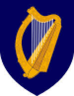
De republiek Ierland heeft als nationaal symbool een Keltische harp. Maar evengoed wordt ook vaak de klaver (shamrock) gebruikt als nationaal symbool. Als u bijvoorbeeld in Ierland een wandelclub bezoekt, is de kans groot dat u wedstrijdbekers uitgestald ziet staan met daarop de shamrock (klaverblad) afgebeeld. De Ierse westkust bestaat grotendeels uit klippen, heuvels en laaggebergte. Het hoogste punt is de berg Carrauntoohil met zijn piek op 1.038 meter, gelegen in het zuidwesten van het land. De republiek Ierland omvat ook enkele kleinere eilanden en eilandgroepjes. Het grootste daarvan is Achill Island. Kleinere eilandjes zijn de Araneilanden, de Blasket-eilanden, Cleareiland, Inishbofin, de Skellig-eilanden en Valentia. De reeksen Wandelkaarten Ierland & Wandelgidsen Ierland zijn bij BIBLIOTREK samen goed voor meer dan 100 artikelen.
Er bestaan in Ierland een dikke 44 National Trails, waarvan de Wicklow Way er één van is. Met zijn 128 Km, is deze een boom van een route door de Wicklow Mountains. VOor deze route zijn de Topografische wandelkaarten van de Ordnance Survey reeks Discovery Series Sheets 50, 56, 61 van Toepassing. Dan izijn er nog vele routes die u zeker graag zult doen, maar dat laten we aan u over. Om er een paar in huis te halen kunt u zeker eens vissen bij de Reisgidsen Ierland, daar vindt je alle informatie van het land in 1 gids.

Reisgids Time to Momo Dublin - Mo'Media • 9789493338555
Reisgids Dublin - Mo'Media Productomschrijving: Dublin is uiterst compact en altijd gezellig druk. Laat je overrompelen door de diversiteit van de wijken, van creatief en knus, historisch en imposant tot modern en ruimtelijk. Struin door het pubrijke Temple Bar met zijn leuke keienstraatjes, ontdek bezienswaardigheden als Trinity College, duizel bij The Millennium Spire of waai uit aan de…

Reisgids Stadsgids Dublin 2025 - Petit Futé • 9782370573551
Stadsgids Dublin 2025 - Petit Futé Productomschrijving: Dublin, classée capitale culturelle depuis 1992, se caractérise d'abord par ses nombreux musées retraçant la vie des Irlandais à travers la littérature, l'art, la musique, le théâtre... Mais elle ne se contente pas d'apparaître comme un musée à ciel ouvert, et pas une semaine ne se passe sans qu'il n'y ait une occasion de faire la fêt…

Landkaart Wegenkaart Planning map Ireland - Lonely Planet • 9781787015814
Wegenkaart & Planning map Ireland - Lonely Planet Productomschrijving: Durable and waterproof, with a handy slipcase and an easy-fold format, Lonely Planet Ireland Planning Map is your conveniently-sized passport to traveling with ease. Get more from your map and your trip with images and information about top country attractions, itinerary suggestions, a transport guide, planning informat…

Landkaart Wegenkaart 3303 Ierland - Nat Geo • 9781566955355
Wegenkaart Ierland - Nat Geo Productomschrijving: Explore the storied "Emerald Isle" with National Geographic's Ireland Adventure Map. Designed to meet the needs of adventure travelers with its detailed, accurate information, this map includes the location of cities and towns with a user-friendly index and a clearly marked road network complete with distances and designations for roads/hi…
Reisgids Irlande Ierland GEOguide - Gallimard • 9782742468072
Reisgids Irlande - Gallimard Productomschrijving: Des pubs chaleureux de Dublin aux cottages rustiques du Donegal, laissez-vous envoûter par la Belle Emeraude ! Un voyage slow, respectueux et responsable, avec des itinéraires en train, à vélo... Des rencontres avec les habitants pour une immersion authentique et loin des foules. Les recommandations de nos auteurs sur place, leurs adre…
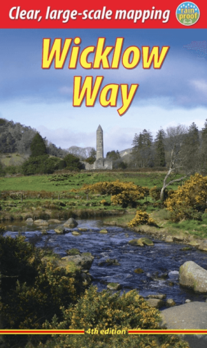
Wandelgids Wicklow Way - Rucksack Readers • 9781913817282
Wandelgids Wicklow Way - Rucksack Readers Productomschrijving: The Wicklow Way, is Ireland's first and most popular Waymarked Way, running between Marlay Park (Dublin) and Clonegal, 82 miles (132 km) to the south. It offers varied and scenic walking on the flanks of the rugged Wicklow mountains with loughs and waterfalls, passing historic buildings and hospitable villages. Much of the rou…

Wandelkaart 22 County Mayo North Discovery Series - OSI Ireland • 9781912140510
Wandelkaart County Mayo - OSI Productomschrijving: Discovery maps worden geproduceerd op een schaal van 1:50.000 (of 2 cm op papier is gelijk aan 1 kilometer op de grond). Elke kaart beslaat een oppervlakte van 40 km x 30 km oppervlakte (met uitzondering van verschillende kaarten in staand formaat, die 42 km x 32 km zijn). Er zijn 93 kaarten in de serie; 75 zijn geproduceerd door Ordnance …
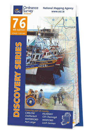
Wandelkaart 76 County Carlow, Kilkenny, Waterford & Wexford - OSI • 9781912140381
Wandelkaart County Carlow, Kilkenny, Waterford & Wexford - OSI Productomschrijving: Ontdek Ierland met de Discovery Series Wandelkaarten van Ordnance Survey Ireland. Omvat: County Carlow, Kilkenny, Waterford & Wexford De Discovery Series wandelkaarten van Ordnance Survey Ireland (OSi) zijn dé keuze voor wandelaars, fietsers en avonturiers die Ierland echt willen verkennen. Deze ho…
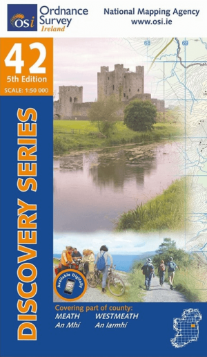
Wandelkaart 42 County Meath & Westmeath - Ordnance Survey Ireland • 9781912140312
Wandelkaart County Meath & Westmeath - Ordnance Survey Ireland Productomschrijving: Ontdek Ierland met de Discovery Series Wandelkaarten van Ordnance Survey Ireland. Omvat: County Meath, West Meath, Kells, Navan, Delvin, Athboy & Trim. De Discovery Series wandelkaarten van Ordnance Survey Ireland (OSi) zijn dé keuze voor wandelaars, fietsers en avonturiers die Ierland echt willen v…

Wandelkaart 86 County Cork (Bandon) - OSI • 9781912140404
Wandelkaart County Cork (Bandon) - OSI Productomschrijving: Ontdek Ierland met de Discovery Series Wandelkaarten van Ordnance Survey Ireland. Omvat: County Cork, Brandon, Timoleague & Clonakilty. De Discovery Series wandelkaarten van Ordnance Survey Ireland (OSi) zijn dé keuze voor wandelaars, fietsers en avonturiers die Ierland echt willen verkennen. Deze hoogwaardige topografisc…

Reisgids Irlande 2026-27 - Le Routard • 9782017338079
Reisgids Irlande - Le Routard Productomschrijving: Le Routard, le meilleur compagnon de voyage depuis 45 ans. Dans cette nouvelle édition du Routard Irlande vous trouverez une première partie en couleurs avec des cartes et des photos, pour découvrir plus facilement le pays et repérer nos coups de cœur ; des suggestions d’itinéraires et des informations pratiques pour organiser votre sé…
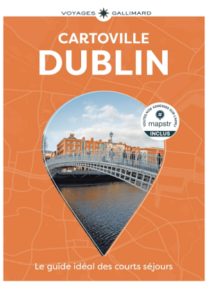
Reisgids Cartoville Dublin - Gallimard • 9782742468751
Reisgids Dublin - Gallimard Productomschrijving: De Trinity College à Temple Bar, de Merrion Square à Smithfield Village, de Parnell Square à Phoenix Park, et des quais de la Liffey au Grand Canal, la capitale irlandaise se déploie en un clin d’œil avec un guide pas comme les autres. • Un concept unique : une carte grand format, dépliable par quartier, pour se repérer immédiatement •…
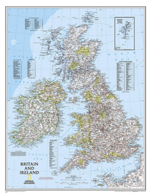
Plano Wandkaart Groot-Brittannië & Ierland 60 x 76 cm - Nat Geo • 9780792250234
Wandkaart Groot-Brittannië & Ierland 60 x 76 cm - Nat Geo Productomschrijving: National Geographic's Classic political map of Britain and Ireland is both an attractive addition to any study or classroom and an informative tool for exploring these fascinating countries. The map features thousands of place names, major highways and roads, airports, ferry routes, bodies of water, and more. Ha…

Plano Wandkaart Ierland 76 x 91 cm - Nat Geo • 9781597752565
Wandkaart Ierland 76 x 91 cm - Nat Geo Productomschrijving: The Classic style Ireland map is one of the most authoritative maps yet published of the Emerald Isle. Of the nearly 1,000 place-names shown on this map, all within the Republic of Ireland adhere to that nation's constitution—that the Irish and English language share official status. Thus, Gaelic (Irish) place-names, along with th…
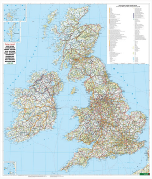
Plano Wandkaart Groot-Brittannië & Ierland - 116 x 99 cm - F&B • 5425013064590
Plano Wandkaart Groot-Brittannië & Ierland Geplastificeerd - F&B Productomschrijving: De plano politieke wandkaarten van Freytag & Berndt brengen elk continent helder in beeld. Grote, duidelijke opgerolde kaart, zonder vouwen. Ideaal om meteen op te hangen in klaslokaal, kantoor of thuis. Landen, hoofdsteden, belangrijke steden en grenzen springen in het oog. Heldere kleuren zorgen voo…

Landkaart Wegenkaart 713 Groot-Brittannië & Ierland 26 - Michelin • 9782067270220
Wegenkaart 713 Groot-Brittannië & Ierland 2026 - Michelin Productomschrijving: Deze kaart omvat de nieuwe versie voor 2026, met alle straten, hoofdwegen, toeristische informatie en locaties voor Groot-Brittannië & Ierland 2026 - Nationale kaarten - Wegenkaarten national: een overzicht van het land voor lange trajecten - Schaal aangepast aant het land - Kaarten met jaartal voor de…
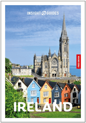
Reisgids Insight Guides Ireland ENG - APA publucations • 9781839054617
Reisgids Insight Guides Ireland ENG - APA publucations Productomschrijving: From deciding when to go, to choosing what to see when you arrive, Insight Guide Ireland, is all you need to plan your trip and experience the best of Ireland, with in-depth insider information on must-see, top attractions like Dublin, the Giant's Causeway, the Aran Islands, Connemara and the Wild Atlantic Way, and…
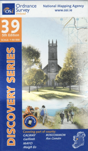
Wandelkaart 39 County Galway, Mayo & Roscommon - OSI • 9781912140602
Wandelkaart County Galway, Mayo & Roscommon - OSI Productomschrijving: Ontdek Ierland met de Discovery Series Wandelkaarten van Ordnance Survey Ireland De Discovery Series wandelkaarten van Ordnance Survey Ireland (OSi) zijn dé keuze voor wandelaars, fietsers en avonturiers die Ierland echt willen verkennen. Deze hoogwaardige topografische kaarten bieden een gedetailleerd en nauwkeuri…

Wandelkaart 32 County Mayo, Roscommon & Sligo - OSI Ireland • 9781912140565
Wandelkaart County Mayo, Roscommon & Sligo - OSI Productomschrijving: Ontdek Ierland met de Discovery Series Wandelkaarten van Ordnance Survey Ireland De Discovery Series wandelkaarten van Ordnance Survey Ireland (OSi) zijn dé keuze voor wandelaars, fietsers en avonturiers die Ierland echt willen verkennen. Deze hoogwaardige topografische kaarten bieden een gedetailleerd en nauwkeurig…
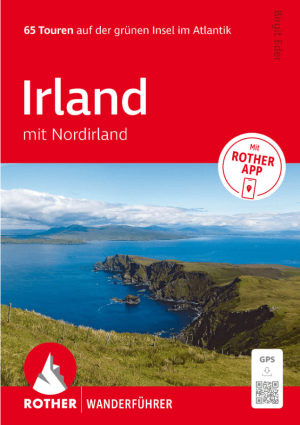
Wandelgids Irland mit Nordirland - Rother Bergverlag • 9783763314904
Wandelgids Irland mit Nordirland - Rother Productomschrijving: 65 Touren auf der grünen Insel im Atlantik. Irland – die perfekte Insel zum Wandern. - 65 sorgfältig ausgewählte Wanderungen in Irland und Nordirland – von Küstenpfaden bis zu Bergtouren - Detaillierte Wegbeschreibungen, Wanderkärtchen und Höhenprofile für jede Tour - Inklusive GPS-Tracks und Rother App für komfortable …
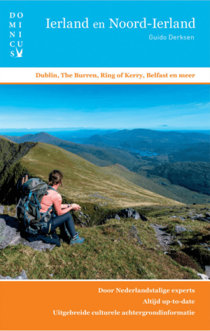
Reisgids Dominicus Ierland en Noord-Ierland - Gottmer • 9789465250106
Reisgids Ierland en Noord-Ierland - Gottmer Productomschrijving: Ierland heeft zijn geheel eigen charme: ruige kusten, golvende groene heuvels, verstilde veengebieden, vriendelijke en humorvolle mensen, Keltische mystiek en vrolijke folkmuziek. Daarbij zijn twee fascinerende grote steden, Dublin en Belfast, elk voor zich al een lange stedentrip waard. Middelgrote plaatsen als Cork en Galw…
Toesristisch Ierland
Toesristisch Ierland is bij velen bekend voor zijn vele historische overblijfselen uit het Keltische tijdperk, voor de typische kliffen langs de kusten en ook voor zijn gist zwarte Guinness bier. Een toeristische trekpleister zijn bijvoorbeeld de kliffen van Moher. Ierland is als wandelland een absolute aanrader. Vooral de kuststreek van Ierland is voor wandelaars ronduit spectaculair en vergelijkbaar met de kustregio’s van de Schotse westkust. UIteraard kunt u Ierland leren kennen met een degelijke Europese Reisgids in handen van Bibliotrek.
In Ierland zijn er ook Historische fiets- en wandelroutes te vinden, een Dikke 44 National trails zijn hier van toepassing. Specifieke plaatsen waar deze routes langskomen behoren toe aan de lijst van meest bezochte toeristische locaties. De stad Belfast, de Giant’s Causeway aan de kust, filmlocaties van Game of Thrones, de touwbrug van Carrick-a-Rede, de Cliffs of Moher, de stad Cork, de Wicklow Mountains, Killarney National Park, de Ring of Kerry, Skellig Michael & Galway. Dit zijn enkele van de meest bezocht toeristische locatie op het eiland van Ierland. Ierland is onderverdeeld in 26 graafschappen, Counties genoemd. Je bezoekt ze allemaal, en zo krijgt een zicht op het Ierse leven, of Irish life zeg maar.
Wandelroutes in Ierland
Wandelroutes in Ierland met de provincies Leinster, Munster, Connacht en Ulster. De republiek Ierland is onderverdeeld in 26 graafschappen, Counties genoemd. Ook in de regio Noord-Ierland zijn er nog eens 6 graafschappen. Het verschil tussen Ierland en Noord-Ierland is eigenlijk niet echt groot, ondanks het feit dat Noord-Ierland dus volledig tot het Verenigd Koninkrijk behoort.
Dublin is de hoofdstad van de republiek Ierland. Belfast is de grootste stad van Noord-Ierland. De republiek Ierland heeft enkele bezienswaardigheden die echt de moeite lonen. Zo zijn er de Araneilanden, de Cliffs of Moher, het voormalige klooster Glendalough en de Kylemore Abbey. Uniek zijn ook de neolithische vondsten van Brú na Bóinne gelegen aan de rivier de Boyne en de zogenaamde Skellig-eilanden. Beiden staan op de UNESCO werelderfgoedlijst. Mis deze bij een bezoek aan Ierland dus zeker niet. Wandelroutes kunt u afleggen met de Wandelkaarten Ierland, of met de Wandelgidsen Ierland, en toeristische informatie vindt u op de pagina Reisgidsen Ierland.