

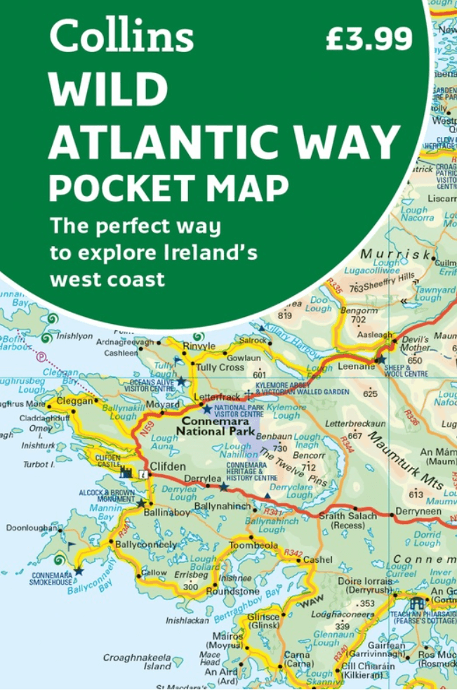
Landkaart Wegenkaart Wild Pocket map Wild Atlantic Way - Harper
Ireland’s Wild Atlantic Way, 2500 km, Covers the whole route
Korte omschrijving
Wegen- & stadskaarten County Mayo, Ierland, County Galway, Ierland, County Donegal, Ireland, County Sligo, Ierland, County Clare, Ierland, County Limerick, Ireland, County Kerry, Ireland en County Cork, Ierland van HarperCollins Publishers. Ideaal voor tochten in Ierland.
Wegenkaart Wild Pocket map Wild Atlantic Way - Harper Collins Productomschrijving: Handy full colour map of Ireland’s Wild Atlantic Way with a high level of detail. Clear mapping of the full...

Specificaties
- Uitgever: HarperCollins Publishers
- ISBN-13: 9780008780418
- HOOFDCATEGORIEËN: Wegenkaart - Landkaart
- Activiteiten: Street/Road maps & city plans
- Regio: County Clare, Ierland, County Cork, Ierland, County Donegal, Ireland, County Galway, Ierland, County Kerry, Ireland, County Limerick, Ireland, County Mayo, Ierland, County Sligo, Ierland
- Land: Ierland
- Taal: Engels
- Reeks/Serie: Pocket Maps
Volledige omschrijving
Wegenkaart Wild Pocket map Wild Atlantic Way - Harper Collins
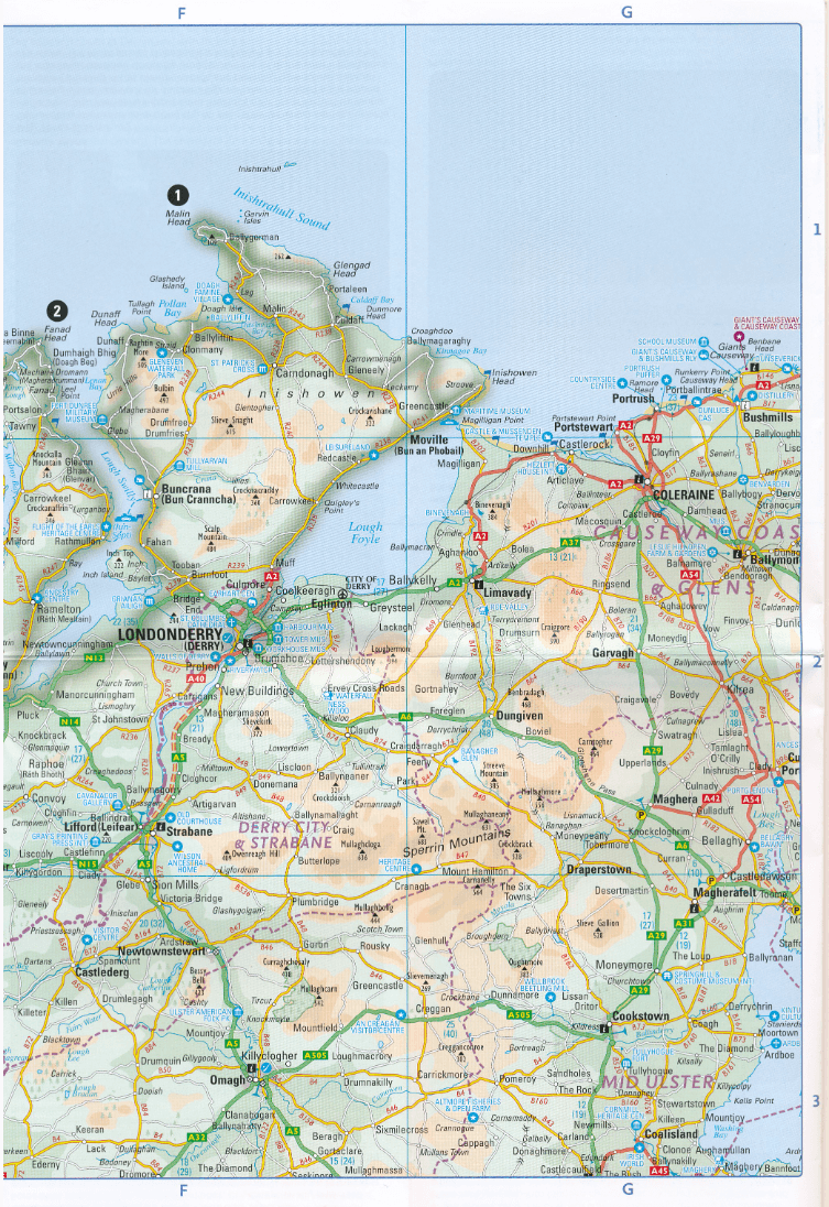
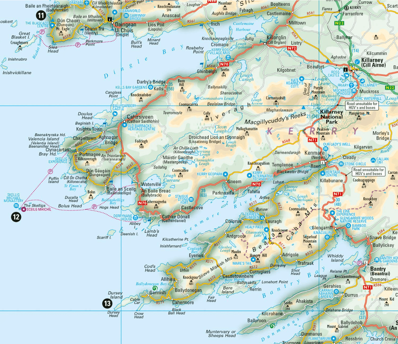
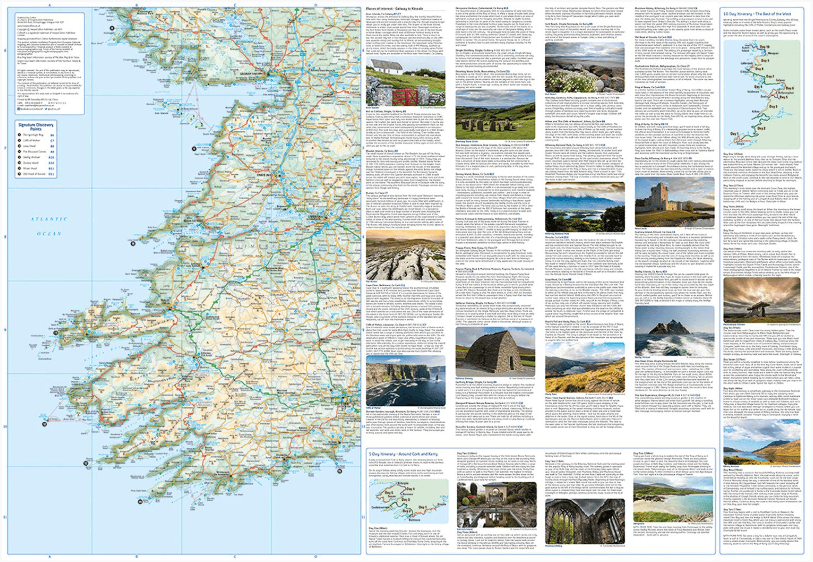
Productomschrijving: Handy full colour map of Ireland’s Wild Atlantic Way with a high level of detail. Clear mapping of the full 2500 km (over 1500 miles), showing the road network and places of interest.Ideal for tourists, locals, hikers and adventurers. Places of interest marked including famous film locations.Excellent value and very detailed for its size.Clear, detailed, full colour Collins road mapping is presented in a handy format ideal for the pocket or handbag. It is excellent value and covers the whole of the Wild Atlantic Way.
This map includes:
• Clear mapping at a scale of 8.7 miles to 1 inch • National Tourist Routes showing best routes through the most scenic areas • Places of interest include film locations such as Star Wars • Tourist and signature locations clearly marked • Suggested itineraries • Detailed place names index • Ideal companion to a sat-nav – it enables route planning and route sense-checkingArtikelen uit dezelfde regio

Wandelkaart 87 County Cork (Kinsale) - OSI • 9781912140749
Wandelkaart County Cork (Kinsale) - OSI Productomschrijving: Ontdek Ierland met de Discovery Series Wandelkaarten van Ordnance Survey Ireland. Omvat: County Cork met Kinsale, Blarney, Glanmire, Midleton, Cobh, Ballincollig, Brandon & Carrigaline. De Discovery Series wandelkaarten van Ordnance Survey Ireland (OSi) zijn dé keuze voor wandelaars, fietsers en avonturiers die Ierland ec…

Wandelkaart 40 County Galway, Longford & Roscommon - OSI • 9781908852625
Wandelkaart Counties Galway, Longford & Roscommon - OSI Productomschrijving: Ontdek Ierland met de Discovery Series Wandelkaarten van Ordnance Survey Ireland. De Discovery Series wandelkaarten van Ordnance Survey Ireland (OSi) zijn dé keuze voor wandelaars, fietsers en avonturiers die Ierland echt willen verkennen. Deze hoogwaardige topografische kaarten bieden een gedetailleerd en na…

Fietskaart County Clare Ireland - XploreIt • 9781738413607
Fietskaart County Clare Ireland - XploreIt Productomschrijving: Een nieuwe editie van de Xploreit-kaart van County Clare, Ierland Deze Xploreit-kaart is een onmisbare metgezel voor uw volgende reis naar County Clare. Waar u zich ook in de county bevindt, een snelle scan van de kaart onthult alle lokale attracties, inclusief de beste autoritten, fietsroutes en wandelingen in de omgeving…

Wandelkaart 16 County Donegal, Fermanagh, Leitrim & Sligo - OSI Ireland • 9781912140503
Wandelkaart Donegal, Fermanagh, Leitrim & Sligo - OSI Productomschrijving: Ontdek Ierland met de Discovery Series Wandelkaarten van Ordnance Survey Ireland De Discovery Series wandelkaarten van Ordnance Survey Ireland (OSi) zijn dé keuze voor wandelaars, fietsers en avonturiers die Ierland echt willen verkennen. Deze hoogwaardige topografische kaarten bieden een gedetailleerd en nauwke…
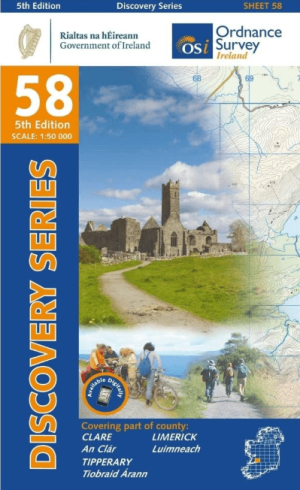
Wandelkaart 58 County Clare, Limerick & Tipperary - OSI • 9781912140220
Wandelkaart County Clare, Limerick & Tipperary - OSI Productomschrijving: Ontdek Ierland met de Discovery Series Wandelkaarten van Ordnance Survey Ireland. Omvat: de Counties Clare, Limerick & Tipperary. De Discovery Series wandelkaarten van Ordnance Survey Ireland (OSi) zijn dé keuze voor wandelaars, fietsers en avonturiers die Ierland echt willen verkennen. Deze hoogwaardige top…