
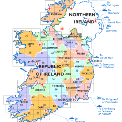
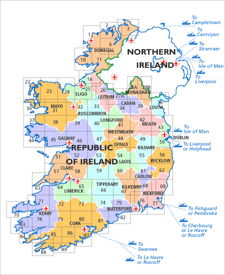
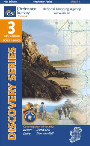
Wandelkaart 1 County Donegal North West - OSI Ireland
Dunglow- Burtonport- Bunbeg- Derrybeg- Aran Island- Inishbofin


Korte omschrijving
Wandelkaarten County Donegal, Ireland, Ireland en Ierland van Ordnance Survey Ireland. Ideaal voor tochten in Ierland.
Wandelkaart Donegal N.w. - OSI Productomschrijving: Discovery Series Sheet 1 includes an array of coastal settlements, many of which can be reached while travelling along the Wild Atlantic W...

Specificaties
- Uitgever: Ordnance Survey Ireland
- ISBN-13: 9781912140206
- HOOFDCATEGORIEËN: Wandelkaart
- Activiteiten: Wandelen, Hiking & Trekking
- Regio: County Donegal, Ireland, Ierland, Ireland
- Land: Ierland
- TOPO's & Stafkaarten: Topografisch wandelen
- Schaal: 1:50000
- Editie: 5
- Taal: Engels
- Reeks/Serie: Discovery Series, OSI
Volledige omschrijving
Wandelkaart Donegal N.w. - OSI
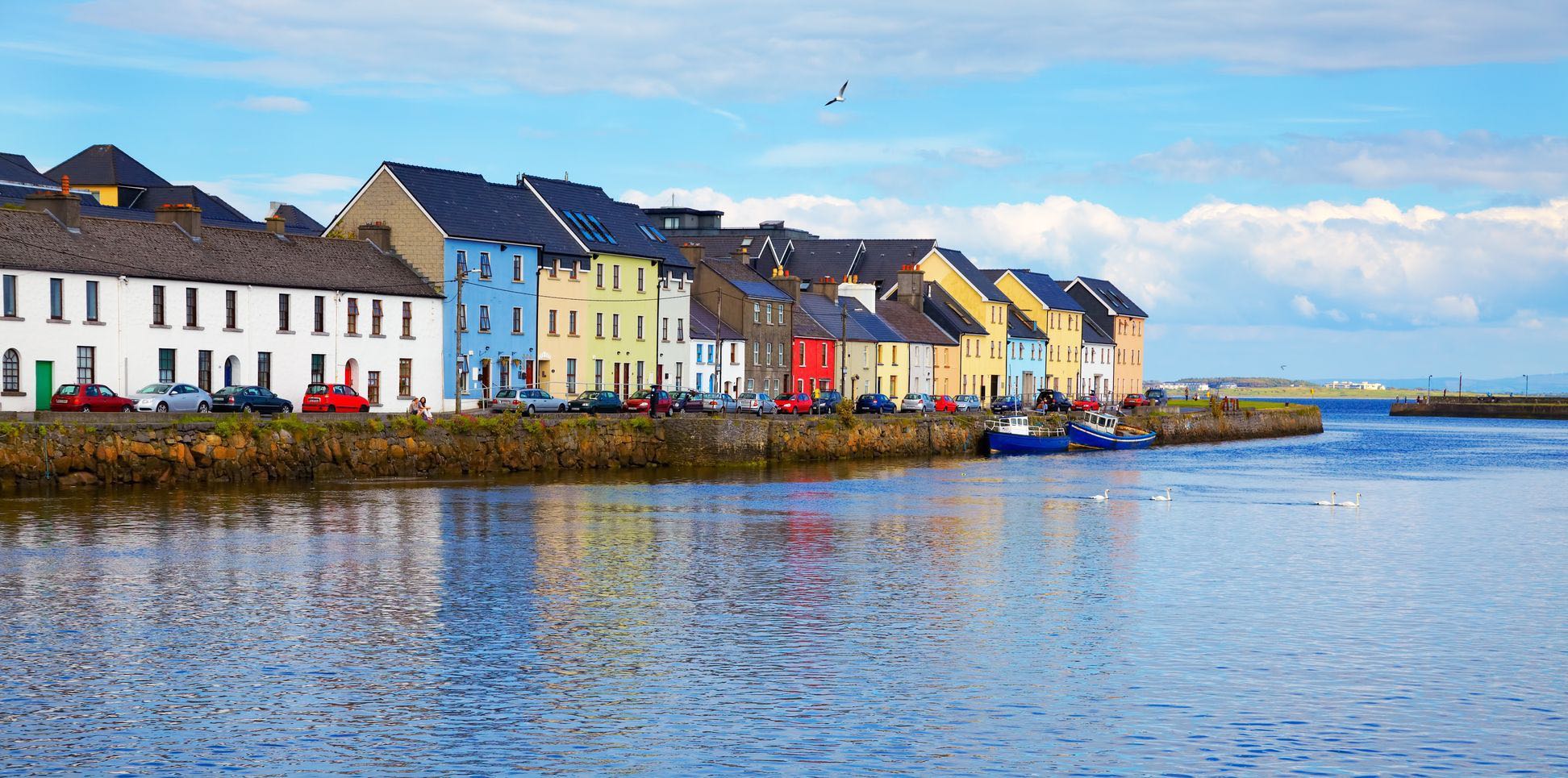
Productomschrijving: Discovery Series Sheet 1 includes an array of coastal settlements, many of which can be reached while travelling along the Wild Atlantic Way. Dunglow, Burtonport, Bunbeg, and Derrybeg all feature on Irelands West Coast. The N56 provides an excellent route north, passing along the coast before heading inland through Gweedore.
A series of beaches can be found on this Sheet including Maghery Strand, Dunmore Strand, and Ballyness Bar. As the Atlantic Ocean has such a strong presence on Sheet 1, it features a host of islands to be seen. Aran Island, Inishbofin and Tory Island can all be viewed if travelling along the magnificent Wild Atlantic Way.
The Gaeltacht districts of Na Rosa (The Rosses), Gaoth Dobhair (Gweedore) and Cloich Chionnaola (Cloghaneely) all fall within the boundaries of Sheet 1. This Sheet is also home to part of the Glenveagh National Park. It is the second largest national park in Ireland covering 170 square kilometres.
The Derryveagh Mountains help to give Donegal the honour of being the most mountainous county in Ulster. The mountains’ highest peak is Mount Errigal, at 751 metres.

Overzichtskaarten
OSI Ireland Topo Wandelkaarten Discovery Series
OSI Ireland Topo Wandelkaarten Discovery Series
Producten op de overzichtskaart
Klik op een product om naar de detailpagina te gaan.
- Wandelkaart 1 County Donegal North West - OSI Ireland
- Wandelkaart 2 County Donegal North & Central - OSI Ireland
- Wandelkaart 3 County Donegal North East & Derry - OSI Ireland
- Wandelkaart 6 County Donegal Central & Tyrone - OSI Ireland
- Wandelkaart 10 County Donegal South West - OSI Ireland
- Wandelkaart 11 County Donegal South - OSI Ireland
- Wandelkaart 16 County Donegal, Fermanagh, Leitrim & Sligo - OSI Ireland
- Wandelkaart 22 County Mayo North Discovery Series - OSI Ireland
- Wandelkaart 23 County Mayo North Coast Discovery Series - OSI Ireland
- Wandelkaart 24 County Mayo & Sligo Discovey Series - OSI Ireland
- Wandelkaart 25 County Sligo East, Leitrim & Roscommon - OSI
- Wandelkaart 26 County Cavan, Fermanagh, Leitrim, Rosc. & Sligo - OSI
- Wandelkaart 30 County Mayo West & Central Discovery Series - OSI
- Wandelkaart 31 County Mayo Central Discovery Series - OSI Ireland
- Wandelkaart 32 County Mayo, Roscommon & Sligo - OSI Ireland
- Wandelkaart 33 County Leitrim, Longford, Roscommon & Sligo - OSI
- Wandelkaart 34 County Cavan, Leitrim, Longford & Westmeath - OSI
- Wandelkaart 35 County Cavan, Louth, Meath, Monaghan - OSI
- Wandelkaart 36 County Armagh, Down, Louth, Meath & Monaghan- OSI
- Wandelkaart 37 County Mayo South West & County Galway - OSI
- Wandelkaart 38 County Galway & South Central County Mayo - OSI
- Wandelkaart 39 County Galway, Mayo & Roscommon - OSI
- Wandelkaart 40 County Galway, Longford & Roscommon - OSI
- Wandelkaart 41 County Longford, Meath & Westmeath - OSI
- Wandelkaart 42 County Meath & Westmeath - Ordnance Survey Ireland
- Wandelkaart 43 County Dublin, County Louth & County Meath - OSI
- Wandelkaart 44 County Galway Coastline - OSI
- Wandelkaart 45 County Galway & it's Southern Coastline - OSI
- Wandelkaart 46 County Galway- Connemara Ireland - OSI
- Wandelkaart 47 County Galway, Offaly, Roscommon & Westmeath - OSI
- Wandelkaart 48 County Offaly & Westmeath - OSI
- Wandelkaart 49 County Kildare, Mearth, Offaly & Westmeath - OSI
- Wandelkaart 50 County Dublin & Counties Kildare, Meath & Wicklow - OSI
- Wandelkaart 51 County Clare & Galway (COASTLINE) - OSI
- Wandelkaart 52 County Clare & Galway (Kust verwijderd) - OSI
- Wandelkaart 53 Clounty Clare, Galway, Offaly & Tipperary - OSI
- Wandelkaart 54 County Laois, Offaly & Tipperary - OSI
- Wandelkaart 55 County Kildare, Laois & Wicklow - OSI
- Wandelkaart 56 County Wicklow, Kildare & Dublin - OSI
- Wandelkaart 57 County Clare - OSI
- Wandelkaart 58 County Clare, Limerick & Tipperary - OSI
- Wandelkaart 59 County Clare, Offaly & Tipperary - OSI
- Wandelkaart 60 County Kilkenny, Laois & Tipperary - OSI
- Wandelkaart 61 County Carlow, Kildare, Kilkenny, Laois & Wicklow - OSI
- Wandelkaart 62 County Carlow, Wexford & Wicklow - OSI
- Wandelkaart 63 County Clare & Kerry - OSI
- Wandelkaart 64 County Clare, Kerry & Limerick - OSI
- Wandelkaart 65 County Clare, Limerick & Tipperary - OSI
- Wandelkaart 66 County Tipperary & Limerick - OSI
- Wandelkaart 67 County Kilkenny & Tipperary - OSI
- Wandelkaart 68 County Carlow, Kilkenny & Wexford - OSI
- Wandelkaart 69 County Wexford - OSI
- Wandelkaart 70 County Kerry (Dingle) - OSI
- Wandelkaart 71 County Kerry (Tralee) - OSI
- Wandelkaart 72 County Kerry, Cork & Limerick - OSI
- Wandelkaart 73 County Cork & Limerick - OSI
- Wandelkaart 74 County Cork, Limerick, Tipperary & Waterford - OSI
- Wandelkaart 75 County Kilkenny, Tipperary & Waterford North - OSI
- Wandelkaart 76 County Carlow, Kilkenny, Waterford & Wexford - OSI
- Wandelkaart 77 County Wexford - OSI
- Wandelkaart 78 County Kerry - OSI
- Wandelkaart 78W County Kerry (Killarney) - OSI
- Wandelkaart 79 County Cork (Macroom) & Kerry - OSI
- Wandelkaart 80 County Cork - OSI
- Wandelkaart 81 County Cork & Waterford - OSI
- Wandelkaart 82 County Waterford - OSI
- Wandelkaart 83 County Kerry (Caherciveen) - OSI
- Wandelkaart 84 County Cork & Kerry - OSI
- Wandelkaart 85 County Cork (Bantry) & Kerry - OSI
- Wandelkaart 86 County Cork (Bandon) - OSI
- Wandelkaart 87 County Cork (Kinsale) - OSI
- Wandelkaart 88 County Cork (Dunmanus Bay) - OSI
- Wandelkaart 89 County Cork (Skibbereen) - OSI
Artikelen uit dezelfde regio

Landkaart Wegenkaart 713 Groot-Brittannië & Ierland 26 - Michelin • 9782067270220
Wegenkaart 713 Groot-Brittannië & Ierland 2026 - Michelin Productomschrijving: Deze kaart omvat de nieuwe versie voor 2026, met alle straten, hoofdwegen, toeristische informatie en locaties voor Groot-Brittannië & Ierland 2026 - Nationale kaarten - Wegenkaarten national: een overzicht van het land voor lange trajecten - Schaal aangepast aant het land - Kaarten met jaartal voor de…
Wandelkaart 3 County Donegal North East & Derry - OSI Ireland • 9781912140008
Wandelkaart Donegal North East & Derry - OSI Ireland Productomschrijving: Ontdek Ierland met de Discovery Series Wandelkaarten van Ordnance Survey Ireland. De Discovery Series wandelkaarten van Ordnance Survey Ireland (OSi) zijn dé keuze voor wandelaars, fietsers en avonturiers die Ierland echt willen verkennen. Deze hoogwaardige topografische kaarten bieden een gedetailleerd en nauwke…
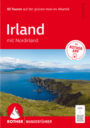
Wandelgids Irland mit Nordirland - Rother Bergverlag • 9783763314904
Wandelgids Irland mit Nordirland - Rother Productomschrijving: 65 Touren auf der grünen Insel im Atlantik. Irland – die perfekte Insel zum Wandern. - 65 sorgfältig ausgewählte Wanderungen in Irland und Nordirland – von Küstenpfaden bis zu Bergtouren - Detaillierte Wegbeschreibungen, Wanderkärtchen und Höhenprofile für jede Tour - Inklusive GPS-Tracks und Rother App für komfortable …

Wandelkaart 6 County Donegal Central & Tyrone - OSI Ireland • 9781912140480
Wandelkaart Donegal Central & Tyrone Ireland - OSI Productomschrijving: Ontdek Ierland met de Discovery Series Wandelkaarten van Ordnance Survey Ireland. De Discovery Series wandelkaarten van Ordnance Survey Ireland (OSi) zijn dé keuze voor wandelaars, fietsers en avonturiers die Ierland echt willen verkennen. Deze hoogwaardige topografische kaarten bieden een gedetailleerd en nauwkeur…
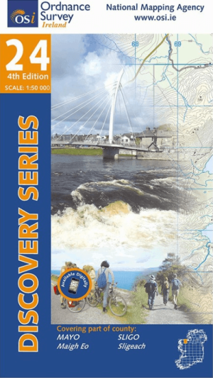
Wandelkaart 24 County Mayo & Sligo Discovey Series - OSI Ireland • 9781912140121
Wandelkaart County Mayo & Sligo - OSI Productomschrijving: Ontdek Ierland met de Discovery Series Wandelkaarten van Ordnance Survey Ireland De Discovery Series wandelkaarten van Ordnance Survey Ireland (OSi) zijn dé keuze voor wandelaars, fietsers en avonturiers die Ierland echt willen verkennen. Deze hoogwaardige topografische kaarten bieden een gedetailleerd en nauwkeurig overzicht v…