
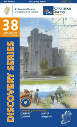
Wandelkaart 38 County Galway & South Central County Mayo - OSI
County Galway & South Central County Mayo
Korte omschrijving
Wandelkaarten County Mayo, Ierland, County Galway, Ierland en Ierland van Ordnance Survey Ireland. Ideaal voor tochten in Ierland.
Wandelkaart County Galway & South Central County Mayo - OSI Productomschrijving: Productomschrijving: Ontdek Ierland met de Discovery Series Wandelkaarten van Ordnance Survey Ireland De...

Specificaties
- Uitgever: Ordnance Survey Ireland
- ISBN-13: 9781912140084
- HOOFDCATEGORIEËN: Wandelkaart
- Activiteiten: Wandelen, Hiking & Trekking
- Regio: County Galway, Ierland, County Mayo, Ierland, Ierland
- Land: Ierland
- TOPO's & Stafkaarten: Topografisch wandelen
- Schaal: 1:50000
- Editie: 6
- Taal: Engels
- Reeks/Serie: Discovery Series, OSI
Volledige omschrijving
Wandelkaart County Galway & South Central County Mayo - OSI
Productomschrijving: Productomschrijving: Ontdek Ierland met de Discovery Series Wandelkaarten van Ordnance Survey Ireland
De Discovery Series wandelkaarten van Ordnance Survey Ireland (OSi) zijn dé keuze voor wandelaars, fietsers en avonturiers die Ierland echt willen verkennen. Deze hoogwaardige topografische kaarten bieden een gedetailleerd en nauwkeurig overzicht van het Ierse landschap, met een schaal van 1:50.000. Ideaal voor wie graag buiten de gebaande paden treedt.
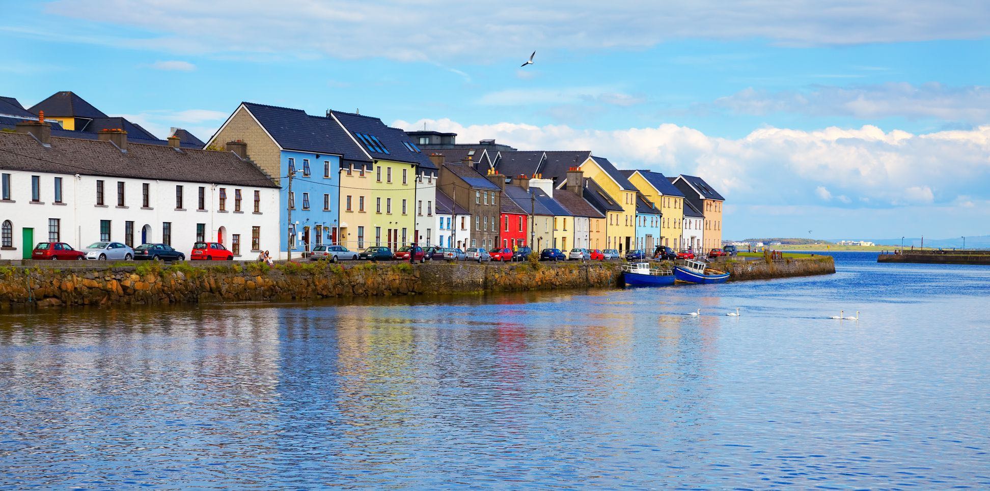
Deze topografische wandelkaart omvat de Countys: County Galway & South Central County Mayo
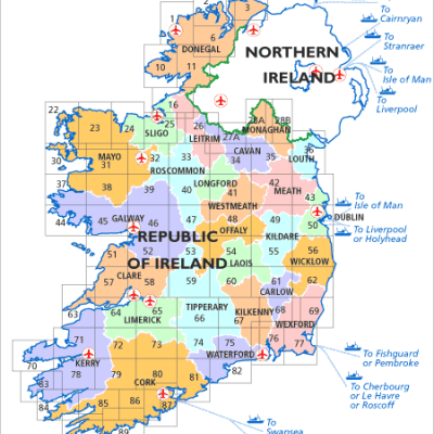
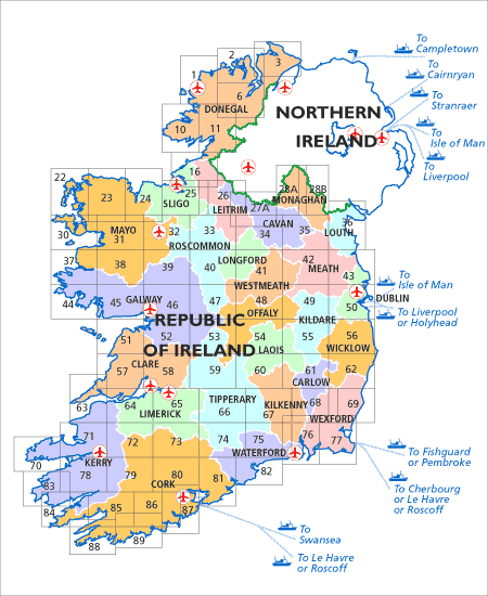
Elke kaart dekt een specifiek gebied en overlapt deels met aangrenzende kaarten. Zo weet je zeker dat je geen enkel stuk landschap mist tijdens je tocht. De kaarten tonen wandelroutes, bergtoppen, meren, rivieren, bossen, historische plekken en lokale wegen – allemaal met een uitzonderlijke helderheid en precisie.
Voordelen van de Discovery Series kaarten:
- Volledige dekking van Ierland per County, met logische overlap voor continu gebruik.
- Duidelijke topografie: hoogtelijnen, terreinsoorten en natuurlijke elementen in één oogopslag zichtbaar.
- Betrouwbaar en actueel: samengesteld door OSi, dé nationale cartografische autoriteit van Ierland.
- Perfect voor outdoor-activiteiten: wandelen, hiken, kamperen of fietsen.
Of je nu de Wicklow Mountains intrekt of de Wild Atlantic Way volgt, met de Discovery Series weet je altijd waar je bent – en waar je naartoe wilt.
Bestel nu jouw Discovery Series kaart en beleef Ierland op z’n best. Ideaal voor voorbereiding én onderweg.
Ga goed voorbereid op pad – kies voor kwaliteit, kies voor Ordnance Survey Ireland.

Overzichtskaarten
OSI Ireland Topo Wandelkaarten Discovery Series
OSI Ireland Topo Wandelkaarten Discovery Series
Producten op de overzichtskaart
Klik op een product om naar de detailpagina te gaan.
- Wandelkaart 1 County Donegal North West - OSI Ireland
- Wandelkaart 2 County Donegal North & Central - OSI Ireland
- Wandelkaart 3 County Donegal North East & Derry - OSI Ireland
- Wandelkaart 6 County Donegal Central & Tyrone - OSI Ireland
- Wandelkaart 10 County Donegal South West - OSI Ireland
- Wandelkaart 11 County Donegal South - OSI Ireland
- Wandelkaart 16 County Donegal, Fermanagh, Leitrim & Sligo - OSI Ireland
- Wandelkaart 22 County Mayo North Discovery Series - OSI Ireland
- Wandelkaart 23 County Mayo North Coast Discovery Series - OSI Ireland
- Wandelkaart 24 County Mayo & Sligo Discovey Series - OSI Ireland
- Wandelkaart 25 County Sligo East, Leitrim & Roscommon - OSI
- Wandelkaart 26 County Cavan, Fermanagh, Leitrim, Rosc. & Sligo - OSI
- Wandelkaart 30 County Mayo West & Central Discovery Series - OSI
- Wandelkaart 31 County Mayo Central Discovery Series - OSI Ireland
- Wandelkaart 32 County Mayo, Roscommon & Sligo - OSI Ireland
- Wandelkaart 33 County Leitrim, Longford, Roscommon & Sligo - OSI
- Wandelkaart 34 County Cavan, Leitrim, Longford & Westmeath - OSI
- Wandelkaart 35 County Cavan, Louth, Meath, Monaghan - OSI
- Wandelkaart 36 County Armagh, Down, Louth, Meath & Monaghan- OSI
- Wandelkaart 37 County Mayo South West & County Galway - OSI
- Wandelkaart 38 County Galway & South Central County Mayo - OSI
- Wandelkaart 39 County Galway, Mayo & Roscommon - OSI
- Wandelkaart 40 County Galway, Longford & Roscommon - OSI
- Wandelkaart 41 County Longford, Meath & Westmeath - OSI
- Wandelkaart 42 County Meath & Westmeath - Ordnance Survey Ireland
- Wandelkaart 43 County Dublin, County Louth & County Meath - OSI
- Wandelkaart 44 County Galway Coastline - OSI
- Wandelkaart 45 County Galway & it's Southern Coastline - OSI
- Wandelkaart 46 County Galway- Connemara Ireland - OSI
- Wandelkaart 47 County Galway, Offaly, Roscommon & Westmeath - OSI
- Wandelkaart 48 County Offaly & Westmeath - OSI
- Wandelkaart 49 County Kildare, Mearth, Offaly & Westmeath - OSI
- Wandelkaart 50 County Dublin & Counties Kildare, Meath & Wicklow - OSI
- Wandelkaart 51 County Clare & Galway (COASTLINE) - OSI
- Wandelkaart 52 County Clare & Galway (Kust verwijderd) - OSI
- Wandelkaart 53 Clounty Clare, Galway, Offaly & Tipperary - OSI
- Wandelkaart 54 County Laois, Offaly & Tipperary - OSI
- Wandelkaart 55 County Kildare, Laois & Wicklow - OSI
- Wandelkaart 56 County Wicklow, Kildare & Dublin - OSI
- Wandelkaart 57 County Clare - OSI
- Wandelkaart 58 County Clare, Limerick & Tipperary - OSI
- Wandelkaart 59 County Clare, Offaly & Tipperary - OSI
- Wandelkaart 60 County Kilkenny, Laois & Tipperary - OSI
- Wandelkaart 61 County Carlow, Kildare, Kilkenny, Laois & Wicklow - OSI
- Wandelkaart 62 County Carlow, Wexford & Wicklow - OSI
- Wandelkaart 63 County Clare & Kerry - OSI
- Wandelkaart 64 County Clare, Kerry & Limerick - OSI
- Wandelkaart 65 County Clare, Limerick & Tipperary - OSI
- Wandelkaart 66 County Tipperary & Limerick - OSI
- Wandelkaart 67 County Kilkenny & Tipperary - OSI
- Wandelkaart 68 County Carlow, Kilkenny & Wexford - OSI
- Wandelkaart 69 County Wexford - OSI
- Wandelkaart 70 County Kerry (Dingle) - OSI
- Wandelkaart 71 County Kerry (Tralee) - OSI
- Wandelkaart 72 County Kerry, Cork & Limerick - OSI
- Wandelkaart 73 County Cork & Limerick - OSI
- Wandelkaart 74 County Cork, Limerick, Tipperary & Waterford - OSI
- Wandelkaart 75 County Kilkenny, Tipperary & Waterford North - OSI
- Wandelkaart 76 County Carlow, Kilkenny, Waterford & Wexford - OSI
- Wandelkaart 77 County Wexford - OSI
- Wandelkaart 78 County Kerry - OSI
- Wandelkaart 78W County Kerry (Killarney) - OSI
- Wandelkaart 79 County Cork (Macroom) & Kerry - OSI
- Wandelkaart 80 County Cork - OSI
- Wandelkaart 81 County Cork & Waterford - OSI
- Wandelkaart 82 County Waterford - OSI
- Wandelkaart 83 County Kerry (Caherciveen) - OSI
- Wandelkaart 84 County Cork & Kerry - OSI
- Wandelkaart 85 County Cork (Bantry) & Kerry - OSI
- Wandelkaart 86 County Cork (Bandon) - OSI
- Wandelkaart 87 County Cork (Kinsale) - OSI
- Wandelkaart 88 County Cork (Dunmanus Bay) - OSI
- Wandelkaart 89 County Cork (Skibbereen) - OSI
Artikelen uit dezelfde regio
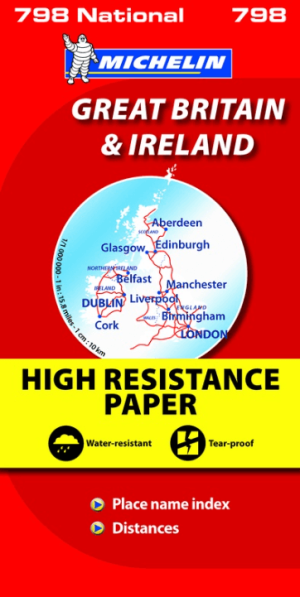
Landkaart Wegenkaart 798 Groot-Brittannië & Ierland - Michelin • 9782067137998
Wegenkaart Groot-Brittannië & Ierland - Michelin Productomschrijving: Deze Nationale kaart van Groot-Brittannië & Ierland, biedt een gedetailleerd overzicht van alle plaatsen. het wegennet wordt verfijnd aangeduid met allerhande symbolen, en voorziet in alle behoeftes, of u op zoek bent naar specifieke wegen, of zich snel uit de voeten wil maken, de plaatsnamenindex, en toeristische inform…
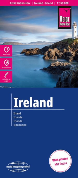
Landkaart Wegenkaart Ierland - Reise Know-How Verlag • 9783831775187
Wegenkaart Ierland - Reise Know-How Verlag Productomschrijving: De Reise Know-How wegenkaart van Ierland is een betrouwbare, gedetailleerde en duurzame landkaart voor wie Ierland zelfstandig wil verkennen. Deze hoogwaardige reiskaart is ideaal voor gebruik tijdens een rondreis met de auto, camper, motor of fiets en biedt alle informatie die je nodig hebt voor een zorgeloze reisplanning. …

Wandelgids Big Trails DEEL 2 Great Britain & Ireland - Vertebrate • 9781839810459
Big Trails DEEL 2 Great Britain & Ireland - Vertebrate Publ. Productomschrijving: More of the best long-distance trails Big Trails: Great Britain & Ireland Volume 2 features twenty-five long-distance trails in England, Scotland, Wales, Northern Ireland and Ireland, and includes a general overview of the trails, specific technical information, overview mapping, key information and stun…

Wandelkaart 44 County Galway Coastline - OSI • 9781912140169
Wandelkaart County Galway Coastline - OSI Productomschrijving: Ontdek Ierland met de Discovery Series Wandelkaarten van Ordnance Survey Ireland. De Discovery Series wandelkaarten van Ordnance Survey Ireland (OSi) zijn dé keuze voor wandelaars, fietsers en avonturiers die Ierland echt willen verkennen. Deze hoogwaardige topografische kaarten bieden een gedetailleerd en nauwkeurig overz…
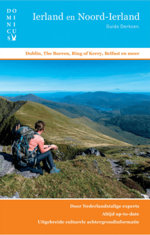
Reisgids Dominicus Ierland en Noord-Ierland - Gottmer • 9789465250106
Reisgids Ierland en Noord-Ierland - Gottmer Productomschrijving: Ierland heeft zijn geheel eigen charme: ruige kusten, golvende groene heuvels, verstilde veengebieden, vriendelijke en humorvolle mensen, Keltische mystiek en vrolijke folkmuziek. Daarbij zijn twee fascinerende grote steden, Dublin en Belfast, elk voor zich al een lange stedentrip waard. Middelgrote plaatsen als Cork en Galw…