

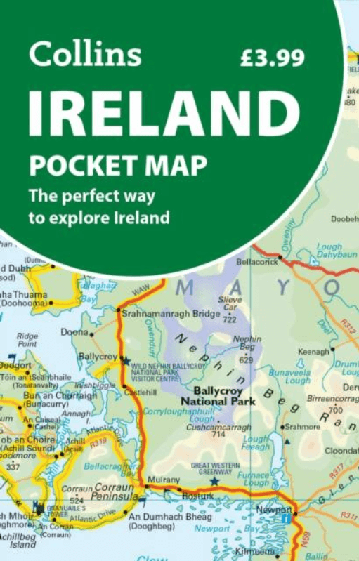
Landkaart Wegenkaart Pocket map Ierland - HarperCollins
Cork, Dublin, Dún Laoghaire, Galway, Limerick Londonderry....

Korte omschrijving
Wegen- & stadskaarten Ierland van HarperCollins Publishers. Ideaal voor tochten in Ierland.
Wegenkaart Pocket map Ierland - HarperCollins Productomschrijving: Full-colour map of Ireland at 9 miles to 1 inch (1:570,240), with clear, detailed road network and counties and new admini...

Specificaties
- Uitgever: HarperCollins Publishers
- ISBN-13: 9780008787448
- HOOFDCATEGORIEËN: Wegenkaart - Landkaart
- Activiteiten: Street/Road maps & city plans
- Regio: Ierland
- Land: Ierland
- Schaal: 1:470000
- Taal: Engels
- Reeks/Serie: Pocket Maps
Volledige omschrijving
Wegenkaart Pocket map Ierland - HarperCollins
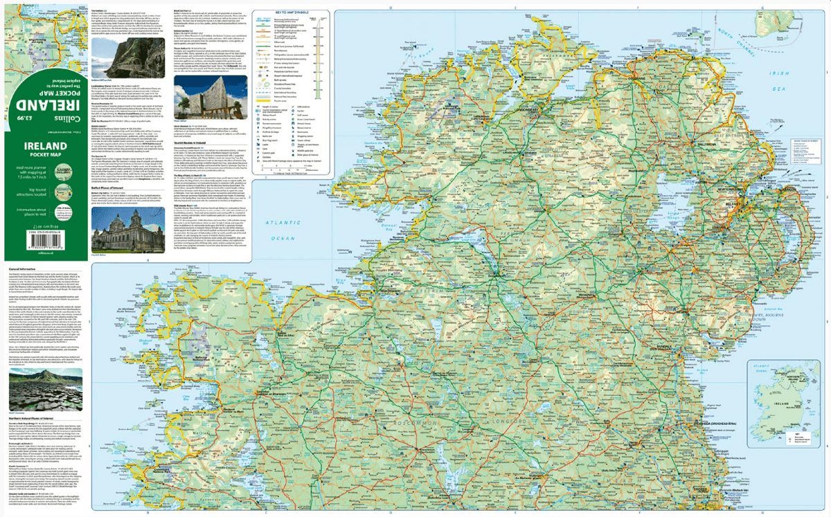
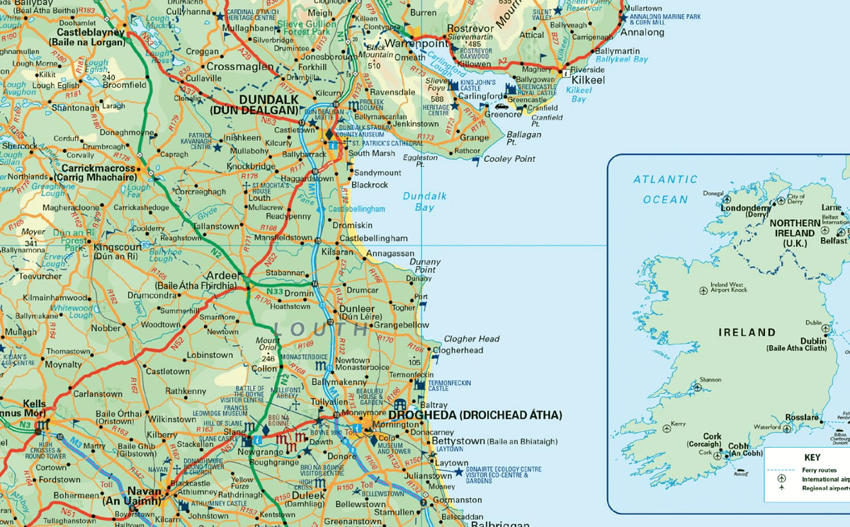
Productomschrijving: Full-colour map of Ireland at 9 miles to 1 inch (1:570,240), with clear, detailed road network and counties and new administrative areas shown in colour. This double-sided map covers the whole of Ireland, and is ideal for reference or route planning. This map of Ireland shows the road network in detail. It is ideal for business users, with colouring of local council areas, but it is also perfect for tourists as a route planning map.
Main features:
Fully updated
New administrative areas shown in colour
Clear, detailed road network
Town and city names, rivers, lakes, spot heights, railway lines and canals are clearly shown
City/town centre, street plans of Belfast, Cork, Dublin, Dún Laoghaire, Galway, Limerick Londonderry/Derry and Waterford showing places of interest
Full index to place names
Mileage chart
Car ferry routes
Key in English, French and German
Area of coverage
Covers the whole of the Republic of Ireland and Northern Ireland
Scale:
1:470,000
7.5 miles to 1 inch
Artikelen uit dezelfde regio

Landkaart Wegenkaart Ierland - Freytag & Berndt • 9783707925081
Wegenkaart Ierland - Freytag & Berndt Productomschrijving: Freytag & Berndt Ierland is een praktische wegenkaart voor reizigers die Ierland met auto, motor, camper of huurwagen willen verkennen. De kaart biedt een duidelijk overzicht van het volledige eiland en is geschikt voor routeplanning tussen steden, kustgebieden, nationale parken en landelijke regio’s. Met schaal 1:350.000 toon…
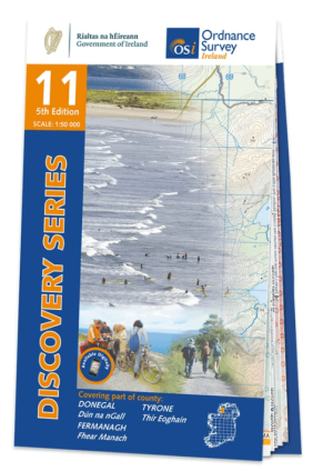
Wandelkaart 11 County Donegal South - OSI Ireland • 9781912140497
Wandelkaart Donegal South - OSI Productomschrijving: Ontdek Ierland met de Discovery Series Wandelkaarten van Ordnance Survey Ireland. De Discovery Series wandelkaarten van Ordnance Survey Ireland (OSi) zijn dé keuze voor wandelaars, fietsers en avonturiers die Ierland echt willen verkennen. Deze hoogwaardige topografische kaarten bieden een gedetailleerd en nauwkeurig overzicht van he…
Landkaart Wegenkaart Ierland - Reise Know-How Verlag • 9783831775187
Wegenkaart Ierland - Reise Know-How Verlag Productomschrijving: De Reise Know-How wegenkaart van Ierland is een betrouwbare, gedetailleerde en duurzame landkaart voor wie Ierland zelfstandig wil verkennen. Deze hoogwaardige reiskaart is ideaal voor gebruik tijdens een rondreis met de auto, camper, motor of fiets en biedt alle informatie die je nodig hebt voor een zorgeloze reisplanning. …

Landkaart Wegenkaart 712 Ierland - Michelin • 9782067170193
Wegenkaart Ierland - Michelin Productomschrijving: Deze Nationale kaart van Ierland, biedt een gedetailleerd overzicht van alle plaatsen. het wegennet wordt verfijnd aangeduid met allerhande symbolen, en voorziet in alle behoeftes, of u op zoek bent naar specifieke wegen, of zich snel uit de voeten wil maken, de plaatsnamenindex, en toeristische informatie, geven u alle elementen om dat we…

Reisgids Ireland Ierland - Mini Rough Guides • 9781835291658
Reisgids Ireland - Mini Rough Guides Productopschrijving: Compact, concise and packed full of essential information about where to go and what to do, this is an ideal on-the-move guide for exploring Ireland. From top tourist attractions like The Rock of Cashel, The Dingle Peninsula and The Giant's Causeway to cultural gems, including The Book of Kells, Newgrange and Temple Bar, including a…