
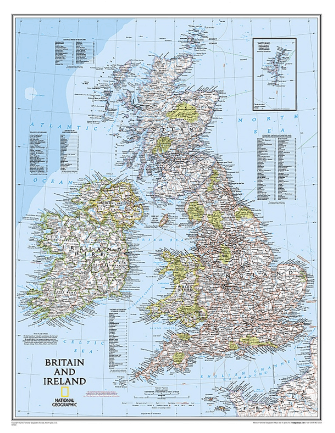
Plano Wandkaart Groot-Brittannië & Ierland 60 x 76 cm - Nat Geo
Geplastificeerd
Korte omschrijving
Wandkaart Groot-Brittannië & Ierland 60 x 76 cm - Nat Geo Productomschrijving: National Geographic's Classic political map of Britain and Ireland is both an attractive addition to any study ...

Specificaties
- Uitgever: National Geographic
- ISBN-13: 9780792250234
- HOOFDCATEGORIEËN: Wandkaarten Planokaart/opgerold
- Activiteiten: Wandkaarten
- Regio: Engeland, Ierland, Noord Ierland, Schotland, Wales
- Land: England, Ierland, Noord Ierland, Schotland, Wales
- Waterafstotende kaart: National Geographic, Geplastificeerd
- Schaal: 1:1680000
- Taal: Engels
- Reeks/Serie: Planokaart/opgerold
- Wandkaarten & Planokaarten: Wandkaarten & Planokaarten
Volledige omschrijving
Wandkaart Groot-Brittannië & Ierland 60 x 76 cm - Nat Geo
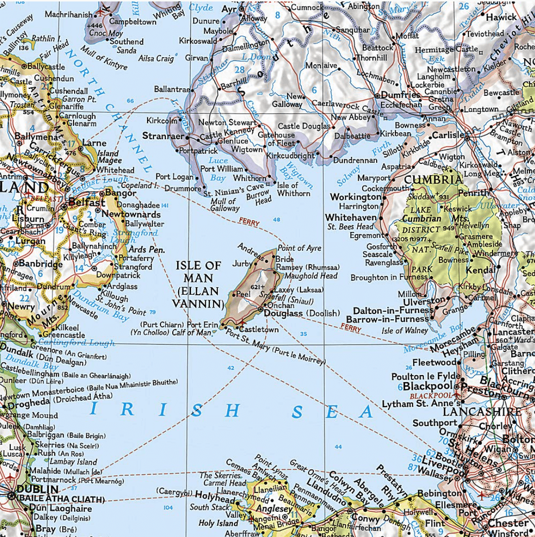
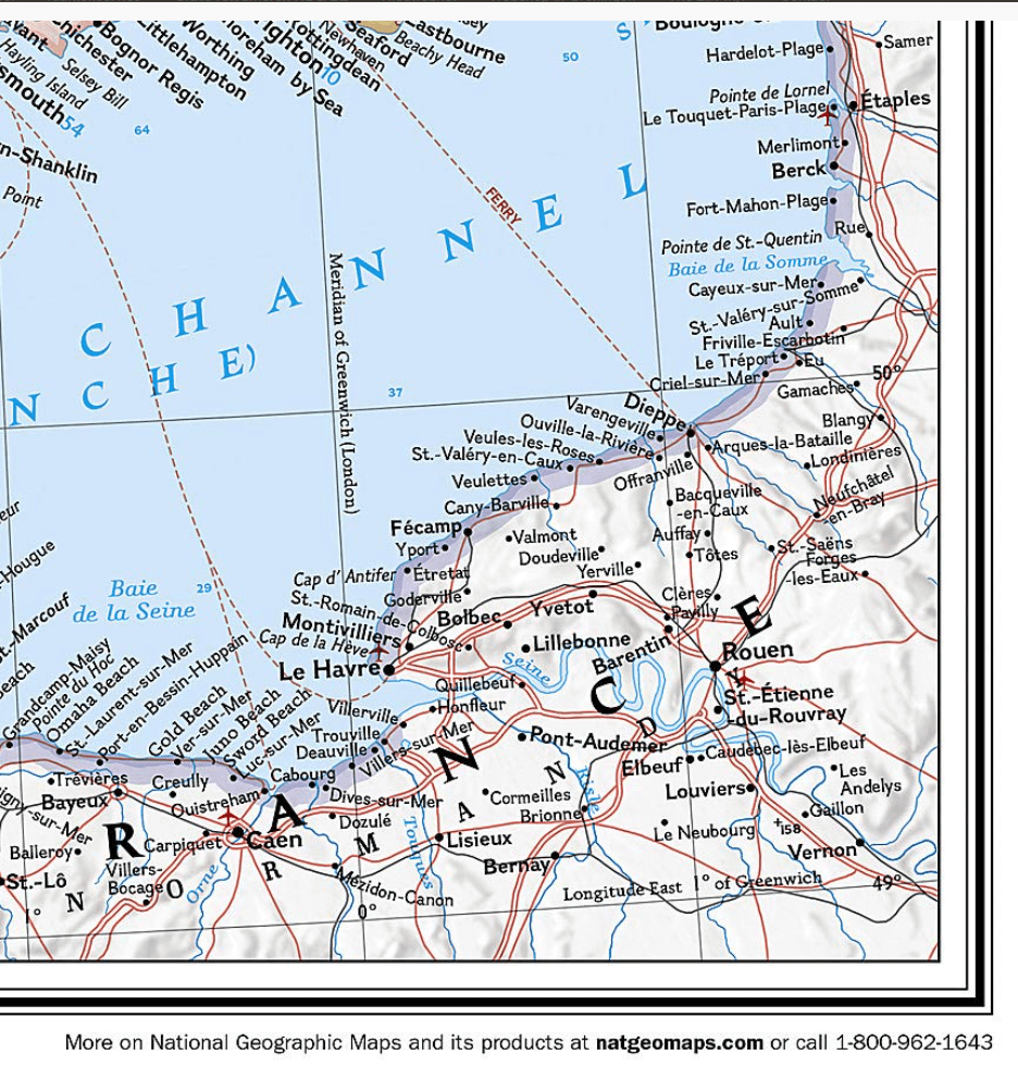
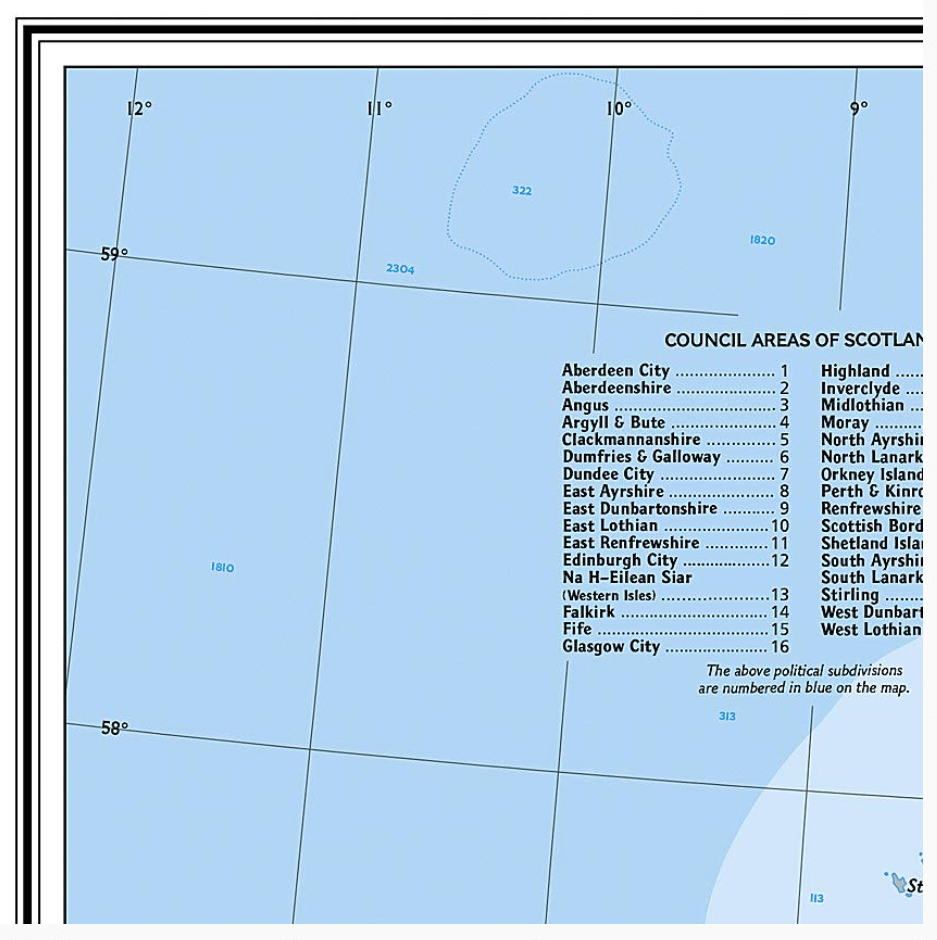
Productomschrijving: National Geographic's Classic political map of Britain and Ireland is both an attractive addition to any study or classroom and an informative tool for exploring these fascinating countries. The map features thousands of place names, major highways and roads, airports, ferry routes, bodies of water, and more. Handy indexes make it easy to identify the counties, districts, council areas, unitary authorities, and metropolitan districts of Ireland, Northern Ireland, Scotland, Wales, and England. An inset provides detail of the Shetland Islands. National parks are clearly indicated in green vignettes, and shaded relief reveals the interesting and varied topography of these island nations.
English and Gaelic (Irish) share official status per the Republic of Ireland's constitution, so place names are rendered in both. In the Gaeltachtl, or predominantly Irish-speaking regions, only Irish place-names have official status and are used on signposts. These districts are found within the counties of Cork, Donegal, Galway, Kerry, Mayo, Meath, and Waterford.
Afmeting: 60 x 76 cm
Artikelen uit dezelfde regio

Wandelgids Epic British Walks - Ordnance Survey • 9780319092064
Wandelgids Epic British Walks - Ordnance Survey Productomschrijving: OS Epic British Walks allows the reader to take their walking dreams one step further with this inspiring introduction to distance walking and with thirty-eight amazing trails of immense diversity, each graded by difficulty, there are routes for first-time hikers as well as for the super-fit, seasoned multi-day rambler. …

Reisgids Great Britain - Groot Brittannië - Lonely Planet • 9781837583515
Travelguide Great Britain - Lonely Planet Productomschrijving: Buckingham Palace, Stonehenge, Manchester United, The Beatles – Britain does icons like nowhere else, and travel here is a fascinating mix of famous names and hidden gems. Covers: Planning chapters, London, Canterbury, Southeast England, Oxford, Cotswolds, Southwest England, Cambridge, East Anglia, Birmingham, the Midlands…

Fietsgids Great British Gravel Rides - Vertebrate Publ. • 9781839811265
Great British Gravel Rides - Vertebrate Productomschrijving: Cycling the wild trails of England, Scotland & Wales Great British Gravel Rides by Markus Stitz is a collection of 25 routes – each is a favourite of a passionate gravel cyclist – exploring the very best gravel cycling across England, Wales and Scotland. Illustrated with stunning action photography and overview mapping; downl…
Landkaart Wegenkaart 10 Groot-Brittannië - AA Road Map • 9780749584733
Wegenkaart Groot-Brittannië - AA Road Map Productomschrijving: Clearest mapping from the experts at the Automobile Association (UK), in a handy foldable map. Fully updated, the maps combine clear design and an easy-to-read scale with more road detail to ensure that you never lose your way. Each map includes information on toll points, service areas, road numbers, motorways, dual carriagewa…

Landkaart Wegenkaart Engeland & Wales UK - Freytag & Berndt • 9783707924077
Wegenkaart Engeland & Wales UK - Freytag & Berndt Productomschrijving: Deze recto/verso gedetailleerde landkaart van Engeland en Wales is zeer geschikt voor het plannen en voor het rondtrekken door het land. Het wegennetwerk is goed weergeven, zowel de hoofdwegen, de provinciale en lokale wegen. Tevens worden wegnummers duidelijk vermeld. Afstanden tussen plaatsen zijn in kilometers op de…