

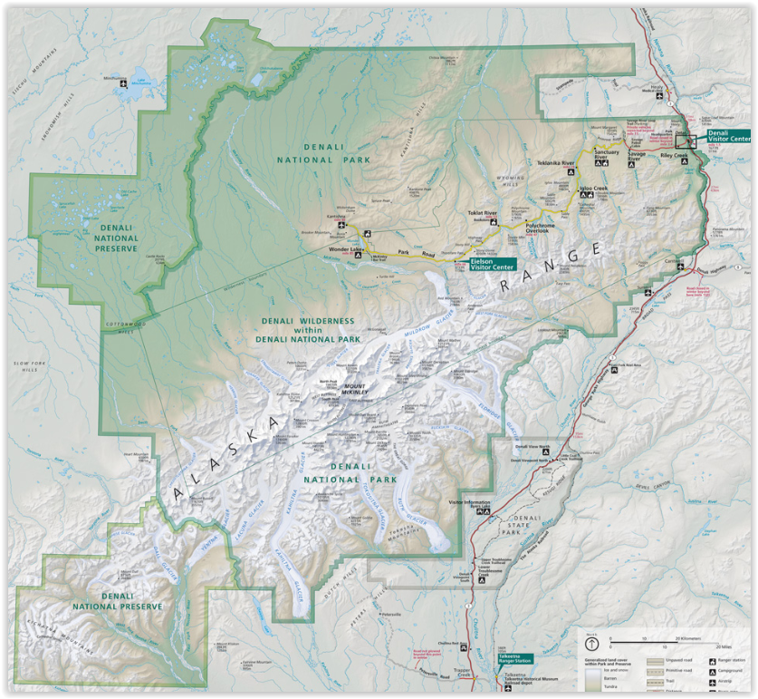
Wanderlkaart 222 Denali NP- Alaskan Range - Alaska - Natge
Met een dikke 24,464 km2 groot- die groter is dan West-Vlaanderen

Korte omschrijving
Wandelkaarten Alaska, USA van National Geographic. Ideaal voor tochten in Verenigde Staten van Amerika (USA).
TOPO Wanderlkaart 222 - Denali NP- Alaskan Range - Nat Geo Productomschrijving: Denali National Park and Preserve is een Amerikaans nationaal park, in het binnenland van Alaska. In centraal ...

Specificaties
- Uitgever: National Geographic
- ISBN-13: 9781566953283
- HOOFDCATEGORIEËN: Wandelkaart
- Activiteiten: Wandelen, Hiking & Trekking
- Auteur: National Geographic
- Regio: Alaska, USA
- Land: Verenigde Staten van Amerika (USA)
- Nationale parken: Delani NP and reserve
- TOPO's & Stafkaarten: Topografisch wandelen
- Schaal: 1:225000
- Taal: Engels
Volledige omschrijving
TOPO Wanderlkaart 222 - Denali NP- Alaskan Range - Nat Geo
Productomschrijving: Denali National Park and Preserve is een Amerikaans nationaal park, in het binnenland van Alaska. In centraal Denali, ligt de hoogste berg van noord Amerika. Compleet gezien is het park een dikke 24,464 km2 groot, die groter is dan West-Vlaanderen. Het Denali landschap is een mix van bos op zijn lager gelegen plaatsen, met de tundra in zijn midden gelegen plaatsen, en gletjers, sneeuw & rotsen op de hoger gelegen delen. De langste gletjer is ddie met naam Kahiltna Glacier. Winter activiteiten zijn dog sledding, cross-country skiing, en snowmobiling.
Engelse omschrijving: Denali National Park and Preserve covers a staggering six million acres of truly wild and pristine wilderness, bisected by a single road. The crown jewel of the park is the towering 20,320 foot Mount McKinley, North America's tallest peak. Expertly researched and created in partnership with local land management agencies, National Geographic's Trails Illustrated map of Denali National Park provides an unparalleled tool for exploring this remarkable region. Key areas of interest featured on this map include Denali State Park; Kroto, Moose Creek, and Lake Creek recreation rivers; Lake Minchumina; and the Kantishna Mining District. The print version of the map includes a detailed inset of the park entrance and headquarters.
If you wish to camp in the park, a chart of campground information that includes the distance from the entrance, number and type of spaces, facilities, access, and contact information for making your reservations will help you plan your stay. Private vehicle travel in the park is limited, but this map's coverage of the shuttle bus system will ensure you have the knowledge you need to access the entire park. Helpful information about regulations, avoiding close encounters with bears, hiking in the Kantishna Mining District, and safety tips, as well as clearly marked campgrounds, rental cabins, bush airstrips, trailheads, and more will help you enjoy all the park has to offer. The map base includes contour lines and elevations for summits, passes and many lakes. Every Trails Illustrated map is printed on "Backcountry Tough" waterproof, tear-resistant paper. A full UTM grid is printed on the map to aid with GPS navigation.
Other features found on this map include: Bear Creek, Birch Creek, Broad Pass, Browne Tower, Chelatna Lake, Chulitna River, Chunilna Creek, Dall Glacier, Denali National Park, Denali National Preserve, East Buttress, Eldridge Glacier, Foraker River, Herron River, Kahiltna Glacier, Lacuna Glacier, Lake Minchumina, McKinley River, Moose Creek, Mount Foraker, Mount Hunter, Mount Mather, Mount McKinley, Muldrow Glacier, Portage Creek, Ruth Glacier, Sheep River, South Buttress, Stephan Lake, Talkeetna River, Tokositna Glacier, Yanert Fork, Yentna Glacier.
Artikelen uit dezelfde regio
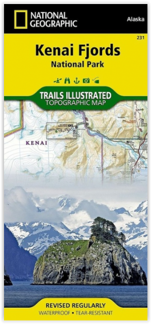
Wandelkaart 231 Kenai Fjords NP- Alaska - Nat Geo • 9781566953856
TOPO Wandelkaart 231 - Kenai Fjords NP- Alaska - Nat Geo Productomschrijving: Kenai Fjords National Park is een nationaal park in de Amerikaanse staat Alaska, gelegen op het Kenai-schiereiland. Grote delen van de Kenai Mountains worden beschermd in het park. In het park ligt het Harding Icefield, een van de grootste ijsvelden van de Verenigde Staten. Engelse omschrijving: National Geog…

Reisgids Alaska Escapade dans le Yukon - Petit Futé • 9782305078830
Alaska & Escapade dans le Yukon - Petit Futé Productomschrijving: Welkom in een van de laatste overgebleven natuurlijke paradijzen op onze prachtige planeet. Besneeuwde toppen zover het oog reikt, immense bossen, toendra's die trillen onder de hoeven van kariboes, otters die tussen de walvissen doorscharrelen aan de voet van enorme gletsjers, kale adelaars die de rivieren afspeuren - de na…

Klimgids Denali - Mt McKinley - Rucksack reades • 9781898481539
Klimgids Denali - Mt McKinley - Summit of North America Productomschrijving: Met zijn 6194 m (20,320 ft) is Denali (Mt McKinley) de hoogste berg in Noord-Amerika. De Arctische latitude zorgt voor extreme weersomstandigheden en de afgelegen wildernis van Alaska betekent dat klimteams zelfstandig en ervaren moeten zijn. De auteur richte zich op de westelijke Buttress route die wordt gebruikt…
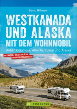
Campergids Westkanada und Alaska mit Wohnmobil - Bruckman Verlag • 9783734315039
Campergids Westkanada und Alaska - Bruckman Verlag Productomschrijving: Westkanada und Alaska mit dem Wohnmobil is een praktische campergids voor reizigers die West-Canada en Alaska op eigen tempo willen verkennen. De gids richt zich op rondreizen met de camper en combineert routeplanning met bruikbare reisinformatie. Geen zweverige “ga waar de wind je brengt”-romantiek, maar gewoon wegen,…
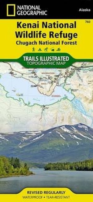
Wandelkaart 760 Kenai National Wildlife Refuge - Alaska - Nat Geo • 9781566953733
TOPO Wandelkaart 760 - Kenai National Wildlife Refuge - Alaska Productomschrijving: The Kenai National Wildlife Refuge is a 1.92-million-acre (7,770 km2) wildlife habitat preserve located on the Kenai Peninsula of Alaska, United States. It is adjacent to Kenai Fjords National Park. Engelse omschrijving: National Geographic's Trails Illustrated map of Kenai National Wildlife Refuge was …