

Wandelkaart 760 Kenai National Wildlife Refuge - Alaska - Nat Geo
Omvat eveneens het Chugach National Forest

Korte omschrijving
Wandelkaarten Alaska, USA van National Geographic. Ideaal voor tochten in Verenigde Staten van Amerika (USA).
TOPO Wandelkaart 760 - Kenai National Wildlife Refuge - Alaska Productomschrijving: The Kenai National Wildlife Refuge is a 1.92-million-acre (7,770 km2) wildlife habitat preserve located on...

Specificaties
- Uitgever: National Geographic
- ISBN-13: 9781566953733
- HOOFDCATEGORIEËN: Wandelkaart
- Auteur: National Geographic
- Regio: Alaska, USA
- Land: Verenigde Staten van Amerika (USA)
- Regionale parken: Chugach National Forest, Alaska USA, Kenai National Wildlife Refuge, Alaska USA
- TOPO's & Stafkaarten: Topografisch wandelen
- Schaal: 1:105600
- Taal: Engels
Volledige omschrijving
TOPO Wandelkaart 760 - Kenai National Wildlife Refuge - Alaska
Productomschrijving: The Kenai National Wildlife Refuge is a 1.92-million-acre (7,770 km2) wildlife habitat preserve located on the Kenai Peninsula of Alaska, United States. It is adjacent to Kenai Fjords National Park.
Engelse omschrijving: National Geographic's Trails Illustrated map of Kenai National Wildlife Refuge was created for all outdoor enthusiasts adventuring in this diverse area on the Kenai Peninsula in Alaska. Created in cooperation with U.S. Fish and Wildlife, U.S. Forest Service, National Park Service and others, this expertly researched map contains an abundance of information about the recreational opportunities available in the area. Coverage includes Kenai NWR, Wilderness and Mountains; Chugach Nation Forest, Tustumena, Kenai and Swan Lakes; Skilak Lake and Wildlife Recreation Area; Seward and Sterling Highways; Kenai, Swanson and Resurrection Rivers; Turnagain Arm; Iditarod National Historical Trail; and a number of State Recreation Areas and Sites.
Let the map guide you over land and water with mapped hiking, equestrian, Nordic ski and ATV trails, bike paths, canoe routes and a complete road network, including numbered Forest Service roads and scenic byways. Trails are labeled according to designated usage and are shown with mileage markers as is the Swanson River canoe route. Your navigation will be aided by the map's contour lines, elevations, labeled passes, peaks and summits, water features and glaciers, as well as boating hazard areas, soundings and nautical beacons. Among the recreation and adventure features pinpointed are campgrounds, trailheads, interpretive trails, anchorage points, boat ramps, dog mushing areas, wildlife viewing areas and scenic viewpoints. Background information and regulations of the area is also provided as well as QR codes for fishing and hunting licensing and current weather conditions. Every Trails Illustrated map is printed on "Backcountry Tough" waterproof, tear-resistant paper. A full UTM grid is printed on the map to aid with GPS navigation.
Other features found on this map include: Chugach National Forest, Kenai Lake, Skilak Lake, Turnagain Arm, Tustumena Lake.
Locatie op kaart
Overzichtskaarten

NAT GEO Alaska trails map
NAT GEO Alaska trails map
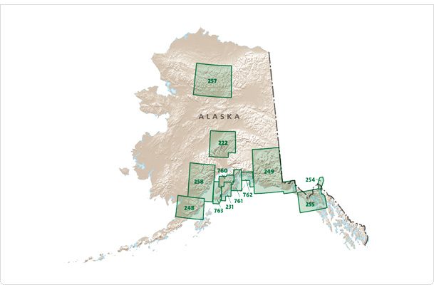
Producten op de overzichtskaart
Klik op een product om naar de detailpagina te gaan.
- Wandelkaart 248 Katmai NP- Alaska - Nat Geo
- Wandelkaart 254 Chilkoot Trail - Klondike Gold Rush - Nat Geo
- Wandelkaart 255 Glacier Bay NP- Alaska - Nat Geo
- Wandelkaart 257 Gates of the Arctic NP- Alaska - Nat Geo
- Wandelkaart 760 Kenai National Wildlife Refuge - Alaska - Nat Geo
- Wandelkaart 761 Prince William Sound West - Alaska - Nat Geo
- Wandelkaart 763 Kachemak Bay State Park - Alaska - Nat Geo
Artikelen uit dezelfde regio
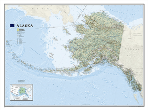
Plano Wandkaart Alaska 103 x 78 cm - Nat Geo • 9781597754118
Wandkaart Alaska 103 x 78 cm - Nat Geo Productomschrijving: One of the largest and most detailed maps available for the North Star State. Rich shaded relief makes Alaska's incredibly diverse terrain easy to visualize and remarkably beautiful. The map includes hundreds of named places including primary and secondary towns, political boundaries, infrastructure, hydrography, national park…

Wandelkaart 764 Chugach State Park- Anchorage - Natgeo • 9781566956789
TOPO Wandelkaart 764 - Chugach State Park- Anchorage - Natgeo Productomschrijving: Chugach State Park omvat een dikke 2004 M² KM, direct ten oosten van Anchorage Bowl in south-central Alaska. Engelse omschrijving: National Geographic's Trails Illustrated map of Chugach State Park and Anchorage combines unmatched detail with helpful information to offer an invaluable tool for making the…

Wandelkaart 254 Chilkoot Trail - Klondike Gold Rush - Nat Geo • 9781566954112
TOPO Wandelkaart 254 - Chilkoot Trail - Nat Geo Klondike Gold Rush - (1896–1899) Productomschrijving: Chilkoot Trail is een 53 km lange tocht door de Coast Mountains vertrekkende vanDyea, Alaska, in Amerika, tot Bennett, British Columbia, in Canada. Het omvatte al altijd een belangrijke route van de kust naar de Yukon goldfields in de late 1890s. De route werd overbodig in 1899 toen er…
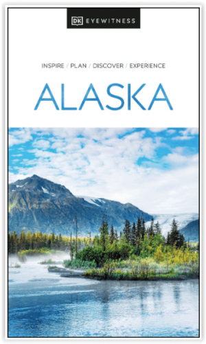
Reisgids Alaska - Eyewitness • 9780241411520
Reisgids Alaska - Eyewitness Productomschrijving: Tour the mighty Mendenhall Glacier, ride the Alaska Marine Highway or brave the cold to catch a glimpse of the mesmerising Northern Lights (Aurora Borealis): everything you need to know is clearly laid out within colour-coded chapters. Discover the best of Alaska with this indispensable travel guide. Inside DK Eyewitness Travel Guide Al…
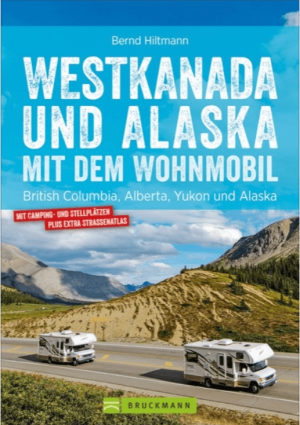
Campergids Westkanada und Alaska mit Wohnmobil - Bruckman Verlag • 9783734315039
Campergids Westkanada und Alaska - Bruckman Verlag Productomschrijving: Westkanada und Alaska mit dem Wohnmobil is een praktische campergids voor reizigers die West-Canada en Alaska op eigen tempo willen verkennen. De gids richt zich op rondreizen met de camper en combineert routeplanning met bruikbare reisinformatie. Geen zweverige “ga waar de wind je brengt”-romantiek, maar gewoon wegen,…