
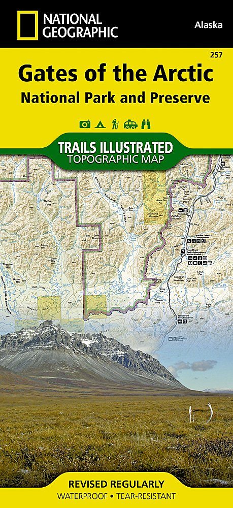
Wandelkaart 257 Gates of the Arctic NP- Alaska - Nat Geo
Een nationaal park ten noorden van de noordpoolcirkel
Korte omschrijving
TOPO Wandelkaart 257 - Gates of the Arctic NP - Alaska Productomschrijving: Het Gates of the Arctic National Park and Preserve is een nationaal park ten noorden van de noordpoolcirkel in de ...

Specificaties
- Uitgever: National Geographic
- ISBN-13: 9781566953764
- HOOFDCATEGORIEËN: Wandelkaart
- Regio: Alaska, USA
- Land: Verenigde Staten van Amerika (USA)
- Nationale parken: Gates of the Arctic NP, Alaska USA
- TOPO's & Stafkaarten: Topografisch wandelen
- Schaal: 1:400000
- Taal: Engels
Volledige omschrijving
TOPO Wandelkaart 257 - Gates of the Arctic NP - Alaska
Productomschrijving: Het Gates of the Arctic National Park and Preserve is een nationaal park ten noorden van de noordpoolcirkel in de Amerikaanse staat Alaska. Het is het meest noordelijk gelegen en op een na grootste nationale park van de Verenigde Staten. Met een oppervlakte van 34.287 km² is het park iets kleiner dan Zwitserland.
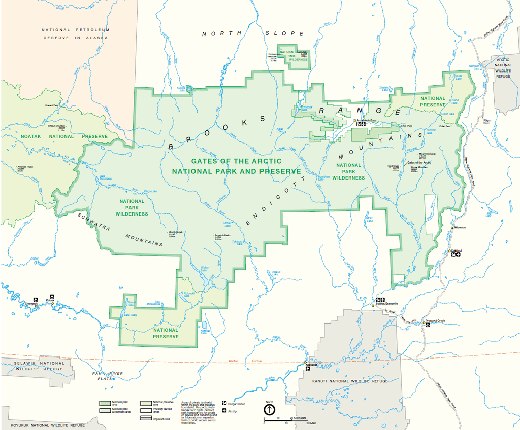
Engelse omschrijving: Let National Geographic's Trails Illustrated map for Gates of the Arctic National Park and Preserve guide you on your adventure in this remote wilderness of northern Alaska. With neither roads or trails within the park, the map's contour lines, elevations, labeled peaks and summits, water features will be essential in your navigation of the area. Coverage includes many land and water points of interest within the park, as well as in neighboring areas, including the Brooks Range; Noatak, Alatna, John, Tinayguk and Koyukuk Wild and Scenic Rivers; Schwatka and Endicott Mountains; Yukon Flats and Kanuti National Wildlife Refuge Area; Noatak National Preserve; Walker Lake; Anaktuvuk Pass; and the Continental Divide. Also pinpointed are the area's bush airstrips; Marion Creek and Galbraith Lake campgrounds; the communities of Wiseman, Coldfoot, Evansville and Bettles; and a nearly 200 mile stretch of the Dalton Highway with its roadside facilities.
The reverse side of the map features a spectacular map of Alaska, mapped with all of her national parks and preserves, along with background information about each one. Detailed information about Gates of the Arctic National Park and Preserve is provided, as are trip planning tips, backcountry activities and safety tips, minimum impact guidelines and essential contact information. This expertly researched map was created in cooperation with the National Park Service, Bureau of Land Management and others.Every Trails Illustrated map is printed on "Backcountry Tough" waterproof, tear-resistant paper. A full UTM grid is printed on the map to aid with GPS navigation.
Other features found on this map include: Alatna River, Brooks Range, Chandler Lake, Cockedhat Mountain, Easter Creek, Endicott Mountains, Fish Creek, Gates of the Arctic National Park, Gates of the Arctic National Preserve, Iniakuk Lake, Jim River, John River, Lake Selby, Mauneluk River, Middle Fork Koyukuk River, Mount Igikpak, Nigu River, Noatak National Preserve, North Fork Koyukuk River, Norutak Lake, Nutuvukti Lake, Reed River, Schwatka Mountains, South Fork Koyukuk River, Walker Lake.
Overzichtskaarten

NAT GEO Alaska trails map
NAT GEO Alaska trails map
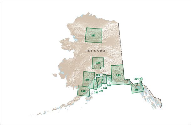
Producten op de overzichtskaart
Klik op een product om naar de detailpagina te gaan.
- Wandelkaart 231 Kenai Fjords NP- Alaska - Nat Geo
- Wandelkaart 248 Katmai NP- Alaska - Nat Geo
- Wandelkaart 254 Chilkoot Trail - Klondike Gold Rush - Nat Geo
- Wandelkaart 255 Glacier Bay NP- Alaska - Nat Geo
- Wandelkaart 257 Gates of the Arctic NP- Alaska - Nat Geo
- Wandelkaart 760 Kenai National Wildlife Refuge - Alaska - Nat Geo
- Wandelkaart 761 Prince William Sound West - Alaska - Nat Geo
- Wandelkaart 763 Kachemak Bay State Park - Alaska - Nat Geo
Artikelen uit dezelfde regio

Reisgids Alaska - Insight Guides ENG • 9781789198713
Reisgids Alaska USA - Insight Guides Productomschrijving: Van het beslissen wanneer te gaan, om te kiezen wat te zien als je aankomt, deze Insight Guides uitgave is alles wat je nodig hebt om uw reis te plannen en ervaar het beste van Alaska, met diepgaande inside-informatie over must-see, top attracties zoals Denali en verborgen culturele juweeltjes zoals Flattop Mountain. Engelse om…
Wandelkaart 760 Kenai National Wildlife Refuge - Alaska - Nat Geo • 9781566953733
TOPO Wandelkaart 760 - Kenai National Wildlife Refuge - Alaska Productomschrijving: The Kenai National Wildlife Refuge is a 1.92-million-acre (7,770 km2) wildlife habitat preserve located on the Kenai Peninsula of Alaska, United States. It is adjacent to Kenai Fjords National Park. Engelse omschrijving: National Geographic's Trails Illustrated map of Kenai National Wildlife Refuge was …

Klimgids Denali - Mt McKinley - Rucksack reades • 9781898481539
Klimgids Denali - Mt McKinley - Summit of North America Productomschrijving: Met zijn 6194 m (20,320 ft) is Denali (Mt McKinley) de hoogste berg in Noord-Amerika. De Arctische latitude zorgt voor extreme weersomstandigheden en de afgelegen wildernis van Alaska betekent dat klimteams zelfstandig en ervaren moeten zijn. De auteur richte zich op de westelijke Buttress route die wordt gebruikt…

Wandelkaart 764 Chugach State Park- Anchorage - Natgeo • 9781566956789
TOPO Wandelkaart 764 - Chugach State Park- Anchorage - Natgeo Productomschrijving: Chugach State Park omvat een dikke 2004 M² KM, direct ten oosten van Anchorage Bowl in south-central Alaska. Engelse omschrijving: National Geographic's Trails Illustrated map of Chugach State Park and Anchorage combines unmatched detail with helpful information to offer an invaluable tool for making the…
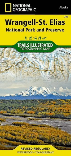
Wandelkaart 249 Wrangell St.Elias NP - Nat.Geo. • 9781566953825
Wrangell St.Elias NP - National Geographic Productomschrijving: Met 13,2 miljoen hectare, zou Wrangell-St. Elias binnen de grenzen passen van Yellowstone, Grand Canyon, Glacier, Olympic en Yosemite National Parks met zelf nog ruimte over. Het strekt zich uit van een van de hoogste toppen van Noord-Amerika > Mount Stain Elias, tot aan de oceaan. Meer dan een kwart van het park is bedekt met…