

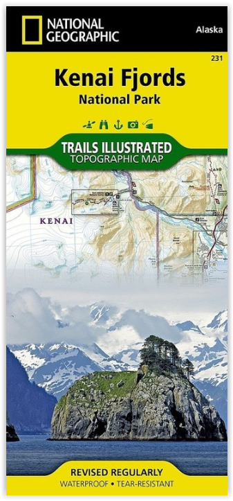
Wandelkaart 231 Kenai Fjords NP- Alaska - Nat Geo
In dit park liggen de Harding Icefields
Korte omschrijving
Wandelkaarten Alaska, USA van National Geographic. Ideaal voor tochten in Verenigde Staten van Amerika (USA).
TOPO Wandelkaart 231 - Kenai Fjords NP- Alaska - Nat Geo Productomschrijving: Kenai Fjords National Park is een nationaal park in de Amerikaanse staat Alaska, gelegen op het Kenai-schiereila...

Specificaties
- Uitgever: National Geographic
- ISBN-13: 9781566953856
- HOOFDCATEGORIEËN: Wandelkaart
- Auteur: National Geographic
- Regio: Alaska, USA
- Land: Verenigde Staten van Amerika (USA)
- Nationale parken: Kenai Fjords NP, Alaska USA
- TOPO's & Stafkaarten: Topografisch wandelen
- Schaal: 1:110000
- Taal: Engels
Volledige omschrijving
TOPO Wandelkaart 231 - Kenai Fjords NP- Alaska - Nat Geo
Productomschrijving: Kenai Fjords National Park is een nationaal park in de Amerikaanse staat Alaska, gelegen op het Kenai-schiereiland. Grote delen van de Kenai Mountains worden beschermd in het park. In het park ligt het Harding Icefield, een van de grootste ijsvelden van de Verenigde Staten.
Engelse omschrijving: National Geographic's Trails Illustrated map of Kenai Fjords National Park is an essential travel companion for outdoor enthusiasts looking to explore the pristine scenery in this area of southern Alaska. Expertly researched and created in partnership with the National Park Service, U.S. Forest Service and others, the map covers popular recreation and adventure points of interest, such as Harding Icefield, Exit Glacier, Resurrection River and Bay, as well as the adjacent Kenai National Wildlife Refuge, Kachemak Bay State Park and Wilderness Park, Chugach National Forest and Skilak Wildlife Recreation Area. Inset maps of Exit Glacier and Seward provide extra detail of these areas.
The map will guide your exploration, whether on land or on water. Hikers, bikers and ATVers will find clearly marked trails with mileage markers, in addition to contour lines, elevations, labeled peaks, glaciers and crevasses. The Iditarod National Historic Trail and Seward Highway Scenic Byway are both marked. Boaters and kayakers will benefit from the sounding information, tidal flats, boating hazard areas, island locations and pinpointed seabed formation warnings, beacons, anchorage spots and boat ramps. Other recreation points of interest include trailheads, campgrounds, public cabins, food storage lockers, ski trails, waterfalls and scenic viewpoints. The map also includes background information, QR codes for real-time weather and essential contact information.Every Trails Illustrated map is printed on "Backcountry Tough" waterproof, tear-resistant paper. A full UTM grid is printed on the map to aid with GPS navigation.
Other features found on this map include: Aialik Bay, Bear Glacier, Chernof Glacier, Chiswell Islands, Chugach National Forest, Harris Bay, Kenai Fjords National Park, Kenai Lake, Kenai Mountains, Kenai Peninsula, McCarty Glacier, Nuka Bay, Nuka Island, Pye Islands, Resurrection Bay, Skilak Glacier, Skilak Lake, Tustumena Glacier.
Locatie op kaart
Artikelen uit dezelfde regio

Wandelkaart 761 Prince William Sound West - Alaska - Nat Geo • 9781566954204
TOPO Wandelkaart 761 - Prince William Sound, West - Alaska - National Geographic Productomschrijving: De Prince William Sound is een deel van de Golf van Alaska gelegen ten zuiden van de Amerikaanse staat Alaska. De Prince William Sound heeft een kustlijn van een kleine 5000 kilometer en ligt ten oosten van het Kenai-schiereiland. In het oosten, noorden en westen wordt de Prince William So…

Wanderlkaart 222 Denali NP- Alaskan Range - Alaska - Natge • 9781566953283
TOPO Wanderlkaart 222 - Denali NP- Alaskan Range - Nat Geo Productomschrijving: Denali National Park and Preserve is een Amerikaans nationaal park, in het binnenland van Alaska. In centraal Denali, ligt de hoogste berg van noord Amerika. Compleet gezien is het park een dikke 24,464 km2 groot, die groter is dan West-Vlaanderen. Het Denali landschap is een mix van bos op zijn lager gelegen …

Landkaart Wegenkaart 3117 Alaska - Nat Geo • 9781566957052
Wegenkaart Alaska - Nat Geo Productomschrijving: Alaska is a land so vast that is boggles the imagination. It is so large that it could easily contain the next three largest states: Texas, California, and Montana and still have room left over. Despite its large size Alaska has very few inhabitants making it the state with the lowest population density. Alaska is known for its dramatic, div…

Wandelkaart 764 Chugach State Park- Anchorage - Natgeo • 9781566956789
TOPO Wandelkaart 764 - Chugach State Park- Anchorage - Natgeo Productomschrijving: Chugach State Park omvat een dikke 2004 M² KM, direct ten oosten van Anchorage Bowl in south-central Alaska. Engelse omschrijving: National Geographic's Trails Illustrated map of Chugach State Park and Anchorage combines unmatched detail with helpful information to offer an invaluable tool for making the…

Arctic, A Guide to Coastal Wildlife - Bradt travel guides • 9781804693414
Arctic, A Guide to Coastal Wildlife - Bradt Productomschrijving: This extensively updated fifth edition of Bradt's The Arctic is an engagingly written and beautifully illustrated full-colour guidebook to some of the world's most exciting wildlife. Designed with expedition-cruise passengers in mind, it is an ideal companion both on board and ashore, providing fascinating accounts of the mos…