

Klimgids Denali - Mt McKinley - Rucksack reades
Met zijn 6194 m- is Denali de hoogste berg in Amerika

Korte omschrijving
Klimgids Denali - Mt McKinley - Summit of North America Productomschrijving: Met zijn 6194 m (20,320 ft) is Denali (Mt McKinley) de hoogste berg in Noord-Amerika. De Arctische latitude zorgt...

Specificaties
- Uitgever: RUCKSACK READERS
- ISBN-13: 9781898481539
- HOOFDCATEGORIEËN: Wandelgids
- Activiteiten: Klimmen & Alpinisme, Wandelen, Hiking & Trekking
- Regio: Alaska, USA
- Land: Verenigde Staten van Amerika (USA)
- Nationale parken: Delani NP and reserve
- Schaal: 1:65000
- Editie: 1
- Taal: Engels
- Klimmen: Rotsklimmen, Summiting
Volledige omschrijving
Klimgids Denali - Mt McKinley - Summit of North America
Productomschrijving: Met zijn 6194 m (20,320 ft) is Denali (Mt McKinley) de hoogste berg in Noord-Amerika. De Arctische latitude zorgt voor extreme weersomstandigheden en de afgelegen wildernis van Alaska betekent dat klimteams zelfstandig en ervaren moeten zijn. De auteur richte zich op de westelijke Buttress route die wordt gebruikt door 80-90 procent van de klimmers.
Het boek bevat beknopt advies over voorbereiding en planning, medisch advies over hoe te voorkomen en beheren van hoogteziekte, met praktische tips over belasting en uitvoering, gletsjerreizen en camperen en een 3-panel uitklapbare kaart toont de route langs de "West Buttress". Het boek is volledig in kleur, met meer dan 60 foto's, en een waterdicht pocket formaat (105 X 145 mm) met 96 pagina's.
Locatie op kaart
Artikelen uit dezelfde regio
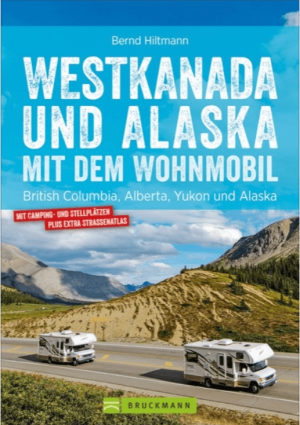
Campergids Westkanada und Alaska mit Wohnmobil - Bruckman Verlag • 9783734315039
Campergids Westkanada und Alaska - Bruckman Verlag Productomschrijving: Westkanada und Alaska mit dem Wohnmobil is een praktische campergids voor reizigers die West-Canada en Alaska op eigen tempo willen verkennen. De gids richt zich op rondreizen met de camper en combineert routeplanning met bruikbare reisinformatie. Geen zweverige “ga waar de wind je brengt”-romantiek, maar gewoon wegen,…

Wandelkaart 763 Kachemak Bay State Park - Alaska - Nat Geo • 9781566950749
Wandelkaart Kachemak Bay State Park, Homer Alaska Omvat: Anchor Point, Chugach Islands, Fox River, Gore Point, Kachemak Bay, Kalgin Island, Kenai Fjords National Park, Kennedy Entrance, Nuka Bay, Nuka Island, Point Adam, Point Pogibshi, Port Dick, Tustumena Lake. Engelse omschrijving: Outdoor enthusiasts exploring the various public recreation lands in the southwestern part of the Kena…

Wandelkaart 761 Prince William Sound West - Alaska - Nat Geo • 9781566954204
TOPO Wandelkaart 761 - Prince William Sound, West - Alaska - National Geographic Productomschrijving: De Prince William Sound is een deel van de Golf van Alaska gelegen ten zuiden van de Amerikaanse staat Alaska. De Prince William Sound heeft een kustlijn van een kleine 5000 kilometer en ligt ten oosten van het Kenai-schiereiland. In het oosten, noorden en westen wordt de Prince William So…

Wandelkaart 254 Chilkoot Trail - Klondike Gold Rush - Nat Geo • 9781566954112
TOPO Wandelkaart 254 - Chilkoot Trail - Nat Geo Klondike Gold Rush - (1896–1899) Productomschrijving: Chilkoot Trail is een 53 km lange tocht door de Coast Mountains vertrekkende vanDyea, Alaska, in Amerika, tot Bennett, British Columbia, in Canada. Het omvatte al altijd een belangrijke route van de kust naar de Yukon goldfields in de late 1890s. De route werd overbodig in 1899 toen er…
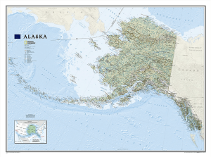
Plano Wandkaart Alaska 103 x 78 cm - Nat Geo • 9781597754118
Wandkaart Alaska 103 x 78 cm - Nat Geo Productomschrijving: One of the largest and most detailed maps available for the North Star State. Rich shaded relief makes Alaska's incredibly diverse terrain easy to visualize and remarkably beautiful. The map includes hundreds of named places including primary and secondary towns, political boundaries, infrastructure, hydrography, national park…