

Wandelkaart OL57 Cairn Gorm Aviemore & Loch Morlich - OSI
OL57 Omvat Cairngorms National Park in Schotland
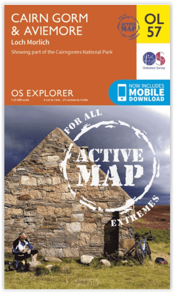
Korte omschrijving
Wandelkaarten Highlands, Schotland van Ordnance Survey. Ideaal voor tochten in Schotland.
Wandelkaart Cairn Gorm - Aviemore & Loch Morlich Schotland Productbeschrijving: Kaart nummer 57OL in de OS Explorer kaarten reeks heeft betrekking op het Cairngorms National Park in Schotlan...


Specificaties
- Uitgever: Ordnance Survey
- ISBN-13: 9780319469750
- HOOFDCATEGORIEËN: Wandelkaart
- Activiteiten: Wandelen, Hiking & Trekking
- Regio: Highlands, Schotland
- Land: Schotland
- Waterafstotende kaart: Ordnance Survey ACTIVE Explorer Weatherproof Maps
- Nationale parken: Cairngorms NP, Schotland
- TOPO's & Stafkaarten: Topografisch wandelen
- Schaal: 1:25000
- Taal: Engels
- Reeks/Serie: Explorer ACTIVE Series OSI
Volledige omschrijving
Wandelkaart Cairn Gorm - Aviemore & Loch Morlich Schotland
Productbeschrijving: Kaart nummer 57OL in de OS Explorer kaarten reeks heeft betrekking op het Cairngorms National Park in Schotland. Dit Nationaal Parkgebied rond de Cairn Gorm en Aviemore hosten vele bergtoppen om te verkennen, en prachtige landschappen in dit deel van Schotland. De Speyside way bewandelen tot Aviemore, of de vele Lochs van het Nationaal Park ontdekken.
Deze kaart vervangt de vorige OS Explorer kaart 403 voor dit gebied. De OS Explorer kaart voor Cairn Gorm & Aviemore is beschikbaar in zowel de standaard papieren versie als de weerbestendige 'Actief' versie.
Kaart nummer OL57 is een all purpose kaart vol gepakt met informatie om u het gebied te helpen leren kennen. De kaarten bestrijken het land. Elke kaart heeft een oppervlakte van 40 km door 40 km (25 mijl door 25 mijl) en zoals andere kaarten van Ordnance Survey, National Grid-vierkanten worden verstrekt zodat elke functie een unieke referentienummer kan worden gegeven.
Productdiscription: Map sheet number OL 57 in the OS Explorer series covers the Cairngorms National Park in Scotland. This area of National Park around Cairn Gorm and Aviemore hosts many mountain peaks to explore and beautiful scenery of this part of Scotland. Walk the Speyside Way from Aviemore, or discover the numerous Lochs of the National Park. This map replaces the previous OS Explorer map 403 for this area. The OS Explorer map for Cairn Gorm & Aviemore is available in both the standard paper version and weatherproof 'Active' version.
Locatie op kaart
Gekoppelde artikelen

Wandelkaart OL57 Cairn Gorm Aviemore & Loch Morlich - OSI • 9780319469750
weatherproof versieWandelkaart Cairn Gorm - Aviemore & Loch Morlich Schotland Productbeschrijving: Kaart nummer 57OL in de OS Explorer kaarten reeks heeft betrekking op het Cairngorms National Park in Schotland. Dit Nationaal Parkgebied rond de Cairn Gorm en Aviemore hosten vele bergtoppen om te verkennen, en prachtige landschappen in dit deel van Schotland. De Speyside way bewandelen tot Aviemore, of de vel…
Artikelen uit dezelfde regio
Mountainbikegids Southern & Central Schotland - Cicerone • 9781852847470
Mountainbikegids - Southern & Central Schotland - Cicerone Productomschrijving: Deze gids beschrijft 21 mountainbike fietsroutes in Midden- en Zuid-Schotland, met inbegrip van de 7 stanes in Dumfries and Galloway, en crosscountry-routes in de Campsie Fells, Pentland Hills en Lammermuirs, de Galloway Forest, Tweed Vallei, Cheviots en Lowther Hills. De routes variëren van 16,5 tot 66km inged…
Wandelkaart 450 Wick & The Flow Country- Schotland - OSI • 9780319473023
Wandelkaart Wick & The Flow Country - Highland's Schotland Omvat ook: Lybster, Latheron & Dunbeath. Productbeschrijving: OS Explorer kaart 450 behandelt Wick en Moray Firth, met inbegrip van Lybster, Latheron en Dunbeath. Wick bestaat al sinds ten minste 1266 en biedt de wereld kortste straat, Ebenezer plaats. De Flow Country is een groot gebied van moerassig, laaggelegen land; het For…
Wandelgids Great Glen Way - Cicerone • 9781786311276
Wandelgids Great Glen Way - Cicerone Press Productomschrijving: Guidebook to walking the Great Glen Way, a 124 Km long National Trail along the Caledonia Canal from Fort William to Inverness. Easily walked within a week in all seasons, the Great Glen Way is an ideal introduction to long-distance walking in Scotland. The route is described in both directions, and a separate OS 1:25K mapping…

Wandelkaart 413 Knoydart- Loch Hourn & Loch Duich - OSI • 9780319246481
Wandelkaart Knoydart- Loch Hourn & Loch Duich - Highlands 413 / Knoydart, Loch Hourn & Loch Duich, Highlands, Schotland. Explorer kaart 413 omvat de Kyle of Lochalsh tot Inverie: dit gebied van ruige kustlijnen nodigt u uit tot exploratie. Met 4 van de Munros en diverse andere belangrijke toppen, naast twee nationale natuurgebieden is het een populaire regio voor degenen die graag de S…
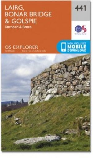
Wandelkaart 441 Lairg Bonar Bridge & Golspie - OSI • 9780319472934
Wandelkaart Lairg- Bonar Bridge & Golspie - Highland's Schotland Omvat ook: Dornoch & Brora. Productbeschrijving: Aan de Moray Firth toont OS Explorer kaart 441 de regio Brora naar Dornoch en het binnenland van Lairg bij Bonar Bridge. Verken rond Loch Fleet en Loch Brora of volg de rivier van Loch Shin naar Kyle of Sutherland. De OS Explorer kaart voor Lairg, Bonar Bridge & Golspie is …