

Wandelkaart 200 Newquay & Bodmin Cornwall - OSI
Padstow - the Eden Project - Holywell Bay & Bodmin


Korte omschrijving
Wandelkaarten Cornwall, England van Ordnance Survey. Ideaal voor tochten in England.
Wandelkaart Newquay & Bodmin Cornwall - OSI Productomschrijving: Kaart nummer 200 in de OS Landranger kaartenserie is de perfecte kaart voor het plannen van dagjes uit en rondreizen in de ge...

Specificaties
- Uitgever: Ordnance Survey
- ISBN-13: 9780319263945
- HOOFDCATEGORIEËN: Wandelkaart
- Activiteiten: Wandelen, Hiking & Trekking
- Regio: Cornwall, England
- Land: England
- UNESCO werelderfgoed: Cornwall & West Devon Mining Landscape, England
- TOPO's & Stafkaarten: Topografisch wandelen
- AONB - Area of Outstanding Beauty/National Landscape: Cornwall, AONB
- Schaal: 1:50000
- Taal: Engels
- Reeks/Serie: Landranger Series OSI
- De Engelse Graafschappen: Cornwall
Volledige omschrijving
Wandelkaart Newquay & Bodmin Cornwall - OSI
Productomschrijving: Kaart nummer 200 in de OS Landranger kaartenserie is de perfecte kaart voor het plannen van dagjes uit en rondreizen in de gebieden Newquay, Bodmin, Camelford en St Austell in Cornwall. Newquay en omgeving is beroemd om zijn surfstranden en is een geliefde vakantiebestemming.
Hoogtepunten van het gebied zijn: Padstow, het Eden Project, Holywell Bay en Bodmin.
Engelse omschrijving: Map sheet number 200 in the OS Landranger map series is the perfect map for planning days out and touring in the Newquay, Bodmin, Camelford and St Austell areas of Cornwall. Newquay and the surrounding area is famous for its surf beaches and is a well-loved holiday destination. Highlights of the area include: Padstow, The Eden Project, Holywell Bay, and Bodmin.

Locatie op kaart
Overzichtskaarten

OSI Landranger & Landranger Active - Land's End - Devon - Cornwall
OSI Landranger & Landranger Active - Land's End - Devon - Cornwall
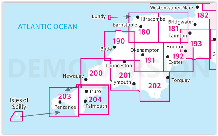
Producten op de overzichtskaart
Klik op een product om naar de detailpagina te gaan.
- Wandelkaart 180 Barnstable & Ilfracombe- Devon England - OSI
- Wandelkaart 180 Barnstaple & Ilfracombe- Devon England - OSI
- Wandelkaart 181 Minehead & Brendon Hills- England - OSI
- Wandelkaart 181 Minehead & Brendon Hills- England - OSI
- Wandelkaart 182 Weston-super-Mare & Bridgwater- England - OSI
- Wandelkaart 182 Weston-super-Mare- Somerset England - OSI
- Wandelkaart 190 Bude & Clovelly- Cornwall England - OSI
- Wandelkaart 190 Bude- Clovelly & Boscastle - OSI
- Wandelkaart 191 Okehampton & North Dartmoor NP - OSI
- Wandelkaart 191 Okehampton & North Dartmoor NP - OSI
- Wandelkaart 192 Exeter & Sidmouth- Devon - OSI
- Wandelkaart 192 Exeter- Sidmouth & Exmouth - OSI
- Wandelkaart 193 Taunton & Lyme Regis- England - OSI
- Wandelkaart 193 Taunton & Lyme Regis- Somerset - OSI
- Wandelkaart 200 Newquay- Bodmin & Camelford - OSI
- Wandelkaart 200 Newquay & Bodmin Cornwall - OSI
- Wandelkaart 201 Plymouth & Launceston England - OSI
- Wandelkaart 201 Plymouth & Launceston England - OSI
- Wandelkaart 202 Torbay - South Dartmoor NP - OSI
- Wandelkaart 202 Torbay & South Dartmoor - OSI
- Wandelkaart 204 Truro- Falmouth & Roseland - OSI
- Wandelkaart 204 Truro & Falmouth- Cornwall England - OSI
- Wandelkaart 203 Land's End & Isles of Scilly - OSI
- Wandelkaart 203 Land's End & Isles of Scilly - OSI
Artikelen uit dezelfde regio

Reisgids Time Out Devon & Cornwall - Crimson Pub. • 9781846702433
Reisgids - Time Out Devon & Cornwall - Crimson Pub. Productomschrijving: Devon en Cornwall zijn uniek, glorieus mooi en rijk aan geschiedenis en dieren in het wild. Ze bieden alles van traditionele vissersdorpen en zandstranden tot wandelingen in de wildernis en kastelen. Accommodaties variëren van campings en huisjes tot boerderijen en boetiekhotels. Of het nu gaat om gezinsvriendelijke o…

Wandelgids Part 2 SWCP Map Booklet St Ives to Plymouth - Cicerone • 9781786312785
Map Booklet Part 2 SWCP - St Ives to Plymouth - Cicerone Productomschrijving: Map of part of the southern section of the 630 mile (1014km) South West Coast Path National Trail. Covers: the trail from St Ives to Plymouth along the west Cornwall and Devon coastline. This convenient and compact booklet of Ordnance Survey 1:25,000 maps shows the route, providing all of the mapping you ne…
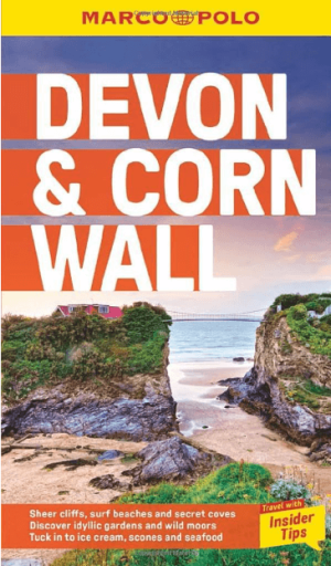
Reisgds Devon & Cornwall + map (ENG) - Marco Polo • 9781914515415
Reisgds Devon & Cornwall - Marco Polo Productomschrijving: Let Marco Polo Devon and Cornwall guide you around these beautiful English counties. Discover boutique hotels, authentic restaurants and ideas for travel with kids with this handy, pocket-sized, authoritative guide, packed with Insider Tips. Let Marco Polo show you all this beautiful region has to offer!

Landkaart Wegenkaart 7 Zuidwest Engeland & Zuid Wales - OSI • 9780319263792
Wegenkaart Zuidwest Engeland & Zuid Wales - OSI Productomschrijving: Plan your journey with this series of road maps from OS. Showing all major road, rail and ferry links as well as settlements and selected features in 1: 250 000 scale, this is the ideal map for planning trips and holidays by car or cycle. OS Road 7 covers: the south-west England plus south Wales, Devon & Cornwall. …
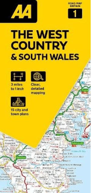
Landkaart Wegenkaart 01 West Country & Wales Zuid - AA Road Maps • 9780749584641
Wegenkaart 01 West Country & Wales Zuid - AA Road Maps Productomschrijving: AA Road Map West Country & South Wales is a practical and slimline, foldable map from the experts at the AA. Encased in a durable, weatherproof cover, the mapping is produced at a scale of 3 miles to 1 inch (1:200,000 / 2km to 1cm) combining clear design, an easy-to-read scale and more road detail to ensure that yo…