

Wandelkaart 1.4/1.5 Kitheron, Pateras & Gerania - Anavasi Ed.
The mountains of Western Attica

Korte omschrijving
Wandelkaarten Griekenland vasteland van Anavasi Editions. Ideaal voor tochten in Griekenland.
Wandelkaart Kitheron, Pateras & Gerania - Anavasi Productomschrijving: Hiking map for Kitheron, Pateras and Gerania in a scale of 1:25.000. The mountains of Western Attica, Kitheron, Pa...

Specificaties
- Uitgever: Anavasi Editions
- ISBN-13: 9789609412681
- HOOFDCATEGORIEËN: Wandelkaart
- Activiteiten: Wandelen, Hiking & Trekking
- Regio: Griekenland vasteland
- Land: Griekenland
- Schaal: 1:25000
- Taal: Engels
- De Griekse Eilanden: Centraal Griekenland
Volledige omschrijving
Wandelkaart Kitheron, Pateras & Gerania - Anavasi
Productomschrijving: Hiking map for Kitheron, Pateras and Gerania in a scale of 1:25.000.
The mountains of Western Attica, Kitheron, Pateras and Gerania are blessed places where one can still experience the nature of Attica, where resin-smelling pines, millenial olive-trees and ancient stones -either natural or man carved- coexist in timeless serenity. Here, a short distance from the capital, you will be revitalized, by the open space and the amazing vistas, by the pure simplicity of a small chapel among the pine trees, or by the harmony of ancient ruins among the olive trees and phrygana.
Every time I look at the wonderful pine forests of Mt Gerania, I wonder how they have escaped from man’s destructive hand.
Embrace, love these mountains and they will give it back generously.
Locatie op kaart
Overzichtskaarten

Anavasi wandelkaarten
Anavasi wandelkaarten

Producten op de overzichtskaart
Klik op een product om naar de detailpagina te gaan.
- Wandelkaart 1.1 Mt. Parnitha NP - Anavasi
- Wandelkaart 1.2 Noord & Zuid Imitos - Anavasi
- Wandelkaart 1.4/1.5 Kitheron, Pateras & Gerania - Anavasi Ed.
- Wandelkaart 2.1 Mt. Parnassos - Anavasi
- Wandelkaart 2.2 Mt Kalidhromo Griekenland - Anavasi
- Wandelkaart 2.4 Nafpaktos Griekenland - Anavasi
- Wandelkaart 3.03 Zagori - Valia Kalda & Metsovo - Anavasi
- Wandelkaart 3.2 - 4.2 Pindosgebergte Zuid - Anavasi
- Wandelkaart 3.3 Gramos Griekenland - Anavasi
- Wandelkaart Fietskaart 5.11 Mt Dirfis & Mt Xerovouni - Anavasi
- Wandelkaart 6.2 - Lake Prespa - Vitsi Mountains - Anavasi
- Wandelkaart 8.1 Mt. Taygetos - Peloponnesos - Anavasi
- Wandelkaart 8.10 Exo Griekenland - Anavasi
- Wandelkaart 8.4 Schiereiland Mani Griekenland - Anavasi
- Wandelkaart 8.5 Mt. Menalo Griekenland - Anavasi
- Wandelkaart 8.61 Mount Erimanthos Griekenland - Anavasi
- Wandelkaart 8.7 Mount Parnonas Griekenland - Anavasi
- Wandelkaart 8.9 Monemvasia & Maleas Griekenland - Anavasi
- Wandelkaart 9.2 Paxos & Antipaxos Griekenland - Anavasi
- Wandelkaart 9.3 Kephalonia- Ithaca Griekenland - Anavasi
- Wandelkaart 9.4 Corfu Griekenland - Anavasi
- Wandelkaart 10.00 Aigina Griekenland - Anavasi
- Wandelkaart 10.11 Skiathos - Aanavasi
- Wandelkaart 10.14 Skyros - Anavasi
- Wandelkaart 10.20 Tinos - Anavasi
- Wandelkaart 10.21 Andros - Anavasi
- Wandelkaart 10.22 Syros N. Cycladen Griekenland - Anavasi
- Wandelkaart 10.23 Paros Griekenland - Anavasi
- Wandelkaart 10.24 Santorini Griekenland - Anavasi
- Wandelkaart 10.25 Serifos Griekenland - Anavasi
- Wandelkaart 10.26 Sifnos Griekenland - Anavasi
- Wandelkaart 10.27 Amorgos Griekenland - Anavasi
- Wandelkaart 10.28 Naxos Griekenland - Anavasi
- Wandelkaart 10.32 Kalimnos Griekenland - Anavasi
- Wandelkaart 10.33 Chalki Griekenland - Anavasi
- Wandelkaart 10.38 Rhodos Griekenland - Anavasi
- Wandelkaart 10.39 - Patmos - Anavasi
- Wandelkaart 10.40 Hydra Griekenland - Anavasi
- Wandelkaart 10.41 Kea (Tzia) Cycladen Griekenland - Anavasi
- Wandelkaart 10.42 Delos Mykonos & Rheneia - Anavasi
- Wandelkaart 10.44 Kythnos Griekenland - Anavasi
- Wandelkaart 10.45 Milos- Kimolos & Polyvos Griekenland- Anavasi
- Wandelkaart 10.46 Folegandros Griekenland - Anavasi
- Wandelkaart 10.47 Anafi Griekenland - Anavasi
- Wandelkaart 10.49 Astypalaia Griekenland - Anavasi
- Wandelkaart 10.51 Ikaria Noord Egeïsche eilanden - Anavasi
- Wandelkaart 11.11-12 Lefka Ori Sfakia - Pahnes - Anavasi
- Wandelkaart 11.13 Samaria & Sougia Griekenland - Anavasi
- Wandelkaart 11.14 Psiloritis (Mt Ida) Kreta - Anavasi
- Wandelkaart 11.15 Mt Dikti & Mt Selena Kreta - Anavasi
- Wandelkaart 11.16 Zakros-Vai Sitia Kreta - Anavasi
- Wandelkaart 11.17 Fragokastello & Plakias- Kreta - Anavasi
- Wandelkaart 11.18 Asterousia & Phaistos - Anavasi
Artikelen uit dezelfde regio

Landkaart Wegenkaart 412 Halkidiki - Terrein Maps • 9786185160005
Wegenkaart Halkidiki - Terrein Maps Productomschrijving: The touring map of the Halkidiki Peninsula provides travelers with everything they need: Scale of 1:125.000, which attributes all the information with clarity and impressive detail. Clear symbols, readable fonts and excellent map composition make the map extremely user friendly. Unique wealth of information. The complete road ne…
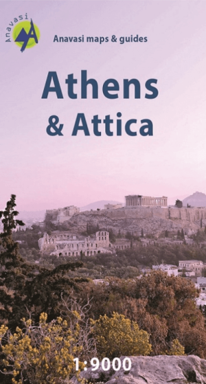
Stadskaart Plattegrond Athene - Anavasi Ed. • 9789609412322
Stadskaart Athene - Anavasi Productomschrijving: Central Athens on a handy size street plan, ideal for your city explorations! The map includes the entire center of Athens from Areos park to the Acropolis and the Panathinaikos Stadium, Keramikos and Megaron concert hall. There is the entire road network, Metro and Tram stations as well as the important monuments and archeological site…

Landkaart Wegenkaart Touring Map 3 Epirus - Terrein Maps • 9789609456241
Wegenkaart Touring Map Epirus - Terrein Maps Productomschrijving: Detailed and updated map of Epirus including a large part of western Macedonia, as well as the islands of Corfu, Paxi, Antipaxi, Erikoussa, Mathraki and Othoni. It uses G.I.S. (Geographical Information Systems) technology and the WGS84 reference system, supplemented by a GS87 grid. Like all of TERRAIN’s large maps, the …

Landkaart Wegenkaart Touring map 1 Thrace - Terrein Maps • 9789609456265
Wegenkaart Touring maps Thrace centr. Griekenland Productomschrijving: Detailed and updated map of Thrace including eastern Macedonia, as well as the islands of Samothrace and Thasos. It uses G.I.S. (Geographical Information Systems) technology and the WGS84 reference system, supplemented by a GS87 grid. Like all of TERRAIN’s large maps, the map of Thrace is printed on Polyart, which is e…
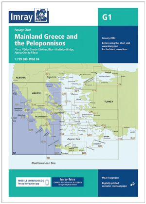
Passagekaart G1 Griekenland vaste land en de Peloponnesos - Imray • 9781786795427
Passage kaart Griekenland vaste land en de Peloponnesos - Imray Productomschrijving: Overzeiler voor het gehele Griekse vaste land en de Peloponnisos. Van de grens met Albanië in het noord-oosten rond het vaste land, Corfú, langs de straat van Korinthe, Athene, en tot aan de berg Olympus in het noorden. Inclusief een detailkaart van Ormos Falirou (schaal: 1 : 729.000) en de westpunt van Kr…