

Wandelkaart 8.1 Mt. Taygetos - Peloponnesos - Anavasi
Een 70 km prachtig massief aan de zuidpunt van Griekenland

Korte omschrijving
Wandelgidsen Peloponnessos van Anavasi Editions. Ideaal voor tochten in Griekenland.
Wandelgids & wandelkaart Taygetos - Anavasi Editions Productomschrijving: Deze is niet zomaar een wandelkaart, dit is een wandelgids met een kaart op schaal 1:25 000 Taygetos strekt zich...

Specificaties
- Uitgever: Anavasi Editions
- ISBN-13: 9789609412865
- HOOFDCATEGORIEËN: Wandelgids, Wandelkaart
- Activiteiten: Wandelen, Hiking & Trekking
- Regio: Peloponnessos
- Land: Griekenland
- Schaal: 1:25000
- Taal: Engels
- De Griekse Eilanden: Peloponnesos (Schiereiland)
Volledige omschrijving
Wandelgids & wandelkaart Taygetos - Anavasi Editions
Productomschrijving: Deze is niet zomaar een wandelkaart, dit is een wandelgids met een kaart op schaal 1:25 000
Taygetos strekt zich uit als een 70 km prachtig massief dat de zuidpunt van Griekenland verankert. Uit een dicht netwerk van uitdagende paden selecteerden we routes die sinds de oudheid favoriet waren bij aanhangers van hemelgoden of hun opvolger, de profeet Elia. Paden gehuld in prachtige natuur. Paden die gebruik maken van gunstige plooien in het terrein, of de ruige kloven volgen die tot voor kort de enige toegangspoort tot de berg waren. Elke route heeft zijn topokaart en hoogteprofiel, plus duur, afstand, moeilijkheidsgraad, vegetatie, bezienswaardigheden en links naar andere routes. Foto's en een routebeschrijving verrijken het beeld
Engelse omschrijving: This is not just a hiking map, this is a hiking guide AND 1: 25 000 map.
Taygetos extends as 70 km of magnificent massif anchoring the southern tip of Greece. From a dense network of challenging trails, we selected routes favored since antiquity by devotees of sky-gods or their successor, the Prophet Elijah. Paths wrapped in glorious nature. Trails that exploit favourable folds in the terrain, or follow the rugged gorges that were until recently the only gateway to the mountain. Each route has its topo map and altitude profile, plus duration, distance, degree of difficulty, vegetation, sights, and links to other trails. Photographs and a route description enrich the picture.
Find out how the ancient Spartans carved out wagon roads to conquer Greece’s most dramatic mountain 2500 years ago, by Professor Yanis Pikoulas. In the new hiking guide with a map 1:25 000 of Taygetos,18 routes are described, divided into areas: Laconian, Messinian, Center and North side of Taygetos, as well as ancient routes crossing the mountain in Antiquity.
Among the 18 routes there are all levels of difficulty: GREEN = EASY | BLUE = INTERMEDITATE | RED = DEMANDING | BLACK = VERY DIFFICULT. The difficulty depends on elevation range, length and type of terrain
See the routes here:
1. Manganari - Refuge - summit Profitis Ilias 2407m 2. Refuge - summit Profitis Ilias 2407m – Agios Dimitrios – Pentavli - Refuge 3. Refuge – peak Chalasmeno 2204m 4. Pikoulianika – peak Koufovouni 1850m 5. Anavryti – Refuge 6. Parori - Faneromeni monastery - Metamorfosi Sotiros - Parori 7. Mystras - Taygeti 8. Mystras - Castle North Gate - Mystras ?AYGETOS (Messenian side) 9. Agios Dimitrios - Mousgia - peak Chalasmeno 2204m 10. Vyros Gorge (Agios Dimitrios - Exochori) 11. Ridomo Gorge (Voreio to Pigadia Stone bridge) 12. Velanidia monastery - Lagou hannCrossing of Mount Taygetos crestline 3. Pentadaktylos NORTH AYGETOS(with the help of EOS SPARTIS and Nikos Laganas) 14. Longastra - Trypi - Pikoulianika - Mystras 15. Marble-bridge – Bridge – Kastori springs - Vrysiotiko - Perivolia springs - Agios Loukas - Ring road of Kastori - Agios Mamas springs 16. Myli Gorge (Georgitsi - Kastori) 17. Georgitsi - Agios Panteleimon 18. Kastorio - Xerovouna (of 2 sections of it) 18a. Latta - Lousina / 18ß. Lousina - Xerovouna
Locatie op kaart
Overzichtskaarten

Anavasi wandelkaarten
Anavasi wandelkaarten

Producten op de overzichtskaart
Klik op een product om naar de detailpagina te gaan.
- Wandelkaart 1.1 Mt. Parnitha NP - Anavasi
- Wandelkaart 1.2 Noord & Zuid Imitos - Anavasi
- Wandelkaart 1.4/1.5 Kitheron, Pateras & Gerania - Anavasi Ed.
- Wandelkaart 2.1 Mt. Parnassos - Anavasi
- Wandelkaart 2.2 Mt Kalidhromo Griekenland - Anavasi
- Wandelkaart 2.4 Nafpaktos Griekenland - Anavasi
- Wandelkaart 3.03 Zagori - Valia Kalda & Metsovo - Anavasi
- Wandelkaart 3.2 - 4.2 Pindosgebergte Zuid - Anavasi
- Wandelkaart 3.3 Gramos Griekenland - Anavasi
- Wandelkaart Fietskaart 5.11 Mt Dirfis & Mt Xerovouni - Anavasi
- Wandelkaart 6.2 - Lake Prespa - Vitsi Mountains - Anavasi
- Wandelkaart 8.1 Mt. Taygetos - Peloponnesos - Anavasi
- Wandelkaart 8.10 Exo Griekenland - Anavasi
- Wandelkaart 8.4 Schiereiland Mani Griekenland - Anavasi
- Wandelkaart 8.5 Mt. Menalo Griekenland - Anavasi
- Wandelkaart 8.61 Mount Erimanthos Griekenland - Anavasi
- Wandelkaart 8.7 Mount Parnonas Griekenland - Anavasi
- Wandelkaart 8.9 Monemvasia & Maleas Griekenland - Anavasi
- Wandelkaart 9.2 Paxos & Antipaxos Griekenland - Anavasi
- Wandelkaart 9.3 Kephalonia- Ithaca Griekenland - Anavasi
- Wandelkaart 9.4 Corfu Griekenland - Anavasi
- Wandelkaart 10.00 Aigina Griekenland - Anavasi
- Wandelkaart 10.11 Skiathos - Aanavasi
- Wandelkaart 10.14 Skyros - Anavasi
- Wandelkaart 10.20 Tinos - Anavasi
- Wandelkaart 10.21 Andros - Anavasi
- Wandelkaart 10.22 Syros N. Cycladen Griekenland - Anavasi
- Wandelkaart 10.23 Paros Griekenland - Anavasi
- Wandelkaart 10.24 Santorini Griekenland - Anavasi
- Wandelkaart 10.25 Serifos Griekenland - Anavasi
- Wandelkaart 10.26 Sifnos Griekenland - Anavasi
- Wandelkaart 10.27 Amorgos Griekenland - Anavasi
- Wandelkaart 10.28 Naxos Griekenland - Anavasi
- Wandelkaart 10.32 Kalimnos Griekenland - Anavasi
- Wandelkaart 10.33 Chalki Griekenland - Anavasi
- Wandelkaart 10.38 Rhodos Griekenland - Anavasi
- Wandelkaart 10.39 - Patmos - Anavasi
- Wandelkaart 10.40 Hydra Griekenland - Anavasi
- Wandelkaart 10.41 Kea (Tzia) Cycladen Griekenland - Anavasi
- Wandelkaart 10.42 Delos Mykonos & Rheneia - Anavasi
- Wandelkaart 10.44 Kythnos Griekenland - Anavasi
- Wandelkaart 10.45 Milos- Kimolos & Polyvos Griekenland- Anavasi
- Wandelkaart 10.46 Folegandros Griekenland - Anavasi
- Wandelkaart 10.47 Anafi Griekenland - Anavasi
- Wandelkaart 10.49 Astypalaia Griekenland - Anavasi
- Wandelkaart 10.51 Ikaria Noord Egeïsche eilanden - Anavasi
- Wandelkaart 11.11-12 Lefka Ori Sfakia - Pahnes - Anavasi
- Wandelkaart 11.13 Samaria & Sougia Griekenland - Anavasi
- Wandelkaart 11.14 Psiloritis (Mt Ida) Kreta - Anavasi
- Wandelkaart 11.15 Mt Dikti & Mt Selena Kreta - Anavasi
- Wandelkaart 11.16 Zakros-Vai Sitia Kreta - Anavasi
- Wandelkaart 11.17 Fragokastello & Plakias- Kreta - Anavasi
- Wandelkaart 11.18 Asterousia & Phaistos - Anavasi
Artikelen uit dezelfde regio
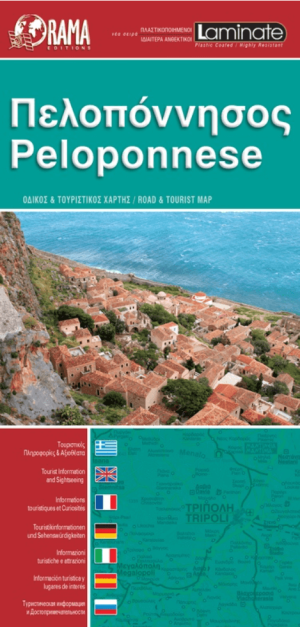
Landkaart Wegenkaart 092 Peloponnesos gepl. - Orama Editions • 9789604487189
Wegenkaart Peloponnesos geplastificeerd - Orama Productomschrijving: Gedetaillieerde & geplastificeerde versie van de wegenkaart van de regio Peloponnesos (Schiereiland). De kaart omvat hotels en campings, met toeristische symbolen die allerhande historische plaatsen, kloosters, museas aangeven. De kaart is meertalig, met belangrijke steden met hun centrum kaart en register, en degelijk kl…

Reisgids Simpelweg Athene en de Peloponnesos - Lannoo • 9789020931846
Simpelweg Athene en de Peloponnesos - Lannoo Productomschrijving: De meest praktische reisgids ter wereld. Nooit eerder was reizen zo eenvoudig De Simpelweg-gidsen onderscheiden zich in helderheid en eenvoud. Super praktisch in gebruik en snel te raadplegen. Geen overbodige details, de Simpelweg-gidsen gaan meteen naar de essentie: wat moet je zien, wat moet je doen, waar vind je de b…
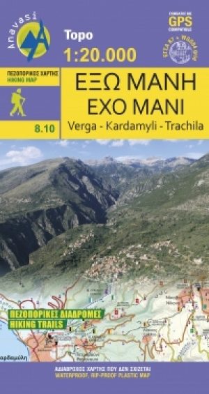
Wandelkaart 8.10 Exo Griekenland - Anavasi • 9789609412438
Wandelkaart 8.10 - Exo Griekenland - Anavasi Productomschrijving: Het schiereiland Mani is het middelste van de drie schiereilanden vanuit de Peloponnesos die uitsteken in de Middellandse Zee. Ten oosten van Mani ligt de Laconische Golf, ten westen ligt de Golf van Messina. De zuidelijkste punt van Mani is Kaap Ténaro. De gebieden zijn uitstekend gelegen voor kustwandelingen, en fietsaange…

Wandelgids Peloponnes Griekenland 45T - Rother • 9783763314218
Wandelgids Peloponnes - Rother Productomschrijving: Der Peloponnes ist vielleicht das Beste, was Griechenland landschaftlich und kulturhistorisch zu bieten hat. Auf der Halbinsel finden sich raue, unbewohnte Gebirge, fruchtbare Hochtäler, eine Küstenregion mit bizarren Felsküsten und herrlichen Sandstränden sowie unzählige antike Stätten. Der Rother Wanderführer »Peloponnes« stellt 45 der…
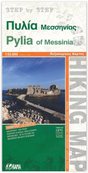
Wandelkaart 010 Pylea Messinia Peloponnesos - Orama • 9789604486854
Wandelkaart Pylea Messinia Peloponnesos - Orama Productomschrijving: Deze kaart omvat een historische streek in het zuidwesten van de Griekse Peloponnesos. Het was ook een departement met als hoofdstad Kalamata. De landstreek werd in de Griekse oudheid door de Spartanen veroverd. Nu is het een mekaa voor wandelaars.