

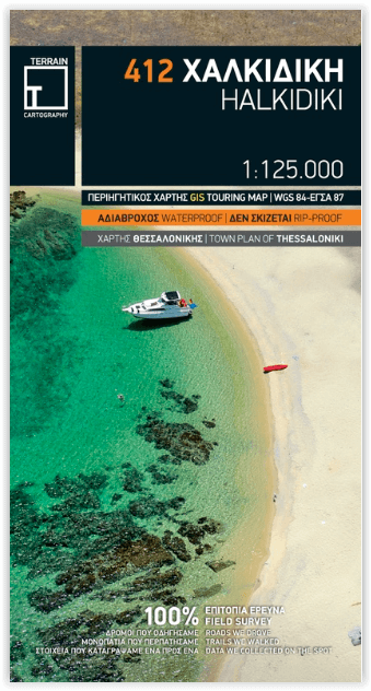
Landkaart Wegenkaart 412 Halkidiki - Terrein Maps
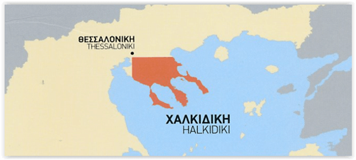
Een schiereiland in Noordoost-Griekenland

Korte omschrijving
Wegenkaart Halkidiki - Terrein Maps Productomschrijving: The touring map of the Halkidiki Peninsula provides travelers with everything they need: Scale of 1:125.000, which attributes al...

Specificaties
- Uitgever: Terrain Editions
- ISBN-13: 9786185160005
- HOOFDCATEGORIEËN: Wegenkaart - Landkaart
- Activiteiten: Street/Road maps & city plans
- Regio: Griekenland vasteland
- Land: Griekenland
- Schaal: 1:125000
- Taal: Engels
Volledige omschrijving
Wegenkaart Halkidiki - Terrein Maps
Productomschrijving: The touring map of the Halkidiki Peninsula provides travelers with everything they need:
Scale of 1:125.000, which attributes all the information with clarity and impressive detail. Clear symbols, readable fonts and excellent map composition make the map extremely user friendly. Unique wealth of information. The complete road network with driving distances, all villages, monasteries and archaeological sites, all beaches, campsites, mountain refuges and much more. Scenic routes are prominently highlighted. A large, clear street plan of central Thessaloniki covers the reverse side, marking places of interest including selected hotels, museums, churches and much else.
A full index of place names, archaeological sites and monasteries is included.
Printed on waterproof and rip-proof polyart paper.
Locatie op kaart
Artikelen uit dezelfde regio

Landkaart Wegenkaart R1 Cyclades & Argosaronic - Anavasi Ed. • 9789609412599
Wegenkaart Cyclades & Argosaronic - Anavasi Ed. Productomschrijving: Cyclades & Argosaronic Islands R1, is a new map covering the areas of Attica with the Argosaronic islands of Salamina, Aegina, Ydra and Poros and all the Cyclades islands, printed on 2 sides with overlap. A very useful map, especially for island-hoppers, with short text for each island presenting the main monuments, o…
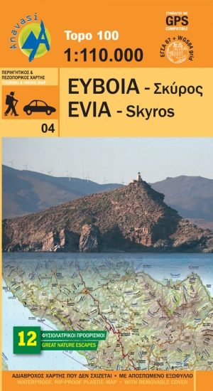
Wandelkaart 04 Evia & Skyros - Anavasi • 9789609412261
Wandelkaart 04 - Evia & Skyros - Griekenland - Anavasi Productomschrijving: Skyros is een Grieks eiland. Het eiland heeft een oppervlakte van 209 km² en is daarmee het grootste eiland van de Noordelijke Sporaden. Wandelen en fietsen op dit eiland is gekend onder de toeristen, alsook de grieken zelf. Skyros bevindt zich op zo'n 35 km van Euboea en is omringd door een dertigtal kleine tot ze…
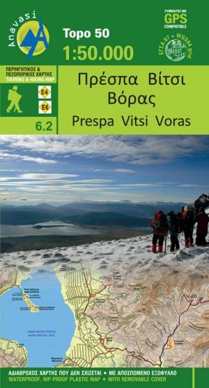
Wandelkaart 6.2 - Lake Prespa - Vitsi Mountains - Anavasi • 9789609412278
Topografische Wandelkaart Lake Prespa - Vitsi Mountains Productomschrijving: Prespa is de naam van twee zoetwatermeren in Zuidoost-Europa, gedeeld door Albanië, Griekenland, en de Republiek Macedonië. Het gebied bevat drie nationale parken, die liggen in Albanië, Griekenland en de Republiek Macedonië. De grootste stad in de regio Prespa Meren is Resen in de Republiek Macedonië. In 2014, we…

Wandelkaart 3.2 - 4.2 Pindosgebergte Zuid - Anavasi • 9789609412186
Topografische Wandelkaart 3.2 - 4.2 - Pindosgebergte Zuid Omvat: Peristeri - Kakarditsa - Tzoumerka - Pindos Epirus Productomschrijving: Zuid-Pindos behandelt het westen en het zuidelijke deel van de prefectuur. In het westen, op de grenzen met Ioannina prefectuur zijn de hoogste toppen Aspra Litharia (1823m) en Katara (1705m). In het Zuiden zijn er de Lakmos bergen (2295 m), Tzoumerk…

Landkaart Wegenkaart Touring Map 3 Epirus - Terrein Maps • 9789609456241
Wegenkaart Touring Map Epirus - Terrein Maps Productomschrijving: Detailed and updated map of Epirus including a large part of western Macedonia, as well as the islands of Corfu, Paxi, Antipaxi, Erikoussa, Mathraki and Othoni. It uses G.I.S. (Geographical Information Systems) technology and the WGS84 reference system, supplemented by a GS87 grid. Like all of TERRAIN’s large maps, the …