

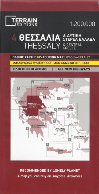
Landkaart Wegenkaart Touring Map 4 Thessaly - Terrein Maps
Touring map of Thessaly

Korte omschrijving
Wegenkaart Touring Map Thessaly - Terrein Maps Productomschrijving: This is the best touring map of Thessaly available, in every respect. Here’s what makes it so special: Excellent map comp...

Specificaties
- Uitgever: Terrain Editions
- ISBN-13: 9789609456234
- HOOFDCATEGORIEËN: Stadskaart plattegrond
- Activiteiten: Street/Road maps & city plans
- Regio: Griekenland vasteland
- Land: Griekenland
- Schaal: 1:200000
- Taal: Engels
- De Griekse Eilanden: Centraal Griekenland
Volledige omschrijving
Wegenkaart Touring Map Thessaly - Terrein Maps
Productomschrijving: This is the best touring map of Thessaly available, in every respect. Here’s what makes it so special: Excellent map composition and spatial distribution.TERRAIN’s map of Thessaly is the map with the most ‘practiced’ composition, and the final result is impressive: all roads, villages and sights that a 1:200.00 scale can ‘tolerate’ are so meticulously placed on the map that using it is a piece of cake!
G.I.S. mapping technology in two geodetic reference systems (GS 87 and WGS 84.)
Also included is a complete alphabetical index of all towns and villages, monasteries and archaeological sites.
Locatie op kaart
Overzichtskaarten

Landkaart Wegenkaarten Regionaal griekenland 1 > 9 - 1:200.000
Landkaart Wegenkaarten Regionaal griekenland 1 > 9 - 1:200.000

Producten op de overzichtskaart
Klik op een product om naar de detailpagina te gaan.
- Landkaart Wegenkaart Touring map 1 Thrace - Terrein Maps
- Landkaart Wegenkaart Touring Map 2 Macedonië - Terrein Maps
- Landkaart Wegenkaart Touring Map 3 Epirus - Terrein Maps
- Landkaart Wegenkaart Touring Map 4 Thessaly - Terrein Maps
- Landkaart Wegenkaart Touring Map 5 Griekenland C. - Terrein Maps
- Landkaart Wegenkaart Touring Map 6 Peloponnesos - Terrein Maps
- Landkaart Wegenkaart Touring Map 7 Kreta - Terrein Maps
- Landkaart Wegenkaart Touring Map 8 Cycladen - Terrein Maps
- Landkaart Wegenkaart Touring Map 9 Dodecanese - Terrein Maps
Artikelen uit dezelfde regio
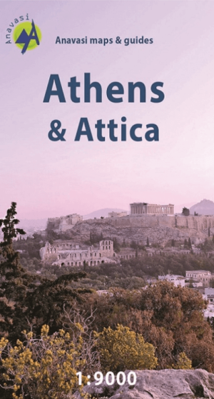
Stadskaart Plattegrond Athene - Anavasi Ed. • 9789609412322
Stadskaart Athene - Anavasi Productomschrijving: Central Athens on a handy size street plan, ideal for your city explorations! The map includes the entire center of Athens from Areos park to the Acropolis and the Panathinaikos Stadium, Keramikos and Megaron concert hall. There is the entire road network, Metro and Tram stations as well as the important monuments and archeological site…

Landkaart Wegenkaart Touring Map 3 Epirus - Terrein Maps • 9789609456241
Wegenkaart Touring Map Epirus - Terrein Maps Productomschrijving: Detailed and updated map of Epirus including a large part of western Macedonia, as well as the islands of Corfu, Paxi, Antipaxi, Erikoussa, Mathraki and Othoni. It uses G.I.S. (Geographical Information Systems) technology and the WGS84 reference system, supplemented by a GS87 grid. Like all of TERRAIN’s large maps, the …
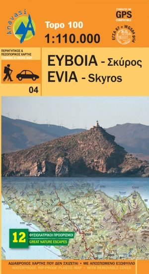
Wandelkaart 04 Evia & Skyros - Anavasi • 9789609412261
Wandelkaart 04 - Evia & Skyros - Griekenland - Anavasi Productomschrijving: Skyros is een Grieks eiland. Het eiland heeft een oppervlakte van 209 km² en is daarmee het grootste eiland van de Noordelijke Sporaden. Wandelen en fietsen op dit eiland is gekend onder de toeristen, alsook de grieken zelf. Skyros bevindt zich op zo'n 35 km van Euboea en is omringd door een dertigtal kleine tot ze…

Wandelkaart 3.2 - 4.2 Pindosgebergte Zuid - Anavasi • 9789609412186
Topografische Wandelkaart 3.2 - 4.2 - Pindosgebergte Zuid Omvat: Peristeri - Kakarditsa - Tzoumerka - Pindos Epirus Productomschrijving: Zuid-Pindos behandelt het westen en het zuidelijke deel van de prefectuur. In het westen, op de grenzen met Ioannina prefectuur zijn de hoogste toppen Aspra Litharia (1823m) en Katara (1705m). In het Zuiden zijn er de Lakmos bergen (2295 m), Tzoumerk…
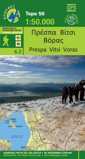
Wandelkaart 6.2 - Lake Prespa - Vitsi Mountains - Anavasi • 9789609412278
Topografische Wandelkaart Lake Prespa - Vitsi Mountains Productomschrijving: Prespa is de naam van twee zoetwatermeren in Zuidoost-Europa, gedeeld door Albanië, Griekenland, en de Republiek Macedonië. Het gebied bevat drie nationale parken, die liggen in Albanië, Griekenland en de Republiek Macedonië. De grootste stad in de regio Prespa Meren is Resen in de Republiek Macedonië. In 2014, we…