

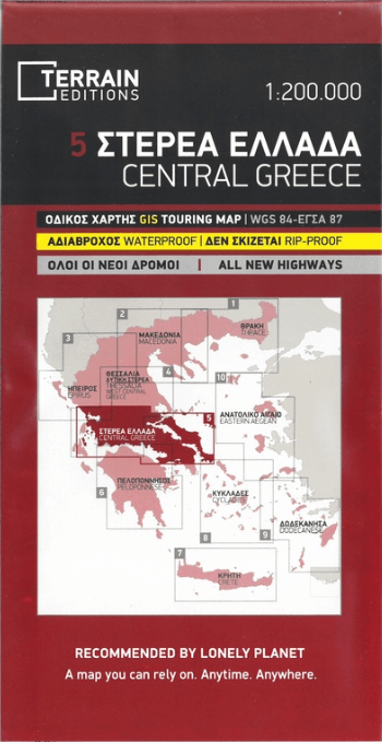
Landkaart Wegenkaart Touring Map 5 Griekenland C. - Terrein Maps
Centraal Griekenland

Korte omschrijving
Wegenkaart Touring Map Griekenland Centraal - Terrein Maps Productomschrijving: This is the best touring map of Central Greece available, in every respect. Here’s what makes it so special: ...

Specificaties
- Uitgever: Terrain Editions
- ISBN-13: 9789609456272
- HOOFDCATEGORIEËN: Stadskaart plattegrond
- Activiteiten: Street/Road maps & city plans
- Regio: Griekenland vasteland
- Land: Griekenland
- Schaal: 1:200000
- Taal: Engels
- De Griekse Eilanden: Centraal Griekenland
Volledige omschrijving
Wegenkaart Touring Map Griekenland Centraal - Terrein Maps
Productomschrijving: This is the best touring map of Central Greece available, in every respect. Here’s what makes it so special: Excellent map composition and spatial distribution.TERRAIN’s map of Central Greece is the map with the most ‘practiced’ composition, and the final result is impressive: all roads, villages and sights that a 1:200.00 scale can ‘tolerate’ are so meticulously placed on the map that using it is a piece of cake!
G.I.S. mapping technology in two geodetic reference systems (GS 87 and WGS 84.)
Also included is a complete alphabetical index of all towns and villages, monasteries and archaeological sites.
Locatie op kaart
Overzichtskaarten

Landkaart Wegenkaarten Regionaal griekenland 1 > 9 - 1:200.000
Landkaart Wegenkaarten Regionaal griekenland 1 > 9 - 1:200.000

Producten op de overzichtskaart
Klik op een product om naar de detailpagina te gaan.
- Landkaart Wegenkaart Touring map 1 Thrace - Terrein Maps
- Landkaart Wegenkaart Touring Map 2 Macedonië - Terrein Maps
- Landkaart Wegenkaart Touring Map 3 Epirus - Terrein Maps
- Landkaart Wegenkaart Touring Map 4 Thessaly - Terrein Maps
- Landkaart Wegenkaart Touring Map 5 Griekenland C. - Terrein Maps
- Landkaart Wegenkaart Touring Map 6 Peloponnesos - Terrein Maps
- Landkaart Wegenkaart Touring Map 7 Kreta - Terrein Maps
- Landkaart Wegenkaart Touring Map 8 Cycladen - Terrein Maps
- Landkaart Wegenkaart Touring Map 9 Dodecanese - Terrein Maps
Artikelen uit dezelfde regio

Landkaart Wegenkaart Touring Map 3 Epirus - Terrein Maps • 9789609456241
Wegenkaart Touring Map Epirus - Terrein Maps Productomschrijving: Detailed and updated map of Epirus including a large part of western Macedonia, as well as the islands of Corfu, Paxi, Antipaxi, Erikoussa, Mathraki and Othoni. It uses G.I.S. (Geographical Information Systems) technology and the WGS84 reference system, supplemented by a GS87 grid. Like all of TERRAIN’s large maps, the …

Landkaart Wegenkaart Touring Map 4 Thessaly - Terrein Maps • 9789609456234
Wegenkaart Touring Map Thessaly - Terrein Maps Productomschrijving: This is the best touring map of Thessaly available, in every respect. Here’s what makes it so special: Excellent map composition and spatial distribution.TERRAIN’s map of Thessaly is the map with the most ‘practiced’ composition, and the final result is impressive: all roads, villages and sights that a 1:200.00 scale can …

Landkaart Wegenkaart 412 Halkidiki - Terrein Maps • 9786185160005
Wegenkaart Halkidiki - Terrein Maps Productomschrijving: The touring map of the Halkidiki Peninsula provides travelers with everything they need: Scale of 1:125.000, which attributes all the information with clarity and impressive detail. Clear symbols, readable fonts and excellent map composition make the map extremely user friendly. Unique wealth of information. The complete road ne…

Landkaart Wegenkaart R1 Cyclades & Argosaronic - Anavasi Ed. • 9789609412599
Wegenkaart Cyclades & Argosaronic - Anavasi Ed. Productomschrijving: Cyclades & Argosaronic Islands R1, is a new map covering the areas of Attica with the Argosaronic islands of Salamina, Aegina, Ydra and Poros and all the Cyclades islands, printed on 2 sides with overlap. A very useful map, especially for island-hoppers, with short text for each island presenting the main monuments, o…

Wandelkaart 2.2 Mt Kalidhromo Griekenland - Anavasi • 9789608195134
Topografische Wandelkaart 2.2 - Mt Kalidhromo Griekenland Productomschrijving: Kallidromo is een berg in Zuidoost Fthiotis en noordoostelijke Phocis, in Centraal-Griekenland. De maximale hoogte ligt op 1,399 m. De Kallidromo ligt ten zuiden van de Golf van Mali, ten oosten van Mount Oeta en ten noorden van de Cephisus-vallei. De strategische locatie van Thermopylae ligt ten noorden van de …