

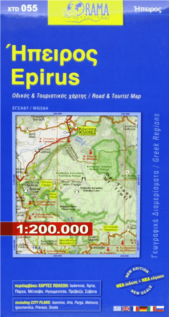
Landkaart Wegenkaart 055 Epirus - Orama Editions
Epirus, vasteland Griekenland
Korte omschrijving
Wegenkaart Epirus - Orama Editions Productomschrijving: Gedetaillieerde wegenkaart van de regio van Epirus, vasteland Griekenland. De kaart omvat hotels en campings, met toeristische symbole...

Specificaties
- Uitgever: Orama Editions
- ISBN-13: 9789609159364
- HOOFDCATEGORIEËN: Wegenkaart - Landkaart
- Activiteiten: Street/Road maps & city plans
- Regio: Griekenland vasteland
- Land: Griekenland
- Schaal: 1:200000
- Editie: 16
- Taal: Engels
- Reeks/Serie: Orama regionale wegenkaarten Griekenland
Volledige omschrijving
Wegenkaart Epirus - Orama Editions
Productomschrijving: Gedetaillieerde wegenkaart van de regio van Epirus, vasteland Griekenland. De kaart omvat hotels en campings, met toeristische symbolen die allerhande historische plaatsen, kloosters, museas aangeven. De kaart is meertalig, met belangrijke steden met hun centrum kaart en register, en degelijk kleurengebruik. Ook hoogteverschillen zijn aangeduid.
Overzichtskaarten
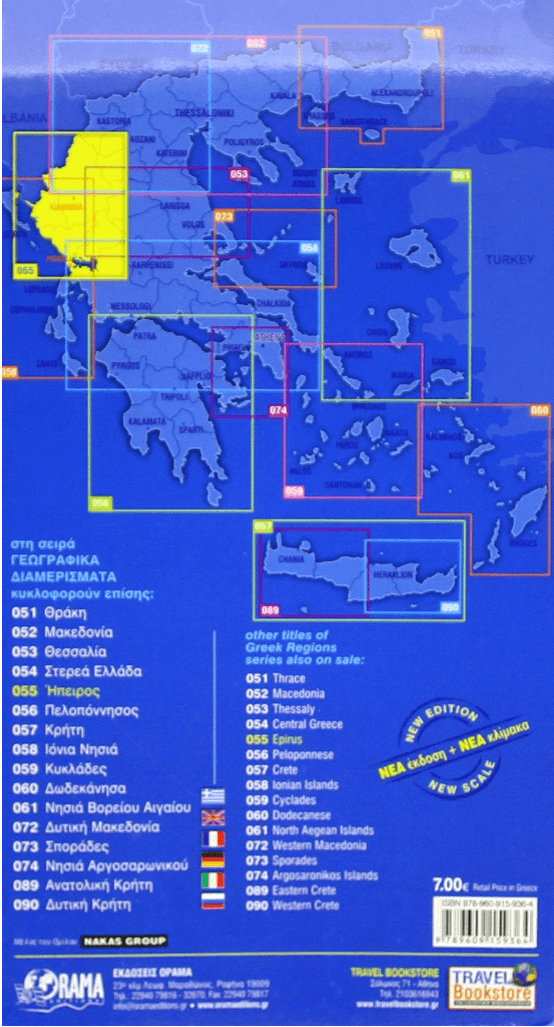
Regionale wegenkaart Griekenland 050 > 074
Regionale wegenkaart Griekenland 050 > 074

Producten op de overzichtskaart
Klik op een product om naar de detailpagina te gaan.
- Landkaart Wegenkaart 051 Thrace - Thracië - Orama Editions
- Landkaart Wegenkaart 052 Macedonië Macedonia - Orama Editions
- Landkaart Wegenkaart 055 Epirus - Orama Editions
- Landkaart Wegenkaart 056 Peloponnesos - Orama Editions
- Landkaart Wegenkaart 057 Kreta Griekenland - Orama Editions
- Landkaart Wegenkaart 058 Ionische Eilanden - Orama Editions
- Landkaart Wegenkaart 059 Cycladen Griekenland - Orama Editions
- Landkaart Wegenkaart 061 Aegean Eilanden Noord - Orama Editions
- Landkaart Wegenkaart 073 Sporades Griekenland - Orama Editions
- Landkaart Wegenkaart 074 Saroniche eilanden - Orama Editions
Artikelen uit dezelfde regio

Landkaart Wegenkaart R1 Cyclades & Argosaronic - Anavasi Ed. • 9789609412599
Wegenkaart Cyclades & Argosaronic - Anavasi Ed. Productomschrijving: Cyclades & Argosaronic Islands R1, is a new map covering the areas of Attica with the Argosaronic islands of Salamina, Aegina, Ydra and Poros and all the Cyclades islands, printed on 2 sides with overlap. A very useful map, especially for island-hoppers, with short text for each island presenting the main monuments, o…

Landkaart Wegenkaart Touring Map 3 Epirus - Terrein Maps • 9789609456241
Wegenkaart Touring Map Epirus - Terrein Maps Productomschrijving: Detailed and updated map of Epirus including a large part of western Macedonia, as well as the islands of Corfu, Paxi, Antipaxi, Erikoussa, Mathraki and Othoni. It uses G.I.S. (Geographical Information Systems) technology and the WGS84 reference system, supplemented by a GS87 grid. Like all of TERRAIN’s large maps, the …

Landkaart Wegenkaart Touring Map 2 Macedonië - Terrein Maps • 9789609456258
Wegenkaart Touring Map Macedonië - Terrein Maps Productomschrijving: Detailed and updated map of Central Macedonia including, naturally, the popular tourist region of Halkidiki and Mount Athos. It uses G.I.S. (Geographical Information Systems) technology and the WGS84 reference system, supplemented by a GS87 grid. Like all of TERRAIN’s large maps, the map of Macedonia is printed on Polyar…
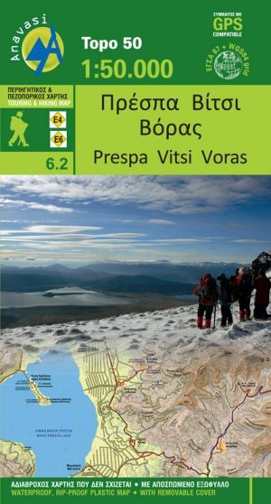
Wandelkaart 6.2 - Lake Prespa - Vitsi Mountains - Anavasi • 9789609412278
Topografische Wandelkaart Lake Prespa - Vitsi Mountains Productomschrijving: Prespa is de naam van twee zoetwatermeren in Zuidoost-Europa, gedeeld door Albanië, Griekenland, en de Republiek Macedonië. Het gebied bevat drie nationale parken, die liggen in Albanië, Griekenland en de Republiek Macedonië. De grootste stad in de regio Prespa Meren is Resen in de Republiek Macedonië. In 2014, we…

Landkaart Wegenkaart 412 Halkidiki - Terrein Maps • 9786185160005
Wegenkaart Halkidiki - Terrein Maps Productomschrijving: The touring map of the Halkidiki Peninsula provides travelers with everything they need: Scale of 1:125.000, which attributes all the information with clarity and impressive detail. Clear symbols, readable fonts and excellent map composition make the map extremely user friendly. Unique wealth of information. The complete road ne…