

Landkaart Wegenkaart R1 Cyclades & Argosaronic - Anavasi Ed.
Salamina- Aegina- Ydra- Poros- all the Cyclades islands


Korte omschrijving
Wegenkaart Cyclades & Argosaronic - Anavasi Ed. Productomschrijving: Cyclades & Argosaronic Islands R1, is a new map covering the areas of Attica with the Argosaronic islands of Salamina, Ae...

Specificaties
- Uitgever: Anavasi Editions
- ISBN-13: 9789609412599
- HOOFDCATEGORIEËN: Wegenkaart - Landkaart
- Activiteiten: Street/Road maps & city plans
- Regio: Griekenland vasteland
- Land: Griekenland
- Schaal: 1:200000
- Taal: Engels
- Reeks/Serie: Anavasi Griekelnad Regionale kaarten
- De Griekse Eilanden: Centraal Griekenland
Volledige omschrijving
Wegenkaart Cyclades & Argosaronic - Anavasi Ed.
Productomschrijving: Cyclades & Argosaronic Islands R1, is a new map covering the areas of Attica with the Argosaronic islands of Salamina, Aegina, Ydra and Poros and all the Cyclades islands, printed on 2 sides with overlap.
A very useful map, especially for island-hoppers, with short text for each island presenting the main monuments, outstanding beaches and hiking trails on each island.

Overzichtskaarten
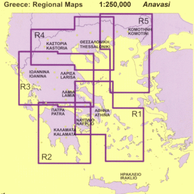
Avavasi Regionale wegenkaarten R1 > R5 - 1:200.000
Avavasi Regionale wegenkaarten R1 > R5 - 1:200.000
Producten op de overzichtskaart
Klik op een product om naar de detailpagina te gaan.
- Landkaart Wegenkaart R1 Cyclades & Argosaronic - Anavasi Ed.
- Landkaart Wegenkaart R2 Peloponnesos - Anavasi
- Landkaart Wegenkaart R3 Griekenland Centraal - Anavasi Ed.
- Landkaart Wegenkaart R4 Grieks Macedonië - Anavasi Ed.
- Landkaart Wegenkaart R5 Thraki-Aegan Noord - Anavasi Ed.
- Landkaart Wegenkaart R6 Kreta Griekenland - Anavasi Ed.
Artikelen uit dezelfde regio
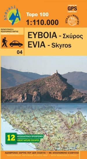
Wandelkaart 04 Evia & Skyros - Anavasi • 9789609412261
Wandelkaart 04 - Evia & Skyros - Griekenland - Anavasi Productomschrijving: Skyros is een Grieks eiland. Het eiland heeft een oppervlakte van 209 km² en is daarmee het grootste eiland van de Noordelijke Sporaden. Wandelen en fietsen op dit eiland is gekend onder de toeristen, alsook de grieken zelf. Skyros bevindt zich op zo'n 35 km van Euboea en is omringd door een dertigtal kleine tot ze…
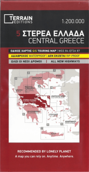
Landkaart Wegenkaart Touring Map 5 Griekenland C. - Terrein Maps • 9789609456272
Wegenkaart Touring Map Griekenland Centraal - Terrein Maps Productomschrijving: This is the best touring map of Central Greece available, in every respect. Here’s what makes it so special: Excellent map composition and spatial distribution.TERRAIN’s map of Central Greece is the map with the most ‘practiced’ composition, and the final result is impressive: all roads, villages and sights th…

Landkaart Wegenkaart 412 Halkidiki - Terrein Maps • 9786185160005
Wegenkaart Halkidiki - Terrein Maps Productomschrijving: The touring map of the Halkidiki Peninsula provides travelers with everything they need: Scale of 1:125.000, which attributes all the information with clarity and impressive detail. Clear symbols, readable fonts and excellent map composition make the map extremely user friendly. Unique wealth of information. The complete road ne…

Wandelkaart 3.2 - 4.2 Pindosgebergte Zuid - Anavasi • 9789609412186
Topografische Wandelkaart 3.2 - 4.2 - Pindosgebergte Zuid Omvat: Peristeri - Kakarditsa - Tzoumerka - Pindos Epirus Productomschrijving: Zuid-Pindos behandelt het westen en het zuidelijke deel van de prefectuur. In het westen, op de grenzen met Ioannina prefectuur zijn de hoogste toppen Aspra Litharia (1823m) en Katara (1705m). In het Zuiden zijn er de Lakmos bergen (2295 m), Tzoumerk…

Wandelkaart 1.4/1.5 Kitheron, Pateras & Gerania - Anavasi Ed. • 9789609412681
Wandelkaart Kitheron, Pateras & Gerania - Anavasi Productomschrijving: Hiking map for Kitheron, Pateras and Gerania in a scale of 1:25.000. The mountains of Western Attica, Kitheron, Pateras and Gerania are blessed places where one can still experience the nature of Attica, where resin-smelling pines, millenial olive-trees and ancient stones -either natural or man carved- coexist in t…