

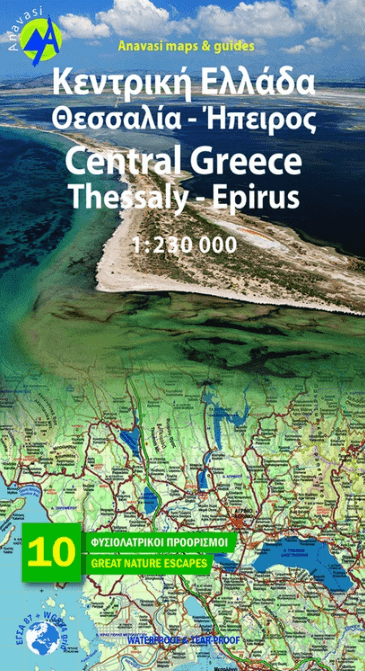
Landkaart Wegenkaart R3 Griekenland Centraal - Anavasi Ed.
Epirus - Thessaly - Katerini - Thiva

Korte omschrijving
Wegenkaart Centraal Griekenland - Anavasi Productomschrijving: Central Greece - Thessaly . A very useful map in the series Topo250, which covers mainland Greece, from Katerini in the north ...

Specificaties
- Uitgever: Anavasi Editions
- ISBN-13: 9789609412063
- HOOFDCATEGORIEËN: Wegenkaart - Landkaart
- Activiteiten: Street/Road maps & city plans
- Regio: Centraal Griekenland
- Land: Griekenland
- Schaal: 1:230000
- Taal: Engels
- Reeks/Serie: Anavasi Griekelnad Regionale kaarten
- De Griekse Eilanden: Centraal Griekenland
Volledige omschrijving
Wegenkaart Centraal Griekenland - Anavasi
Productomschrijving: Central Greece - Thessaly . A very useful map in the series Topo250, which covers mainland Greece, from Katerini in the north to Thiva in the south. Includes all new motorways, shaded relief with names of mountains, lakes and rivers, towns and villages, monasteries, monuments, national parks, European (E4, E6) and national (O1, O2, O3) trails , mountain refuges, ski resorts and more.
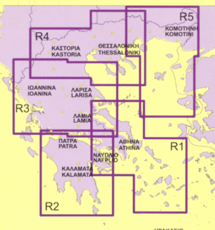
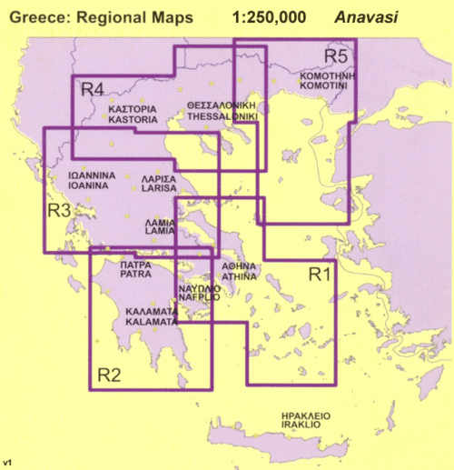
Overzichtskaarten
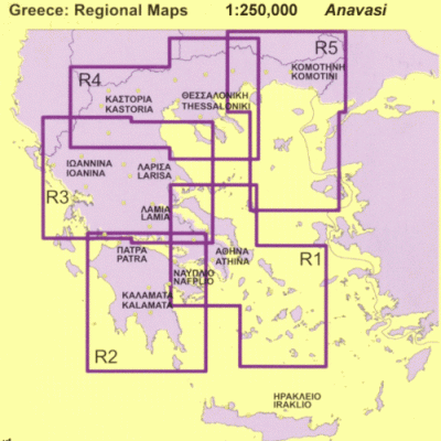
Avavasi Regionale wegenkaarten R1 > R5 - 1:200.000
Avavasi Regionale wegenkaarten R1 > R5 - 1:200.000
Producten op de overzichtskaart
Klik op een product om naar de detailpagina te gaan.
- Landkaart Wegenkaart R1 Cyclades & Argosaronic - Anavasi Ed.
- Landkaart Wegenkaart R2 Peloponnesos - Anavasi
- Landkaart Wegenkaart R3 Griekenland Centraal - Anavasi Ed.
- Landkaart Wegenkaart R4 Grieks Macedonië - Anavasi Ed.
- Landkaart Wegenkaart R5 Thraki-Aegan Noord - Anavasi Ed.
- Landkaart Wegenkaart R6 Kreta Griekenland - Anavasi Ed.
Artikelen uit dezelfde regio

Landkaart Wegenkaart 155 Etoloakarnania - Orama Editions • 9789604480104
Wegenkaart Etoloakarnania - Orama Editions Productomshrijving: Gedetaillieerde wegenkaart van een Griekse nomos, gelegen in het uiterste westen van Centraal-Griekenland. De kaart omvat hotels en campings, met toeristische symbolen die allerhande historische plaatsen, kloosters, musea aangeven. De kaart is meertalig, met belangrijke steden met hun centrum kaart en register, en degelijk kleu…
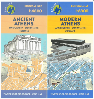
Stadskaart Plattegrond Athene OUD & MODERN - Anavasi Ed. • 9789609412667
Stadskaart Athene OUD & MODERN - Anavasi Ed. Productomschrijving: Culturele wandelkaart van zowel het oude Athene als het nieuwe moderne metropool zoals die vandaag is gekend. Een kaartenset bestaande uit 2 kaarten, van toen en nu. Ancient and Modern Athens, is a 2 maps set showing for the first time information such as the topography of ancient Athens, the course of the rivers Ili…
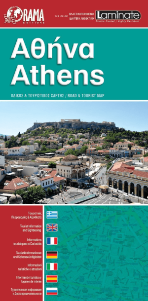
Stadskaart Plattegrond C291 Athene geplastificeerd - Orama • 9789604488933
Stadskaart Athene geplastificeerd - Orama Editions Productomschrijving: Gedetaillieerde Stadskaart & plattegrond van de stad Athene, de kaart is in dit geval de Geplastificeerde versie. De kaart omvat hotels en campings, met toeristische symbolen die allerhande historische plaatsen, kloosters, museas aangeven. De kaart is meertalig, met belangrijke steden met hun centrum kaart en register,…

Wandelkaart 4.21 Meteora 3D, Kalampaka Griekenland - Anavasi Ed. • 9789609412636
Wandelkaart Meteora Kalampaka Griekenland - Anavasi Productomschrijving: Meteora is een UNESCO geklasseerd gebied met oude rotsformaties waar de oude kloosters zijn op gebouwd in centraal Griekenland. Het gebied is heel gekend onder wandelaars. The hiking map of Meteora in scale 1:10 000 by Anavasi editions is a world first in the printed cartography with its the three-dimensional dep…
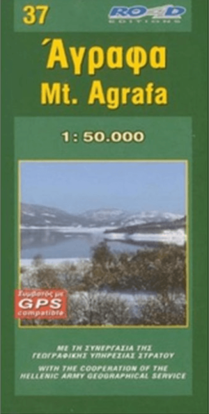
Wandelkaart 37 Mount Agrafa (Bergebied) - Road Editions • 9789608481992
Wandelkaart Mount Agrafa - Road Editions Productomschrijving: Agrafa is een ruig en weinig toeristisch berggebied in Centraal-Griekenland, op de grens van Evrytanië en Thessalië. De streek combineert hoge toppen, diepe kloven, oude bergdorpen en historische wandelpaden in een van de meest ongerepte landschappen van Griekenland. Daardoor is Agrafa vooral interessant voor reizigers die stilt…