

Wandelgids South Pennine Walks - Cicerone
30 wandelingen tussen de Yorkshire Dales en Peak National Park
Korte omschrijving
Wandelgidsen North & North East England en Yorkshire Dales van CICERONE Press. Ideaal voor tochten in England.
Wandelgids - South Pennine Walks - Cicerone Productomschrijving: De 30 rondwandelingen in deze gids hebben betrekking op de Zuid-Pennines, de uitgestrektheid van de heuvesl rond de Lancashir...

Specificaties
- Uitgever: CICERONE Press
- ISBN-13: 9781852843908
- HOOFDCATEGORIEËN: Wandelgids
- Activiteiten: Wandelen, Hiking & Trekking
- Regio: North & North East England, Yorkshire Dales
- Land: England
- Nationale parken: Yorkshire Dales NP, England
- Editie: 1
- Taal: Engels
Volledige omschrijving
Wandelgids - South Pennine Walks - Cicerone
Productomschrijving: De 30 rondwandelingen in deze gids hebben betrekking op de Zuid-Pennines, de uitgestrektheid van de heuvesl rond de Lancashire / Yorkshire grens tussen de Yorkshire Dales en het Peak National Park. Deze wandelingen variëren van 4 tot 8 en een halve mijl om gevarieerde en contrasterende landschappen te kunnen verkennen. Door zowel ervaren als beginnende wandelaars kunnen deze routes worden afgelegd.
Product description: The 30 circular walks in this guidebook cover the South Pennines, the expanse of hill country that straddles the Lancashire / Yorkshire border between the Yorkshire Dales and Peak National Parks. These walks range from four to eight and a half miles and explore an area of varied and contrasting landscapes. For experienced and novice walkers.
Seasons:
Year-round walking possibilities.
Centres:
Heptonstall, Todmorden, Hebden Bridge, Haworth, Holme Chapel. The area is within easy reach of Manchester, Huddersfield, Leeds, Bradford, Sheffield and Halifax.
Difficulty:
Nothing difficult. Walks of no more than eight or nine miles.
Must See:
Hardcastle Crags, Stoodley Pike, Pendle Hill, the ancient packhorse bridge at Wycoller... whichever you choose, you will be delighted.
Locatie op kaart
Artikelen uit dezelfde regio

Wandelgids North Yorkshire historic walks - Cicerone • 9781852843892
Wandelgids - North Yorkshire historic walks - Cicerone Productomschrijving: Een gids over historische wandelingen in North Yorkshire, in 20 meestal circulaire routes. Zij brengen u van open heidegebied en blootgestelde delen van heuvel en kliffen naar de meer beschutte dales en de straten van York. Wandelingen bevatten Skipton Castle, Ripon en Fountains Abbey, Ripley Castle, Castle Howard,…
Landkaart Wegenkaart 08 Engeland Noord & Scottish Borders • 9780749584719
Wegenkaart Engeland Noord & Scottish Borders - AA Road Maps Productomschrijving: AA Road Map North of England & Scottish Borders is a practical and slimline, foldable map from the experts at the AA. Encased in a durable, weatherproof cover, the mapping is produced at a scale of 3 miles to 1 inch (1:200,000 / 2km to 1cm) combining clear design, an easy-to-read scale and more road detail to …
Wandelgids Dales Country Yorkshire England - Cicerone • 9781852843236
Wandelgids - Dales Country Yorkshire England - Cicerone Productomschrijving: Een gids over 30 familiewandelingen in de Yorkshire Dales, Engeland. De 30 circulaire wandelingen nemen de bekende Dales plekken in zoals Malham en Ingleborough. Routes nemen tussen een halve tot een volledige dag in beslag. Ook minder bezochte, bijna geheime routes, ingedeeld van gemakkelijk tot inspannend. P…
Wandelgids Park Rangers Favourite Walks Yorkshire Dales - Collins • 9780008462659
Park Rangers Favourite Walks Yorkshire Dales - Collins Productomschrijving: Wandelgids voor het Yorkshire Dales National Park, met 20 beste routes uitgekozen door de parkwachters. Elke wandeling varieert in lengte van 2 tot 10 km en kan in minder dan 4 uur worden afgelegd. Engelse omschrijving: Walking guide to the Yorkshire Dales National Park, with 20 best routes chosen by the park r…
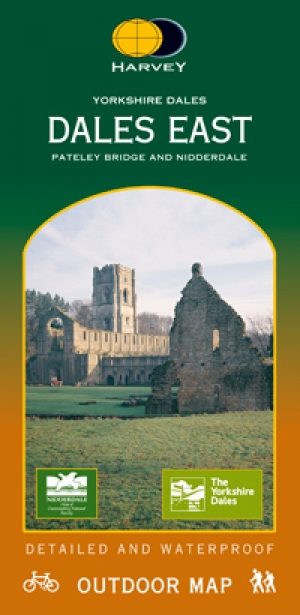
Wandelkaart Dales East - Pately Bridge & Nidderdale - Harvey maps • 9781851374601
Wandelkaart Dales East - Pately Bridge & Nidderdale - Harvey maps Productomschrijving: Gedetailleerde kaart om te wandelen die ook GPS compatibel is. Omvat gesorteerde off-road fietsroutes. Met een groot gebied op een compacte blad. De Oostelijke Yorkshire Dales heeft betrekking op het gebied van Masham tot Ilkley, waaronder Pately bridge, alsook waterdicht voor gebruik buitenshuis. Ni…