

Wandelgids Peak Bagging in Peak District NP - Vertebrate Publ.
32 routes - 121 peaks and Ethels - 74 accessible Ethels

Korte omschrijving
Wandelgidsen Derbyshire & Peak District, England van Vertebrate Publishing. Ideaal voor tochten in England.
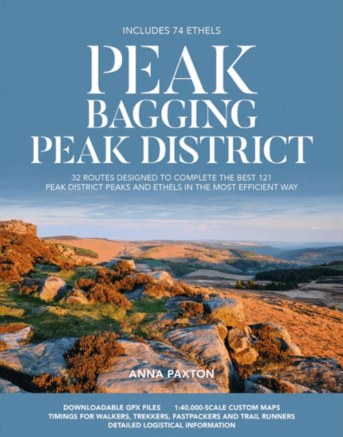
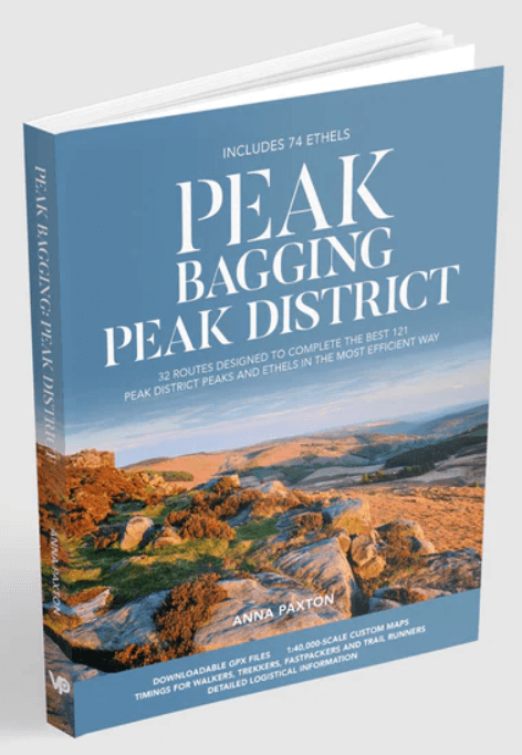
Peak Bagging in Peak District NP - Vertebrate Productomschrijving: This number includes 32 routes designed to complete the best 121 Peak District peaks and Ethels (like the Scotisch Munro's)...

Specificaties
- Uitgever: Vertebrate Publishing
- ISBN-13: 9781839812675
- HOOFDCATEGORIEËN: Wandelgids
- Activiteiten: Wandelen, Hiking & Trekking
- Auteur: Anna Paxton
- Regio: Derbyshire & Peak District, England
- Land: England
- Nationale parken: Peak District NP, Derbyshire UK
- Editie: 1
- Taal: Engels
- De Engelse Graafschappen: Derbyshire
Volledige omschrijving
Peak Bagging in Peak District NP - Vertebrate
Productomschrijving: This number includes 32 routes designed to complete the best 121 Peak District peaks and Ethels (like the Scotisch Munro's) in the most efficient way. In Peak Bagging Peak District, local author Anna Paxton guides you to 121 of the most rewarding summits in the national park, including the 74 accessible Ethels plus 47 other notable tops. Whether you’re a hillwalker or trail runner, this is the definitive guide to bagging the best of the Peak.
Explore dramatic edges and moorland plateaus, rugged ridgelines and peaceful valleys. Hike classic circuits like Mam Tor and Lose Hill, scale the Dragon’s Back on Chrome Hill and Parkhouse Hill, and roam Kinder Scout’s wild uplands via the Pennine Way.
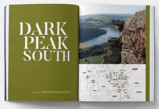
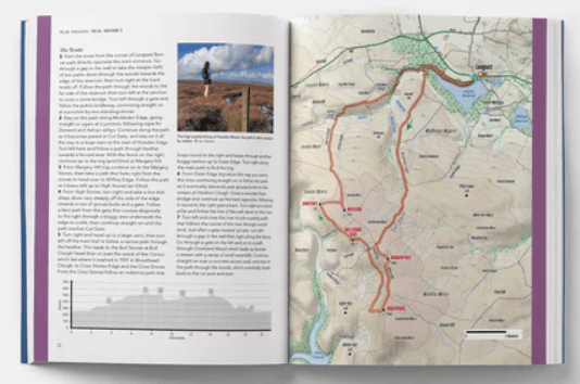
The 32 routes are grouped into five regions, covering the diverse landscapes of the Dark Peak and White Peak. Each route includes 1:40,000-scale maps and elevation profiles, turn-by-turn directions, public transport, parking, and refreshment details, downloadable GPX files, and custom timings for walkers, trekkers, fastpackers and runners.
Packed with expert insight and stunning photography, Peak Bagging Peak District is your ultimate guide to the high points of the Peak District.
Artikelen uit dezelfde regio

Wandelkaart 245 National Forest - OSI • 9780319475461
Wandelkaart National Forest - OSI Productomschrijving: The National Forest is een milieuproject in Midden-Engeland dat wordt beheerd door The National Forest Company. U kunt deze wel zeer speciale plaats terug vinden in- en rond de gehuchten van north Leicestershire, south Derbyshire and southeast Staffordshire. Engelse omschrijving: The National Forest is an environmental project in …

Fietsgids Pennine Bridleway Cycling guide - Vertebrate Publ. • 9781839810428
Pennine Bridleway Cycling guide - Vertebrate Productomschrijving: From Derbyshire through the Yorkshire Dales to Cumbria Pennine Bridleway by Hannah Collingridge is a guidebook to this National Trail taking you from Derbyshire through the Yorkshire Dales to Cumbria, following the Pennine Hills AONB. Together with stunning photography, the route features Ordnance Survey 1:50,000 maps, e…

Mountainbikegids Gravel Rides Peak District - Vertebrate Publ. • 9781839812316
Gravel Rides Peak District - Vertebrate Productomschrijving: 15 gravel bike adventures in the Dark & White Peak Gravel Rides Peak District by Hetty Kingston showcases 15 of the best gravel bike rides in the stunning Peak District National Park. From 18.3 to 60.8 kilometres in length (plus a 105-kilometre bonus route) and covering a variety of terrain, there is something for every grave…

Wandelgids Derbyshire walking guide - Cicerone • 9781852846336
Wandelgids - Derbyshire walking guide - Cicerone Productomschrijving: Een handige gids die 60 circulaire dagwandelingen beschrijft, variërend van eenvoudig tot matig, in termen van moeilijkheden en terrein, die geschikt zijn voor het hele gezin. Derbyshire beschikt over een interessante geschiedenis die ook door middel van deze routes onderzocht kan worden, en elk thema rond een specifieke…

Wandelgids Park Rangers Favourite Walks Peak District - Collins • 9780008439125
Park Rangers Favourite Walks Peak District - Collins Productomschrijving: Wandelgids voor het Peak District National Park, met 20 van de beste routes uitgekozen door de parkwachters. Elke wandeling varieert in lengte van 2 tot 10 km en kan worden voltooid in minder dan 4 uur. Engelse omschrijving: Walking guide to the Peak District National Park, with 20 best routes chosen by the park …