

Fietsgids Pennine Bridleway Cycling guide - Vertebrate Publ.
From Derbyshire through the Yorkshire Dales to Cumbria

Korte omschrijving
Fietsgidsen Cumbria & Lake District, England, Derbyshire & Peak District, England, North England en Midlands, England van Vertebrate Publishing. Ideaal voor tochten in United Kingdom, Great Britain.
Pennine Bridleway Cycling guide - Vertebrate Productomschrijving: From Derbyshire through the Yorkshire Dales to Cumbria Pennine Bridleway by Hannah Collingridge is a guidebook to this N...

Specificaties
- Uitgever: Vertebrate Publishing
- ISBN-13: 9781839810428
- HOOFDCATEGORIEËN: Fietsgids
- Activiteiten: Fietsen / VTT / MTB
- Auteur: Hannah Collingridge
- Regio: Cumbria & Lake District, England, Derbyshire & Peak District, England, Midlands, England, North England
- Land: United Kingdom, Great Britain
- AONB - Area of Outstanding Beauty/National Landscape: Northern Pennines AONB
- Taal: Engels
- Fietsen: Fietsen in het Buitenland
- National Trails UK, England & Wales: Pennine Way, England
- VTT / MTB: Mountainbike
Volledige omschrijving
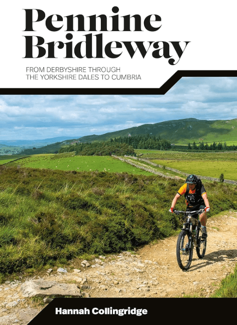
Pennine Bridleway Cycling guide - Vertebrate
Productomschrijving: From Derbyshire through the Yorkshire Dales to Cumbria
Pennine Bridleway by Hannah Collingridge is a guidebook to this National Trail taking you from Derbyshire through the Yorkshire Dales to Cumbria, following the Pennine Hills AONB. Together with stunning photography, the route features Ordnance Survey 1:50,000 maps, easy-to-follow directions and interesting facts about landmarks along the way.
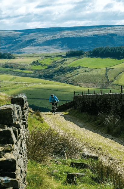
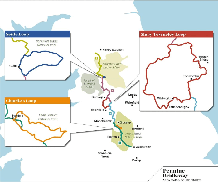
Pennine Bridlewayis a guidebook to this National Trail taking you on a multi-day off-road cycling adventure from Derbyshire through the Yorkshire Dales to Cumbria, following the Pennine Hills. This big ride is split into four sections; each section includes detailed directions as well as information on points of interest along the route, bringing the history and landscape of the trail into context.
There are also three loops, including the Mary Towneley Loop, which can be tackled separately or as part of the main trail. The guidebook is illustrated throughout with stunning action photography by professional photographer Joolze Dymond. Researched, ridden and written by mountain biking expert and freelance writer Hannah Collingridge, this guidebook features clear and easy to use Ordnance Survey 1:50,000 maps, easy-to-follow directions, details of distance, ascent and difficulty gradings, bikepacking hints and tips and local knowledge.
Artikelen uit dezelfde regio

Reisgids Michelin Noord Engeland & Wales - Cardiff-Manchester • 9789401498456
Reisgids Michelin Noord Engeland & Wales Productomschrijving: De Groene Reisgids Noord-Engeland & Wales. De serie Groene Reisgidsen van Michelin is een beproefde en betrouwbare reisgidsenreeks. Of u nu lekker lang met vakantie gaat of er zomaar even tussenuit trekt, de Groene Reisgids wijst u de weg naar alle bijzonderheden die uw reisbestemming te bieden heeft, op een boeiende, grondige e…

Scramblegids Lake District North 110 scrambles - Cicerone • 9781852848323
Scramblegids / Lake District North - 110 scrambles (9781852848323) Cicerone Press Productomschrijving: Gids naar 110 scramble (klauter/wandel) routes in het Engelse Lake District. Graded scrambles routes op de rotsen in ghylls Road, Ennerdale, Newlands, Buttermere, Borrowdale, Thirlmere, Patterdale, Mardale & Swindale. Routes variëren van rang 1 door rangen 2 tot en met 4, waar het gebruik…
Wandelgids Park Rangers Favourite Walks Lake District - Collins • 9780008439149
Wandelgids Lake District - Collins Productomschrijving: Wandelgids over het Lake District National Park, met 20 beste routes uitgekozen door de parkwachters. Elke wandeling varieert in lengte van 2 tot 10 km en kan in minder dan 4 uur worden afgelegd. Engelse omschrijving: Walking guide to the Lake District National Park, with 20 best routes chosen by the park rangers. Each walk varies…

Wandelgids 063 Pathfinder guides Peak District England - OS • 9780319090275
Wandelgids Peak District England - OS Productomschrijving: The Pathfinder Guide for the Lake District is the ideal companion to gaining an appreciation of England's most mountainous region with its balanced range of walks across the whole of the National Park. There are a total of 28 outstanding circular walks in the Lake District National Park from 3 to 10 miles with easy-to-follow route…
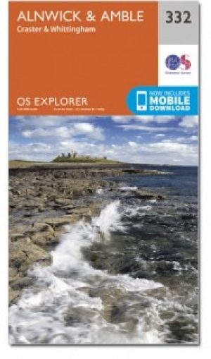
Wandelkaart 332 Alnwick & Amble Northumberland - OSI • 9780319472040
Wandelkaart Alnwick & Amble - Northumberland England Omvat ook: Craster & Whittingham. Productbeschrijving: Kaart nummer 332 in de OS Explorer kaarten reeks heeft betrekking op de Northumbrian kust van Embleton Bay naar Amble en landinwaarts tot zover de bron van de rivier de Aln looptt. Plaatsen om te bezoeken zijn onder andere: Craster, kasteel van Alnwick, Warkworth Castle, Craster …