

Mountainbikegids Gravel Rides Peak District - Vertebrate Publ.
15 gravel bike adventures in the Dark & White Peak
Korte omschrijving
Fietsgidsen Derbyshire & Peak District, England van Vertebrate Publishing. Ideaal voor tochten in England.
Gravel Rides Peak District - Vertebrate Productomschrijving: 15 gravel bike adventures in the Dark & White Peak Gravel Rides Peak District by Hetty Kingston showcases 15 of the best grav...

Specificaties
- Uitgever: Vertebrate Publishing
- ISBN-13: 9781839812316
- HOOFDCATEGORIEËN: Fietsgids
- Activiteiten: Fietsen / VTT / MTB
- Auteur: Hetty Kingston
- Regio: Derbyshire & Peak District, England
- Land: England
- Nationale parken: Peak District NP, Derbyshire UK
- Taal: Engels
- Fietsen: Fietsen in het Buitenland
- De Nationale Parken: Peak District Nationaal Park, England
- De Engelse Graafschappen: Derbyshire, South Yorkshire
- VTT / MTB: Mountainbike
Volledige omschrijving
Gravel Rides Peak District - Vertebrate
Productomschrijving: 15 gravel bike adventures in the Dark & White Peak
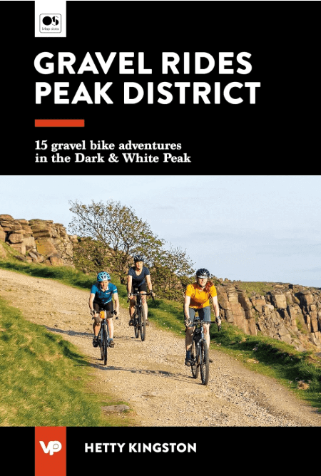
Gravel Rides Peak District by Hetty Kingston showcases 15 of the best gravel bike rides in the stunning Peak District National Park. From 18.3 to 60.8 kilometres in length (plus a 105-kilometre bonus route) and covering a variety of terrain, there is something for every gravel cyclist. Features clear and easy-to-use Ordnance Survey maps.
Explore the fast-rolling, smooth gravel of disused railway lines on the High Peak Trail and Monsal Trail, traverse the breathtaking gritstone Eastern Edges on the outskirts of Sheffield, and discover unexpected gravel delights tucked away in the most unexpected places in the Dark and White Peak.
Researched, ridden and written by Peak local Hetty Kingston, the routes feature clear and easy-to-use Ordnance Survey maps; easy-to-follow directions; details of distance, timings and difficulty gradings; stunning action photography; refreshment stops and local knowledge; and a detailed appendix.

Locatie op kaart
Artikelen uit dezelfde regio

Wandelkaart OL01 Peak District NP & Dark Peak area - OS • 9780319263655
Wandelkaart Peak District NP & Dark Peak area - OS Productomschrijving: Peak District National Park & Dark Peak area, Derbyshire England. Omvat: Parts of Peak districh National & Dark peak Area, Kinder Scout, Bleaklow, Black Hill & Ladybower Reservoir. Ontdek de OL-serie van Ordnance Survey: De OL-serie (Outdoor Leisure) van Ordnance Survey is dé referentie voor wie gaat wandele…

Wandelgids 073 Pathfinder guides More Peak District - OS • 9780319091081
Wandelgids More Peak District - OS Productomschrijving: This companion to the Pathfinder Peak District Guidebook contains 28 additional circular walks of 5km (3 miles) to 17km (10.5 miles). Like the main book, each is graded by length difficulty, and ranges from relatively easy strolls to some of the more challenging routes with considerable vertical ascent. Each route includes a deta…

Wandelgids Peak District Boundary Walk - Vertebrate Publ. • 9781909461536
Peak District Boundary Walk - Vertebrate Productomschrijving: 190 miles around the edge of the National Park To celebrate Britain's first national park, supporters of Friends of the Peak District have devised a 190-mile walking route around its boundary – the Peak District Boundary Walk. Peak District Boundary Walk includes a detailed route description, Ordnance Survey 1:25,000-scale …

Wandelgids Peak District-Bakewell & The White Peak - Cicerone • 9781786312570
Wandelgids Peak District-Bakewell & The White Peak - Cicerone Productomschrijving: Would you like to explore the best of Bakewell and the White Peak? This guidebook covers 15 of the best short walks in the Peak District (between 4 and 10km, all under three hours), including Taddington, Chatsworth Park, Sheldon and Magpie Mine, Elton and Robin Hood's Stride, and the Monsal Trail. Why c…

Wandelgids Peak Bagging in Peak District NP - Vertebrate Publ. • 9781839812675
Peak Bagging in Peak District NP - Vertebrate Productomschrijving: This number includes 32 routes designed to complete the best 121 Peak District peaks and Ethels (like the Scotisch Munro's) in the most efficient way. In Peak Bagging Peak District, local author Anna Paxton guides you to 121 of the most rewarding summits in the national park, including the 74 accessible Ethels plus 47 other…