

Wandelgids Northumberland walking guide - Cicerone
36 graded walks of 4 to 14 miles


Korte omschrijving
Wandelgidsen Northumberland, Engeland van CICERONE Press. Ideaal voor tochten in England.
Wandelgids Northumberland walking guide - Cicerone Press Productomschrijving: Guidebook to walking in Northumberland. 36 graded walks of 4 to 14 miles, from the beautiful coast with its imme...

Specificaties
- Uitgever: CICERONE Press
- ISBN-13: 9781786311818
- HOOFDCATEGORIEËN: Wandelgids
- Activiteiten: Wandelen, Hiking & Trekking
- Auteur: Vivienne Crow
- Regio: Northumberland, Engeland
- Land: England
- Editie: 2
- Taal: Engels
- De Nationale Parken: Northumberland National Park, England
- De Engelse Graafschappen: Northumberland
Volledige omschrijving
Wandelgids Northumberland walking guide - Cicerone Press
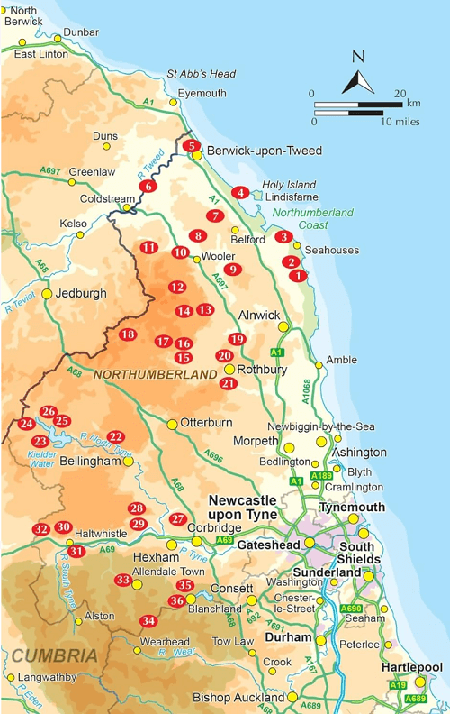
Productomschrijving: Guidebook to walking in Northumberland. 36 graded walks of 4 to 14 miles, from the beautiful coast with its immense, empty beaches and dramatic, crag-top castles to the remote hills of the Cheviots and Pennines AONB. Includes Hadrian's Wall, Lindisfarne Priory, Kielder, Berwick, Bamburgh and Dunstanburgh Castles and more.
Seasons:
It's always a great time to walk in Northumberland - each season holds its delights - but walkers need to be prepared for snow in the Cheviots and on the Pennines in winter.
Centres:
Lindisfarne, Craster, Berwick-upon-Tweed, Seahouses, Wooler, Rothbury, Allendale, Haltwhistle, Alwinton, Ingram, Kielder and many other villages.
Difficulty:
A wide selection of walks including full days on the hills and coast and shorter walks at lower levels. Terrain includes moorland, farmland, forest tracks, coastal paths and woodland trails. Routes range from 6 to 22km. No technical difficulties.
Must See:
The remote Cheviot Hills and impressive Iron Age forts; historic coastal routes, including the lesser-known side of Lindisfarne; Hadrian's Wall; the moors and valleys of the Pennines; Kielder Water and through its sprawling forests.
Artikelen uit dezelfde regio
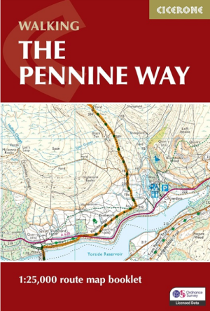
Wandelgids Map Booklet Pennine Way - Cicerone • 9781786311412
Map Booklet Pennine Way - Cicerone Productomschrijving: Map of the 270 miles (435km) Pennine Way National Trail, between Edale in the Peak District and Kirk Yetholm in the Scottish Borders. This booklet is included with the Cicerone guidebook to the trail, and shows the full route on OS 1:25,000 maps. This popular long-distance route typically takes three weeks to complete. Seasons: …
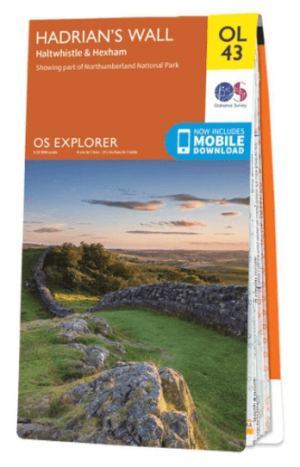
Wandelkaart OL43 Hadrian's Wall- Haltwhistle & Hexham - OS • 9780319263624
Wandelkaart Hadrian's Wall- Haltwhistle & Hexham - OS Productomschrijving: Topografische wandelkaart van Hadrian's Wall- Haltwhistle & Hexham. Omvat: Haltwhistle & Hexham, historic Hadrian's Wall path across Northern England, with parts of Northumberland National park & The Pennine Way. Ontdek de OL-serie van Ordnance Survey: De OL-serie (Outdoor Leisure) van Ordnance Survey is …

Wandelgids 087 Pathfinder guides Northumberland - OS • 9780319092576
Wandelgids Northumberland - OS Productomschrijving: Opening with a gentle short walk at Kielder Water and concluding with an energetic and challenging ramble to the summit of The Cheviot, walks are arranged in the book by completion time, with shorter and easier routes at the start and longer outings at the end. Walks are professionally authored and depicted with GPS waypoints, Ordnance S…

Wandelkaart 340 Holy Island & Bamburgh - OSI • 9780319475768
Wandelkaart Holy Island & Bamburgh - Explorer Active Productomschrijving: Holy Island en Bamburgh zijn 2 aan de kust liggende eilanden/archipel die de interesse trekt van velen in het teken van natuur bezoek, wandelen of fietsen. De locatie is zeer mooi wat de natuur betreft. Omvat: Cheswick, Ancroft, Haggerston, Bowsden, Beal, Fenwick, Holy Island, Holburn, Doddington, Belford, Waren …

Wandelgids Day Walks in Northumberland - Vertebrate Publ. • 9781912560615
Day Walks in Northumberland - Vertebrate Productomschrijving: 20 coastal & countryside routes Day Walks in Northumberlandfeatures 20 routes between 7.6 and 14.5 miles (12.2km and 23.3km) in length, spread across the coast and the countryside of Northumberland and suitable for hillwalkers of all abilities. Researched and written by local walking guide David Wilson, this book covers …