

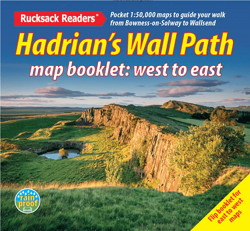
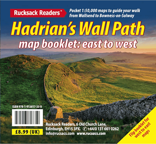
Wandelgids Hadrian's Wall Path Map booklet - Ruksack Readers
Wallsend, Tyne and Wear > Bowness-on-Solway, Cumbria - 135 KM

Specificaties
- Uitgever: RUCKSACK READERS
- ISBN-13: 9781913817350
- HOOFDCATEGORIEËN: Wandelkaart
- Activiteiten: Wandelen, Hiking & Trekking
- Auteur: Jacqueline Cantaloube, Jacquetta Megarry
- Regio: Cumbria, England, Tyne and Wear, England
- Land: England
- Historische wandelroutes: Hadrian's Wall path (135 km)
- Lange afstand wandelroutes: Hadrian's Wall path (135 km)
- Schaal: 1:100000
- Taal: Engels
- Iconische Wandelroutes: Hadrians Wall Path, UK
- National Trails UK, England & Wales: Hadrians Wall, England
Gekoppelde artikelen

Wandelgids Hadrian's Wall Path - Rucksack Readers • 9781913817312
standaard versieWandelgids Hadrian's Wall Path Productomschrijving: Hadrian's Wall Path runs for 86 miles (135 km) between Bowness-on-Solway and Wallsend (Newcastle) along the line of the Roman Wall completed in AD122 under the Emperor Hadrian. This National Trail crosses northern England from Irish Sea to North Sea and offers many chances to look at the forts, milecastles and interpretation centres withi…
Artikelen uit dezelfde regio
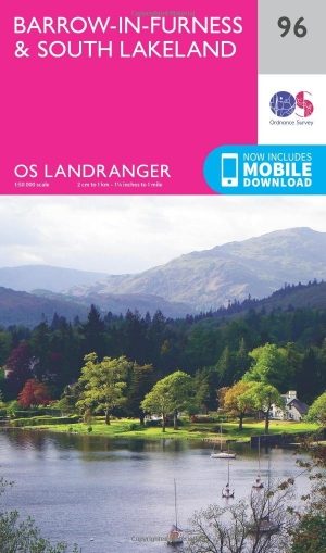
Wandelkaart 96 Barrow-in-Furness & South Lakeland - OSI • 9780319261941
Wandelkaart Barrow-in-Furness & South Lakeland - England Productbeschrijving: OS Landranger kaart 96, is de ideale kaart voor het plannen van wandelingen in deze prachtige kuststreek van het Lake District. Buitenshuis kunnen liefhebbers kiezen tussen dramatische lakeside Panorama's of kust paden. Hoogtepunten van het gebied zijn Piel kasteel, Walney Island, Ulverston en Coniston Water …

Wandelkaart Coast to Coast (west) St Bees to Keld - Harvey maps • 978185137618
Wandelkaart Coast to Coast (west) St Bees to Keld - Harvey maps Productomschrijving: Toont de gehele westelijke helft van de route op één deel van de kaart. Heeft betrekking op het gedeelte van St Bees naar Keld. Omvat alle alternatieve routes. Gedetailleerde kaart met aanvullende informatie en handige telefoonnummers, schaal van 1: 40.000. Nieuwe generatie HARVEY Superwalker, XT25 wat…
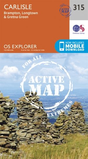
Wandelkaart 315 Carlisle- Cumbra England - OSI • 9780319471876
Wandelkaart Carlisle - Cumbra England Omvat ook: Brampton, Longtown & Gretna Green Productomschrijving: Omvat Dalston, Carlisle, Gretna Green en Longtown, deze kaart maakt ook deel uit van de Solway Coast AONB en de North Pennines AONB of de gebieden of Outstanding Natural Beauty. Nationale wandelpaden en recreatieve paden gedekt zijn: kust Cumbrian Way, Cumbria Way en de Hadrianus Wal…

Wandelgids Hadrian's Wall Path short walks - Cicerone • 9781786311573
Hadrian's Wall Path - short walks - Cicerone Productomschrijving: Mark Richards heeft 15 van de beste korte wandelingen rond Hadrian's Wall voor je uitgezocht. Onze gids is voorzien van goed leesbare Ordnance Survey-kaarten en duidelijke routebeschrijvingen, perfect als je voor het eerst gaat wandelen of iets zoekt waar je met het hele gezin van kunt genieten. We hebben informati…
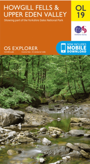
Wandelkaart OL19 Howgill Fells & Upper Eden Valley - OS • 9780319263341
Wandelkaart Howgill Fells & Upper Eden Valley - OS Productomschrijving: Topografische wandelkaart van The Howgill Fells & The Upper Eden Valley, dat deels in het Lake Distrisct National Park ligt. Omvat: Howgill Fells & Upper Eden Valley, parts of the Yorkshire Dales National Park en The Lake Distrisct National Park, The Pennine Journey, Dales High Way, Dales Way, E2 European Long D…