

Wandelgids Trekking the Coast to Coast Path - Knife Edge
Two-way trekking guide - St-Beest to Robin Hood's Bay

Korte omschrijving
Wandelgidsen Cumbria, England en North Yorkshire, Engeland van Knife Edge Outdoor Limited. Ideaal voor tochten in England.
Trekking the Coast to Coast Path - Knife Edge Productomschrijving: Deze beroemde wandelroute van om en bij de 290 km, loopt door 3 nationale parken, 3 wereldbekende nationale parken die elk ...

Specificaties
- Uitgever: Knife Edge Outdoor Limited
- ISBN-13: 9781912933143
- HOOFDCATEGORIEËN: Wandelgids
- Activiteiten: Wandelen, Hiking & Trekking
- Auteur: Andrew McCluggage
- Regio: Cumbria, England, North Yorkshire, Engeland
- Land: England
- Nationale parken: Lake District NP, Cumbria England, North York Moors NP, England, Yorkshire Dales NP, England
- Editie: 1
- Taal: Engels
- Iconische Wandelroutes: Coast to coast path, UK
- National Trails UK, England & Wales: Coast to Coast Walk, England
Volledige omschrijving
Trekking the Coast to Coast Path - Knife Edge
Productomschrijving: Deze beroemde wandelroute van om en bij de 290 km, loopt door 3 nationale parken, 3 wereldbekende nationale parken die elk appart hun eigen specifieke voordelen bieden.
Route: St-Beest to Robin Hood's Bay
Engelse omschrijving: The definitive two-way guide to the Coast to Coast Path: both eastbound and westbound routes are described in full.
Real Maps: Full Ordnance Survey mapping inside (1:25,000). All accommodation is numbered and marked on the maps. 19 different itineraries: schedules of 11, 12, 13, 14, 15, 16, 17, 18 and 19 days for hikers and runners. Includes both eastbound and westbound itineraries. Difficult calculations of time, distance and altitude gain/loss are done for you.
Also includes:
• Detailed information on equipment and travelling light
• Full accommodation listings: the best pubs, B&Bs and hotels

Artikelen uit dezelfde regio

Wandelkaart 301 Scarborough- Bridlington - OSI • 9780319471739
Wandelkaart Scarborough- Bridlington & Flamborough Head Productbeschrijving: Kaart nummer 301 in de OS Explorer kaarten reeks heeft betrekking op de oostkust van Yorkshire rond Scarnorough, Bridlington en Flamborough Head. Hoogtepunten van het gebied zijn onder andere: Cleveland Way, de Yorkshire Wolds Way, Het nationall park zelf, en de North Sea Trail. De OS Explorer kaart voor Scarborou…
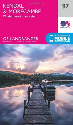
Wandelkaart 97 Kendal & Morecambe- Cumbria - OSI • 9780319263402
Wandelkaart Kendal & Morecambe - Cumbria England Productomschrijving: Kendal, Windermere & Lancaster voor 1 grote 30x40km wandelkaart van de regio in Cumbria Engalnd. De locatie, net als de rest van Cumbria is één groot wandelparadijs. Kendal is een gebied in South Lakeland, in het Engelse graafschap Cumbria. De reden voor deze locatie is omdat het de poort vormt van het Lake District Nati…
Wandelkaart 315 Carlisle- Brampton & Longtown - OSI • 9780319245675
Wandelkaart Carlisle- Brampton- Longtown - Cumbria England Productbeschrijving: Brampton, Longtown & Gretna Green. 315 / Carlisle, Brampton, Longtown & Gretna, Cumbria, England - Omvat Carlisle, Gretna Green en Longtown, deze kaart omvat ook deel van de Solway Coast en de North Pennines gebieden of Outstanding Natural Beauty AONB. Nationale routes en recreatieve paden die zijn gedekt …

Wandelkaart 89 West Cumbria England - OSI • 9780319261873
Wandelkaart West Cumbria - England Productbeschrijving: West Cumbria staat bekend om zijn aantrekkelijke landschap en het Lake District National Park & Wast Water Lakes, die zich uitstrekken over 3 mijl langs de Washdale valley. De OS Landranger kaart nummer 89 van West Cumbria omvat ook Cockermouth, Workington, Maryport, Dovenby, Uldale, Ennerdale Bridge, Egermont, Gosforth, Keswick, Scaf…

Wandelkaart 297 Lower Wharfedale & Washburn Valley - OSI • 9780319245491
Wandelkaart Lower Wharfedale & Washburn Valley - North Yorkshire Omvat ook: Harrogate & Ilkley Moor Productomschrijving: Kaart nummer 297 in de OS Explorer kaarten reeks heeft betrekking op het Nidderdale AONB en het Yorkshire Dales National Park. De stad van Harrogate is omgeven door het Harrogate Ringway recreatief pad, terwijl de Dales Way loopt langs Ilkley, Otley en Guisely. Ander…