

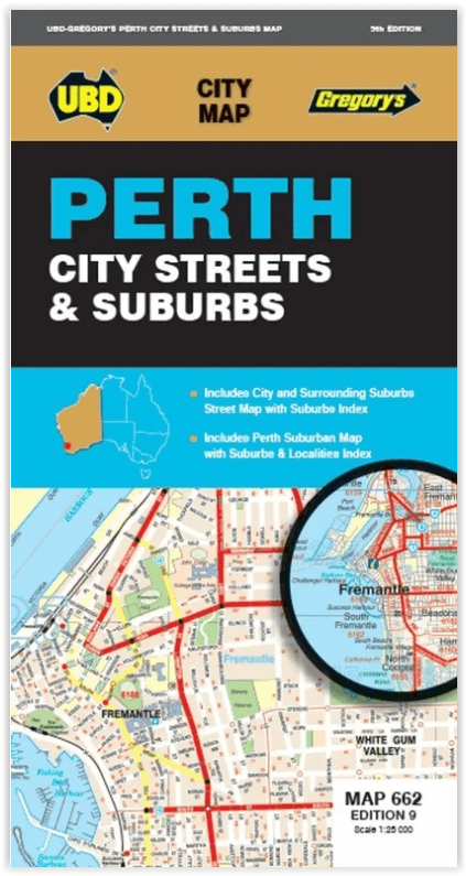
Stadsplattegrond 662 Perth City Streets & Suburbs - UBD GRegory's
Westminster- Coolbellup- Maylands- Trigg- Fremantle- Bullsbrook
Korte omschrijving
Stadskaart Perth City Streets & Suburbs - UBD GRegory's Productomschrijving: The latest edition of the Perth City Streets and Suburbs city map has been fully revised and updated and includes...

Specificaties
- Uitgever: UBD Gregory's Universal Publishers
- ISBN-13: 9780731933433
- HOOFDCATEGORIEËN: Stadskaart plattegrond
- Activiteiten: Street/Road maps & city plans
- Regio: Perth, West Australië
- Land: Australië
- Schaal: 1:25000
- Editie: 9
- Taal: Engels
- De Australische Regio's: Western Australia
Volledige omschrijving
Stadskaart Perth City Streets & Suburbs - UBD GRegory's
Productomschrijving: The latest edition of the Perth City Streets and Suburbs city map has been fully revised and updated and includes detailed street level mapping of Perth and surrounding suburbs at a scale of 1: 25 000 with coverage from Westminster in the north, Coolbellup in the south, Maylands in the east and along the coast from Trigg in the north to Fremantle in the south.
There is also Perth suburban coverage at a scale of 1: 100 00 with coverage from Bullsbrook in the north, North Dandalup in the south, The Lakes in the east and along the coast from Quinns Rocks in the north to Mandurah in the south with insets for the towns of Pinjarra and Yanchep.
- With all this information contained in one convenient fold out map it is an essential tool when travelling in and around the Perth region.
Locatie op kaart
Artikelen uit dezelfde regio

Landkaart Wegenkaart Western Australia state handy map - Hema • 9321438001560
Wegenkaart Western Australia state handy map - Hema Productomschrijving: A compact map of Western Australia (WA) for touring throughout the state with a distance grid and index for planning and reference. Marked on the mapping are highways, major and minor roads, camping and rest areas, 24-hour fuel, information centres, picnic areas, caravan parks and lookouts.

Reisgids Australië - een reis door Zuid en West - Edicola • 9789492920997
Reisgids Australië - een reis door Zuid en West - Edicola Productomschrijving: Na het succes van Australië - Een rondreis door het zuiden van Lisanna Weston heeft zij nu samen met Sanne de Groot een tweede reisgids geschreven: Een reis door Zuid- en West. Lisanna Weston, succesvol reisorganisatie-onderneemster in Australië en Sanne de Groot, onderdeel van Dutchies Travel en veelvoudig Aust…

Kampinggids Perth & The South West 4WD + Camping escapes - Hema • 9781865006215
Wegenatlas Kampinggids Perth & The South West Productomschrijving: 4WD + Camping Escapes – Perth & the South West is a guide to the best four-wheel driving and camping locations in South West Western Australia. Each regional section outlines the area’s 4WD Tracks and Featured Camping Areas, with a Camping Directory at the end to provide comprehensive coverage of other camping areas. T…
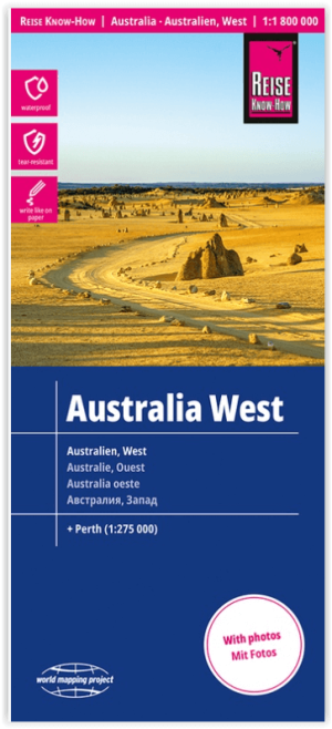
Landkaart Wegenkaart Australië West - Reise Know How • 9783831774739
Wegenkaart West Australië - Reise Know How Productomschrijving: Reis Know-How-kaarten (wereldkaart-projectreeks) zijn gemakkelijk te lezen, waterdichte en zeer duurzame reiskaarten die speciaal zijn ontworpen voor dagelijks gebruik op de weg. Omvat: The Northern Territories, Western Australia & Southern Australia. Onze kaarten combineren state-of-the-art, GPS-compatibele cartograf…
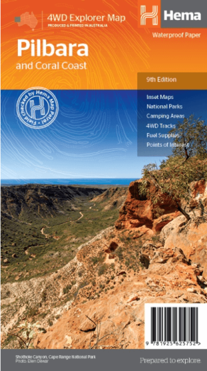
Landkaart Wegenkaart Pilbara & Coral Coast - Hema Maps • 9781925625752
Wegenkaart Pilbara & Coral Coast - Hema Productomschrijving: This regional waterproof map of the Pilbara and Coral Coast is ideal for discovering the northern reaches of Western Australia. The main map covers the diverse marine attractions around Shark Bay, François Peron National Park and the Ningaloo Reef. It also stretches to the gorges of Karijini, lush habitats of Millstream Chichest…