

Stadskaart Sydney city map - Lonely Planet
Balgowlah Heights- Balmain- Balmain East- Balmoral- Bondi- Bronte
Korte omschrijving
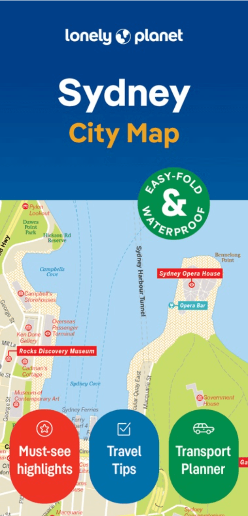
Stadskaart Sydney - Lonely Planet Productomschrijving: Durable and waterproof, with a handy slipcase and an easy-fold format, Lonely Planet Sydney City Map is your conveniently-sized passpo...

Specificaties
- Uitgever: Lonely Planet Publications
- ISBN-13: 9781787017764
- HOOFDCATEGORIEËN: Stadskaart plattegrond
- Activiteiten: Street/Road maps & city plans
- Regio: New South Wales, Australië, Sydney, Australië
- Land: Australië
- Editie: 2
- Taal: Engels
- Reeks/Serie: Lonely Planet City maps
Volledige omschrijving
Stadskaart Sydney - Lonely Planet
Productomschrijving: Durable and waterproof, with a handy slipcase and an easy-fold format, Lonely Planet Sydney City Map is your conveniently-sized passport to traveling with ease.
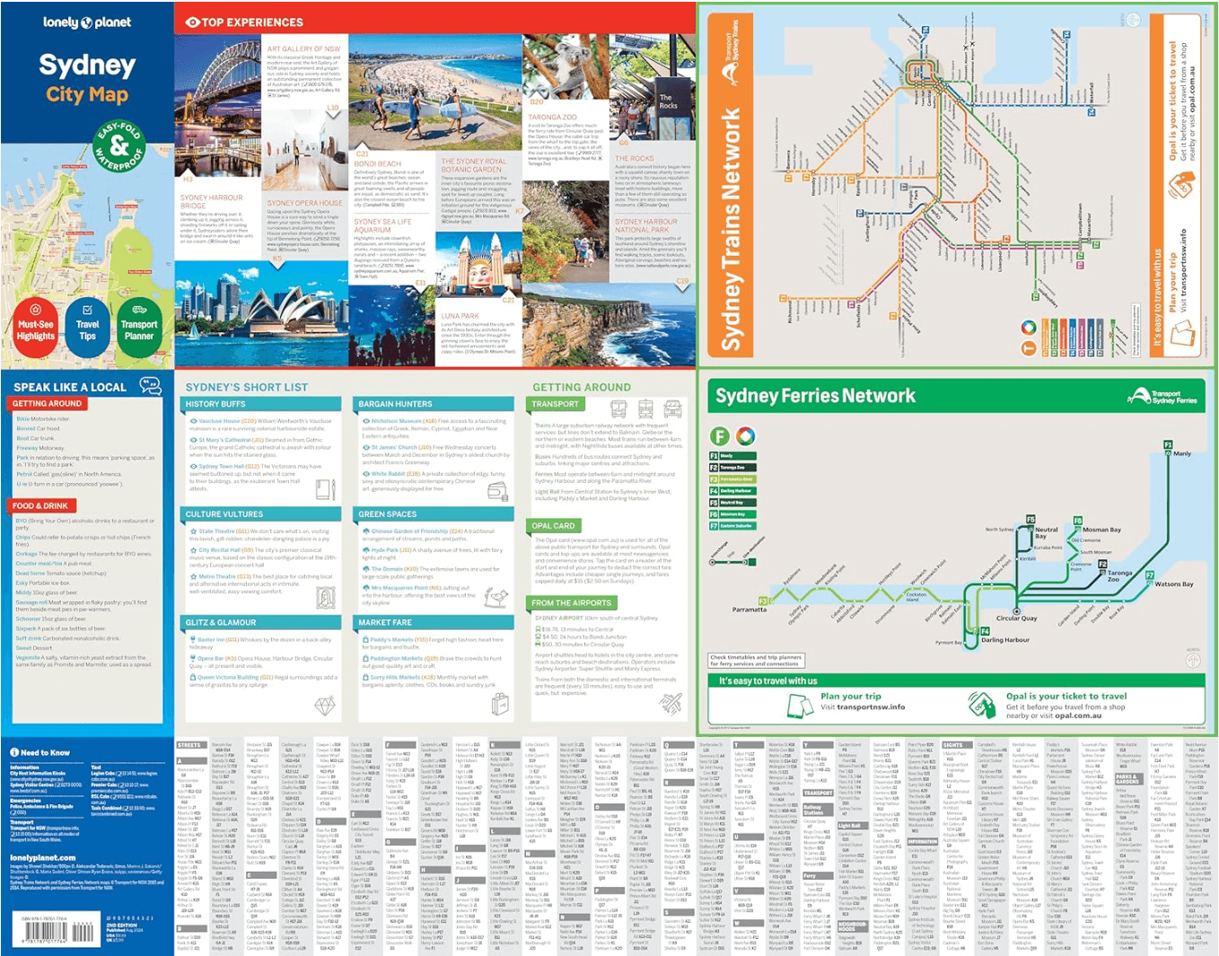
Get more from your map and your trip with images and information about top city attractions, transport maps, itinerary suggestions, extensive street and site index, and practical travel tips and directory. With this easy-to-use, full colour navigation tool in your back pocket, you can truly get to the heart of Sydney, so begin your journey now!
- Durable and waterproof
- Easy-fold format and convenient size
- Handy slipcase
- Full colour and easy-to-use
- Extensive street and site index
- Images and information about top city attractions
- Handy transport maps
- Practical travel tips and directory
- Itinerary suggestions
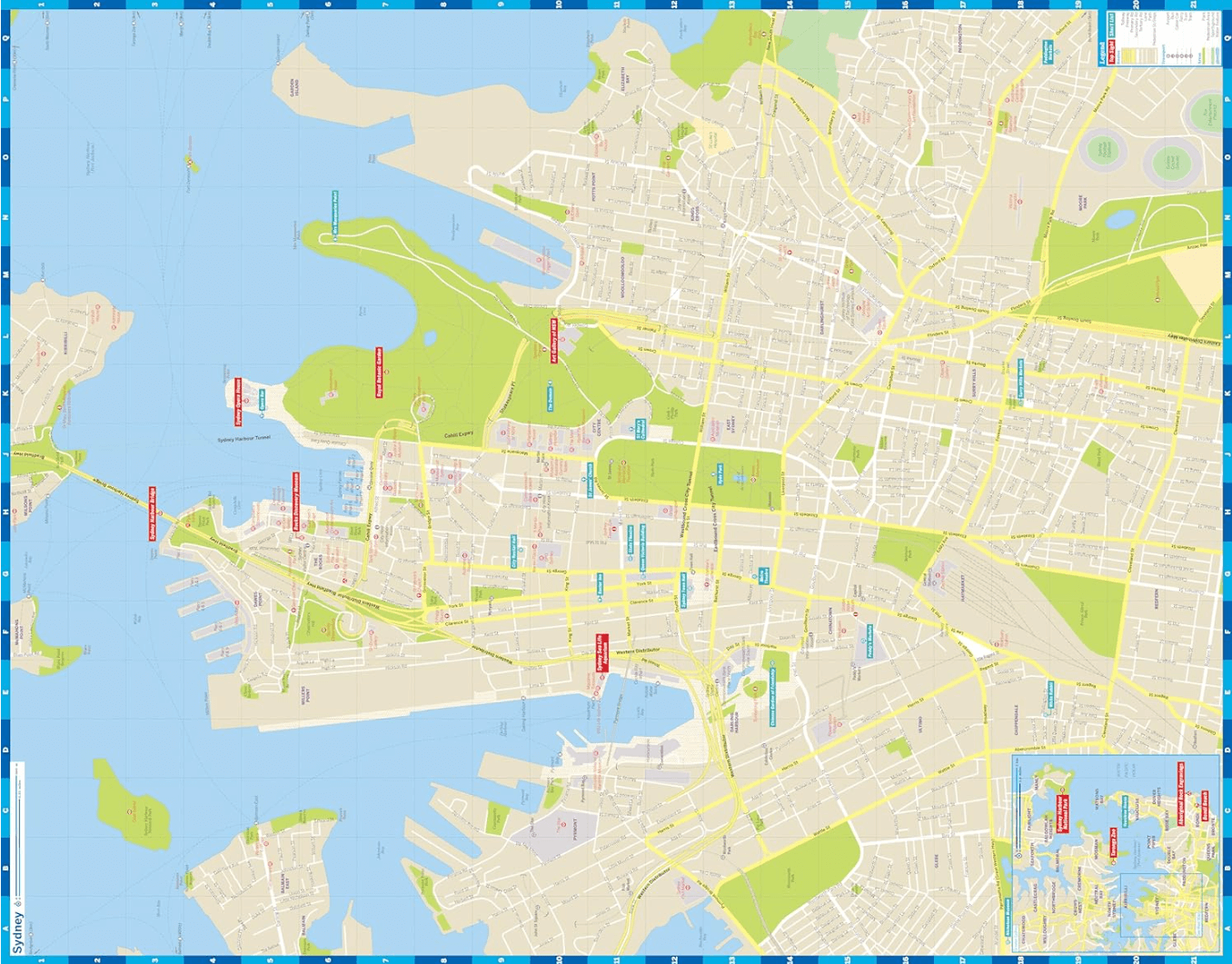
Covers: Balgowlah Heights, Balmain, Balmain East, Balmoral, Bondi, Bronte, Castlecrag, Chatswood, Chinatown, Chippendale, City Centre, Cremorne, Crows Nest, Darling Harbour, Darlinghurst, Dawes Point, Double Bay, Dover Heights, East Sydney, Elizabeth Bay, Fairlight, Garden Island, Glebe, Haymarket, Kings Cross, Kirribilli, Manly, McMahons Point, Millers Point, Milsons Point, Moore Park, Mosman, Neutral Bay, North Sydney, Northbridge, Paddington, Point Piper, Potts Point, Pyrmont, Queens Park, Redfern, Rose Bay, Seaforth, Surry Hills, Sydney, The Rocks, Ultimo, Vaucluse, Watsons Bay, Willoughby, Woolloomooloo
Full Map Dimensions: 62.9 cm x 49.5 cm (24.5 in. x 19.5 in.)
Artikelen uit dezelfde regio

Landkaart Wegenkaart 299 Wollongong Suburban Streets NSW - UBD • 9780731932054
Wegenkaart Wollongong Suburban Streets NSW - UBD Productomschrijving: Street level mapping and street index at a scale of 1 : 25 000 from Helensburgh in the north to Dunmore in the south. Coverage included for Berry & Nowra, North Nowra & Bomaderry - Index to suburbs & localities - Overview map of Wollongong to Nowra at a scale of 1 : 685 700

Stadsplattegrond 262 Sydney City Streets & Suburbs - Gregory's • 9780731933464
Stadskaart Sydney City Streets & Suburbs - UBD Gregory's Productomschrijving: The latest edition of the Sydney City Streets and Suburbs Map has been fully revised and updated and includes coverage at scales of 1:25 000 and 1: 100 000; One side features mapping of Sydney city and surrounding suburbs at a scale of 1: 25 000 with coverage along the coast from Dee Why in the north to Malab…

Landkaart Wegenkaart 295 Port Stephens NSW - UBD Gregory's • 9780731931910
Wegenkaart Port Stephens New South Wales Productomschrijving: The latest edition of the Port Stephens touring map has been fully revised and updated and features: A regional touring map covering Port Stephens, Hawks Nest/Tea Gardens, Karuah, Lemon Tree Passage and Raymond Terrace. Maps and street index of Nelson Bay and surrounding suburbs. Maps of Hawks Nest/Tea Gardens, Karuah, Raym…

Landkaart Wegenkaart New South Wales handy map - Hema • 9781925625608
Wegenkaart New South Wales handy map - Hema Productomschrijving: A fully indexed state map of New South Wales (NSW) at a scale of 1:1,400,000. Marked on the map are national parks, camping areas, caravan parks, rest areas, points of interest and 24-hour fuel accompanied by a distance grid.
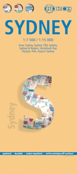
Stadskaart plattegrond Sydney Australia - Borch • 9783866093133
Wandelkaart Sydney Australia - Borch Productomschrijving: Our soft-laminated folded map of Sydney in the 8th edition shows: Inner Sydney 1:15 000, Sydney CBD 1:7 500, Sydney 1:120 000, Sydney & Region 1:450 000, Homebush Bay Olympic Park 1:15 000, Airport Sydney 1:25 000, Public Transport Sydney, Australia administrative & time zones, Top 30 Sights. Borch Maps show hotels, museums, monumen…